Project description

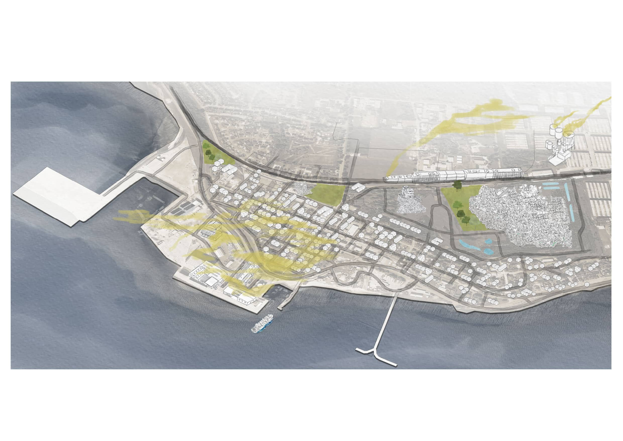
After Oil: Invergordon in Transition is a design proposal that looks into the future possibilities of a former oil tank site on the Cromarty Firth as an energy demonstration landscape, linking the oil tank site, coastline and town edge with the blue-green infrastructure of Invergordon. Invergordon is a port town, born of industry and with a military past, trying to find a way forward beyond extractive fuel industries.

The project asks how the former oil tank site, coastline and town edge can be brought together as a living blue-green infrastructure, reconnecting brownfield land, shore ecology and everyday life in Invergordon. Combined landscape interventions aimed at triggering and showcasing transition for the town are investigated by Oil.

Second, the proposal recognises the historic significance of energy production for this place and broadens the meaning of energy beyond technical infrastructure alone. Here too, energy is understood through social energy, regenerative energy, and renewable energy.

Through remediation, planting, habitat succession, social occupation, renewable energy collection and use, and changing repair, After Oil imagines a townscape that grows beyond a fixed time frame and a changing environment. Transition is understood here as a gradual process that becomes part of Invergordon’s everyday life.

Cromarty Firth in Transition
Energy Transition in Invergordon Harbour
3D Scan
Fieldwork
PLANTS

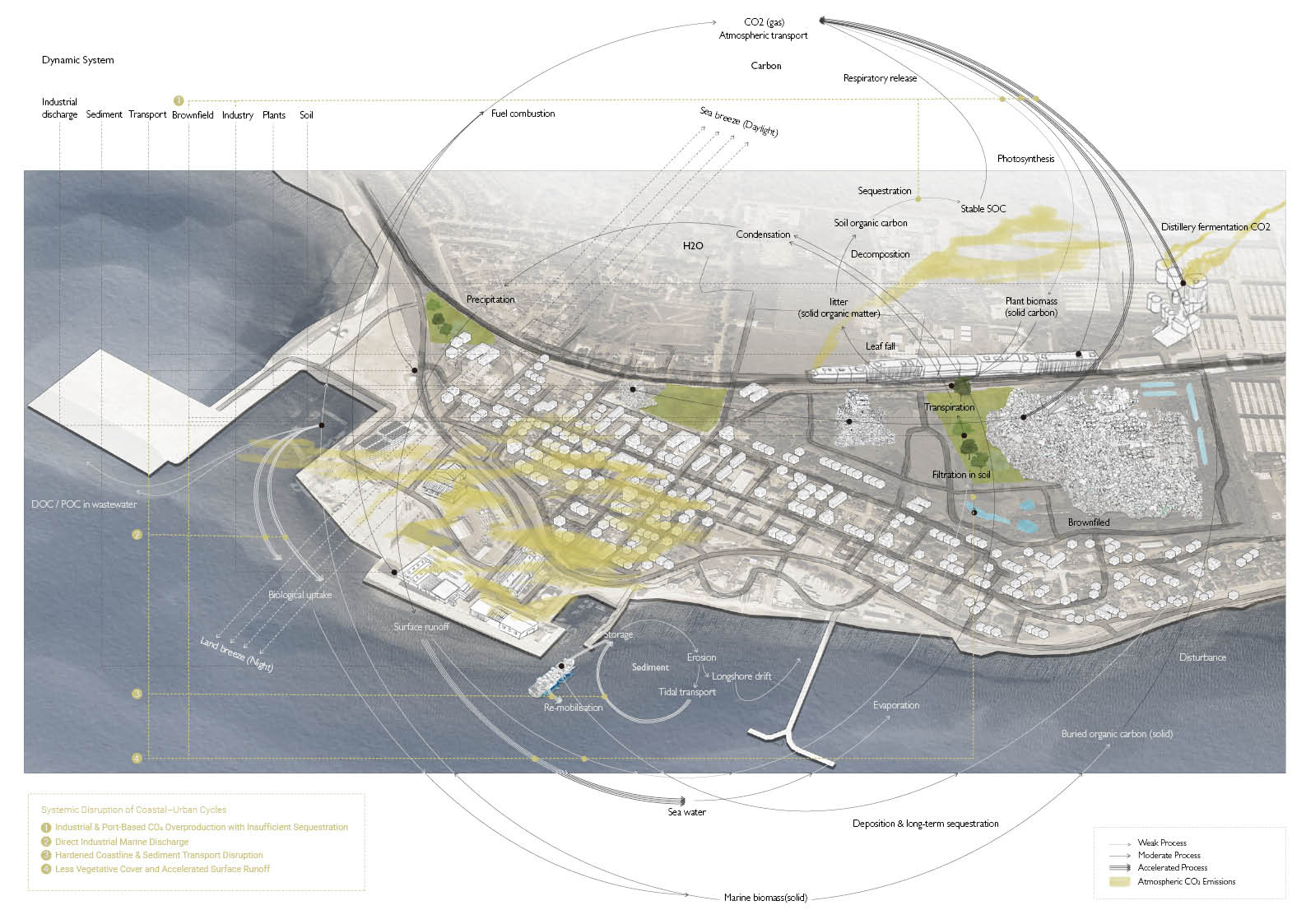
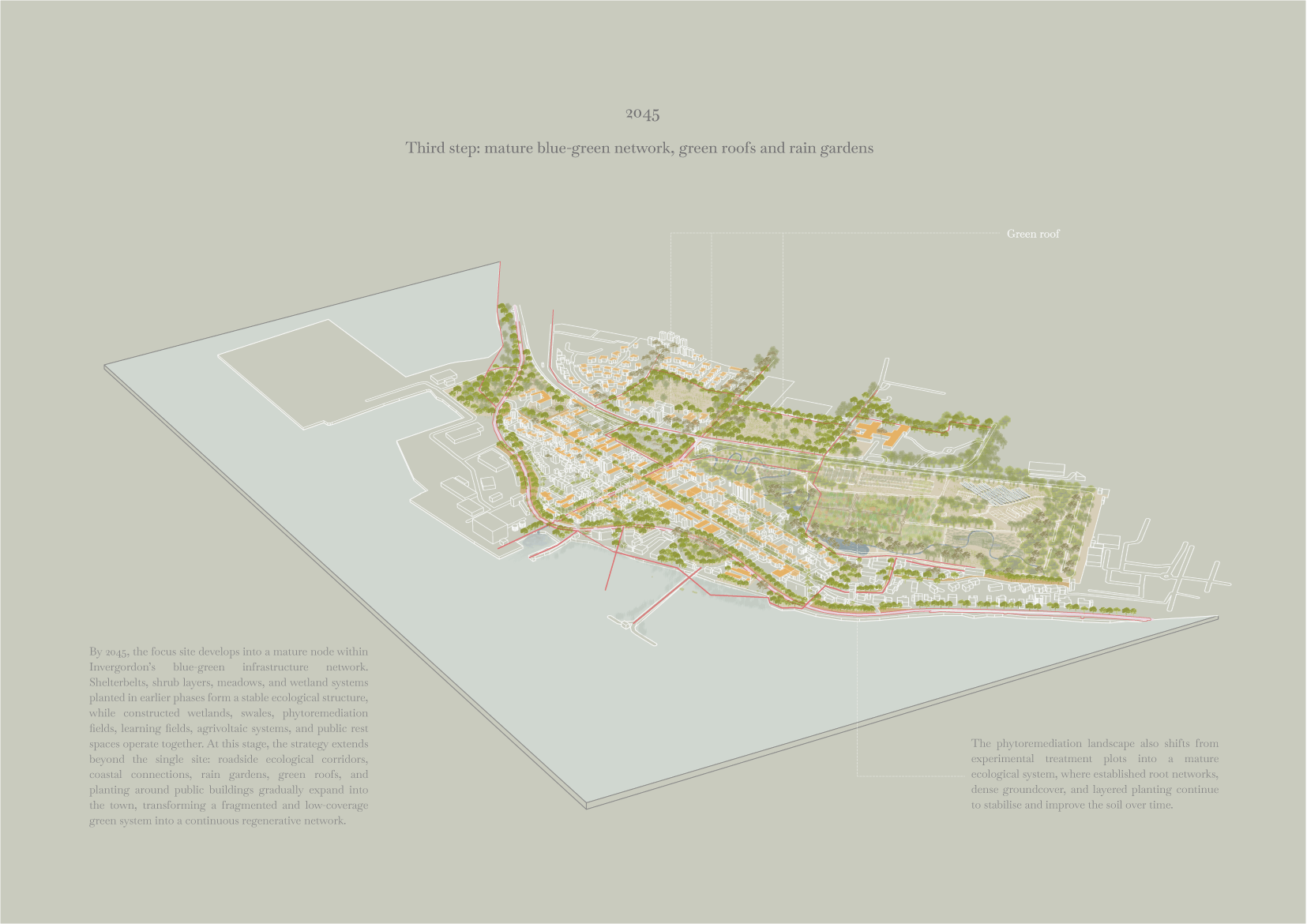
Waterfront regeneration, green roofs, neighbourhood swale systems and extra tree planting between buildings and streets change Invergordon's coastal edge from a bland brown industrial frontier into a more permeable planted and publicly accessible blue-green boundary. Green roofs store rainwater and create new habitat, whilst swales help gather and filter surface water runoff before it enters the coast. Combined with tree planting and soft landscape edges they increase vegetation cover locally by about one third to one half improving biodiversity, microclimate, stormwater management and day to day access to the waterfront.

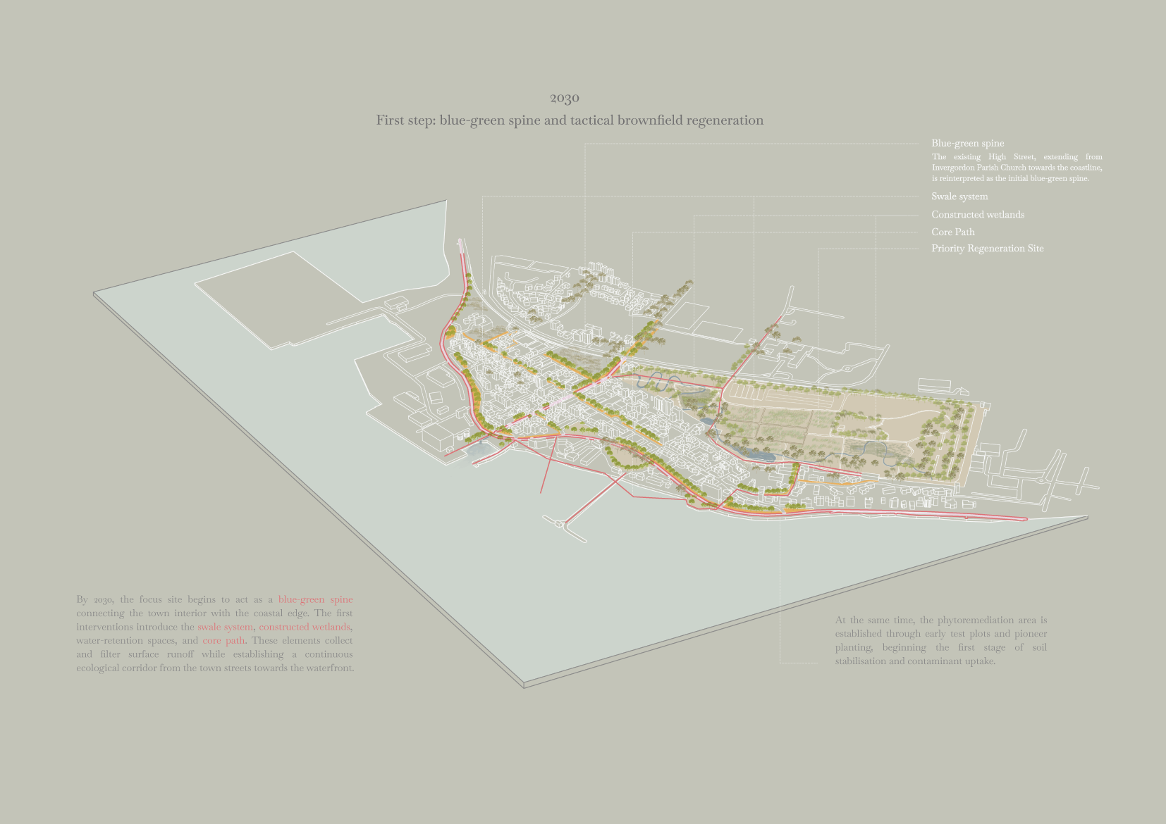
Via cycle paths, roadside swales, pollinator corridors, green roofs and street trees, the town centre is linked to the coastal fringe as one continuous blue-green public corridor. Swales treat surface runoff by slowing, storing and filtering water; pollinator planting enhances habitat quality; trees provide shade, shelter and pedestrian comfort; and green roofs bring vegetation to areas that lack ground space. With these additions implemented across the focus site and adjacent neighbourhoods, total vegetation cover along the corridor could increase by ~1/3 to 2/3. The mature planting system is estimated to capture approximately 8–15 tonnes of CO2 annually.

Town detail
Masterplan

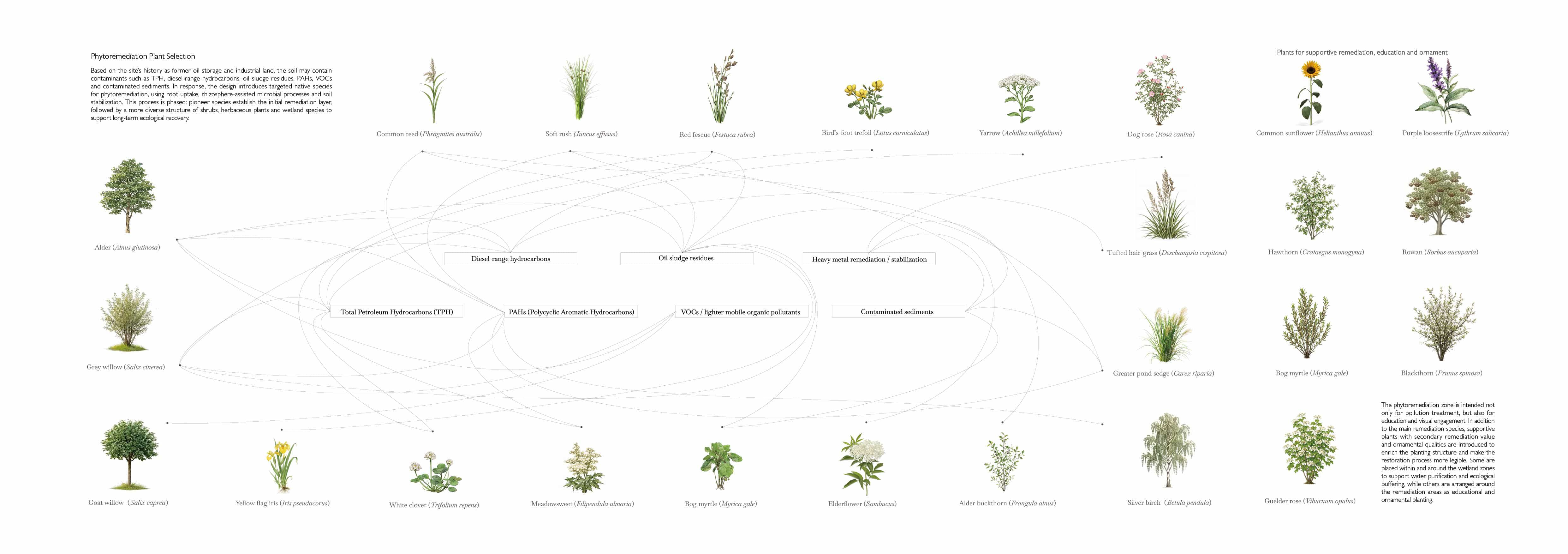
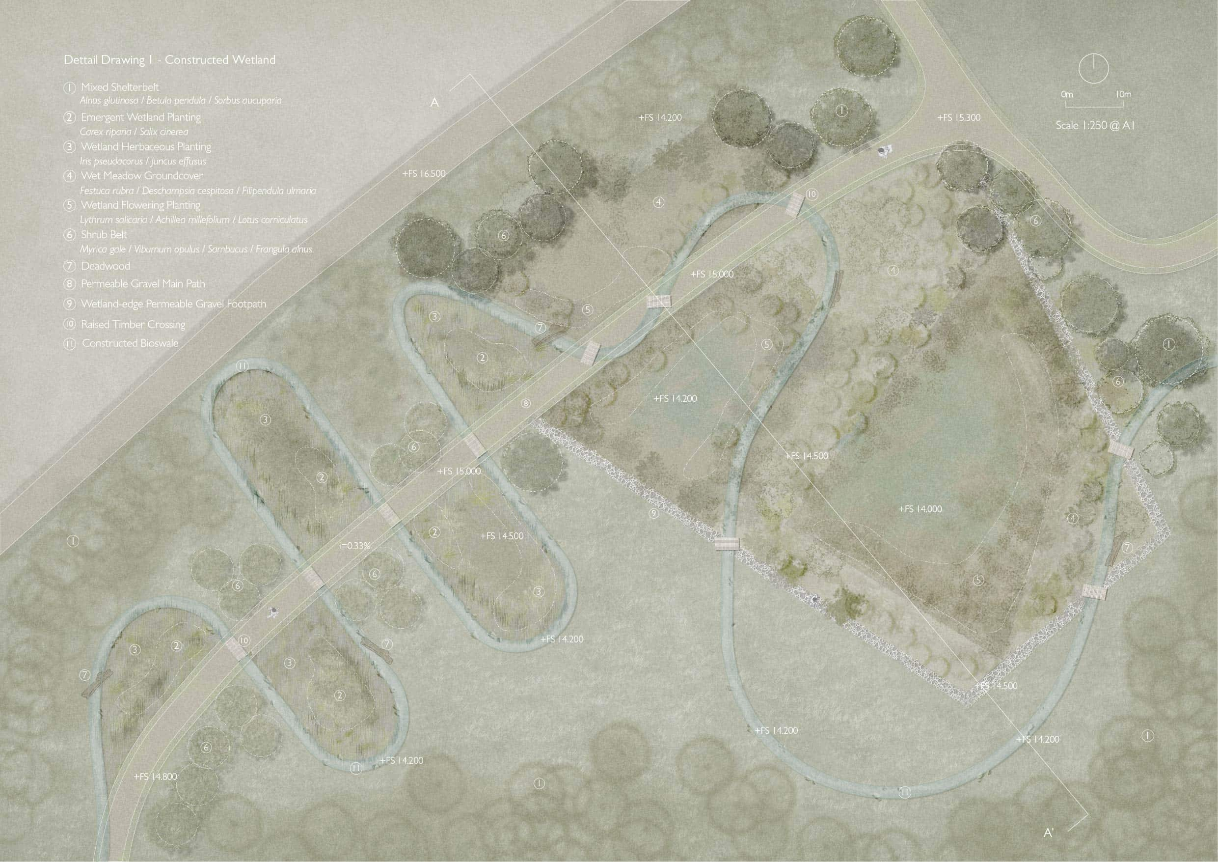
Regenerative energy is about healing land, water and ecological systems. After the existing low area where water naturally accumulates, there are two constructed wetlands located at the main entrances. They create an accessible water-management and ecological repair system with permeable gravel paths, raised timber crossings and swales.

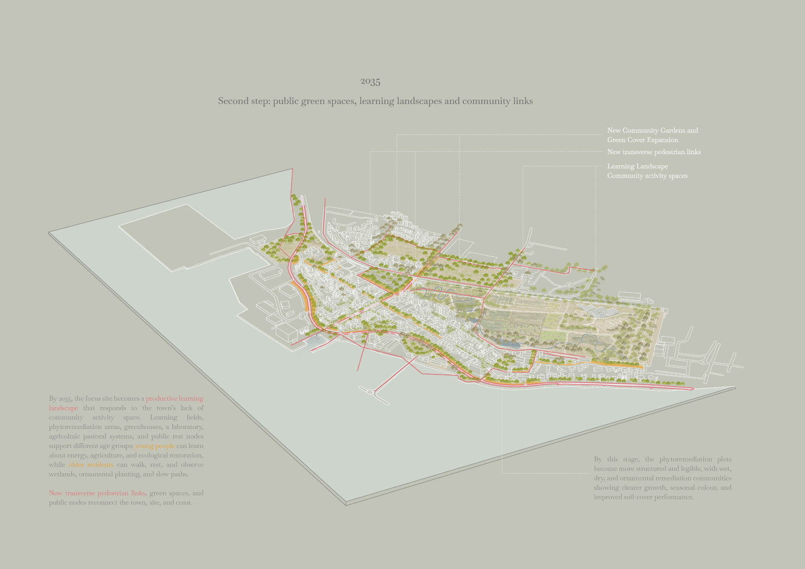
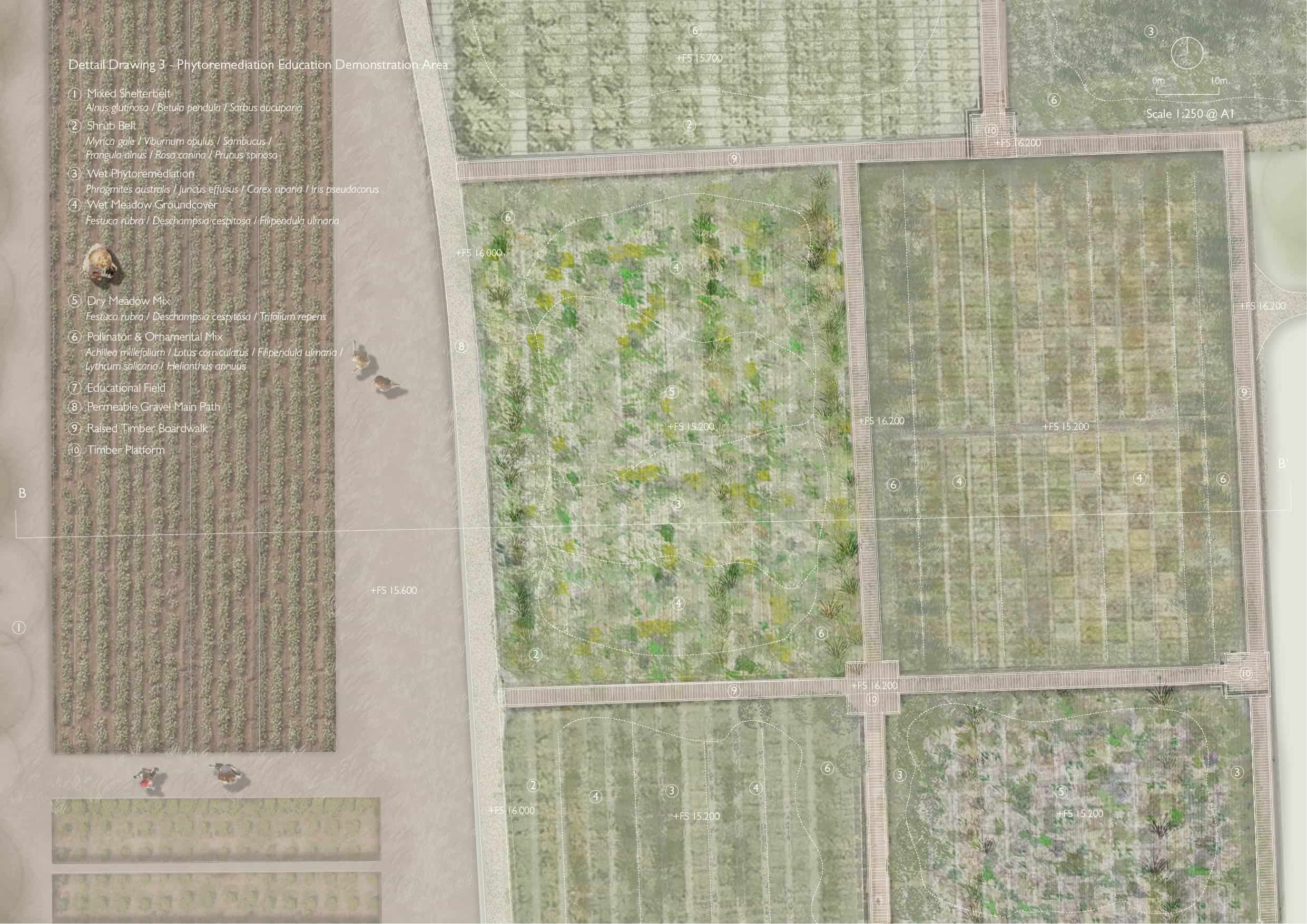
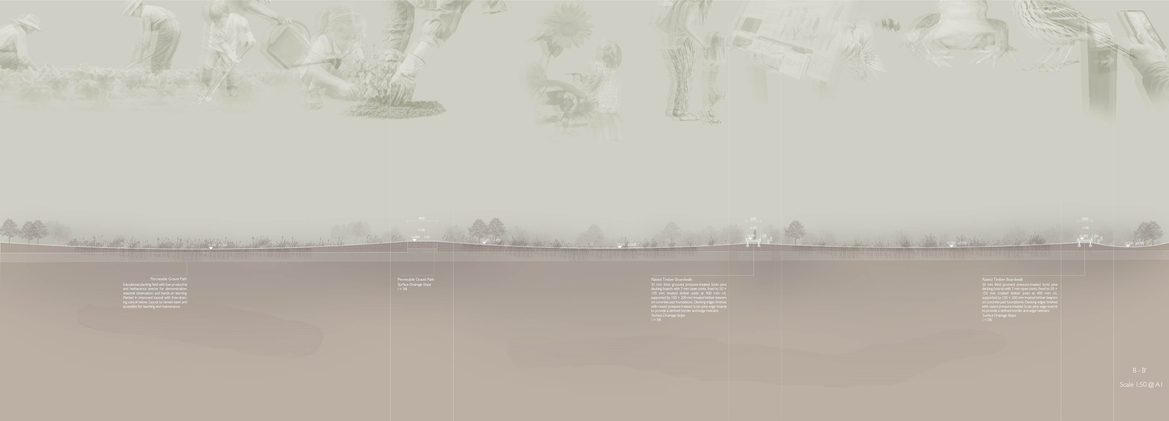
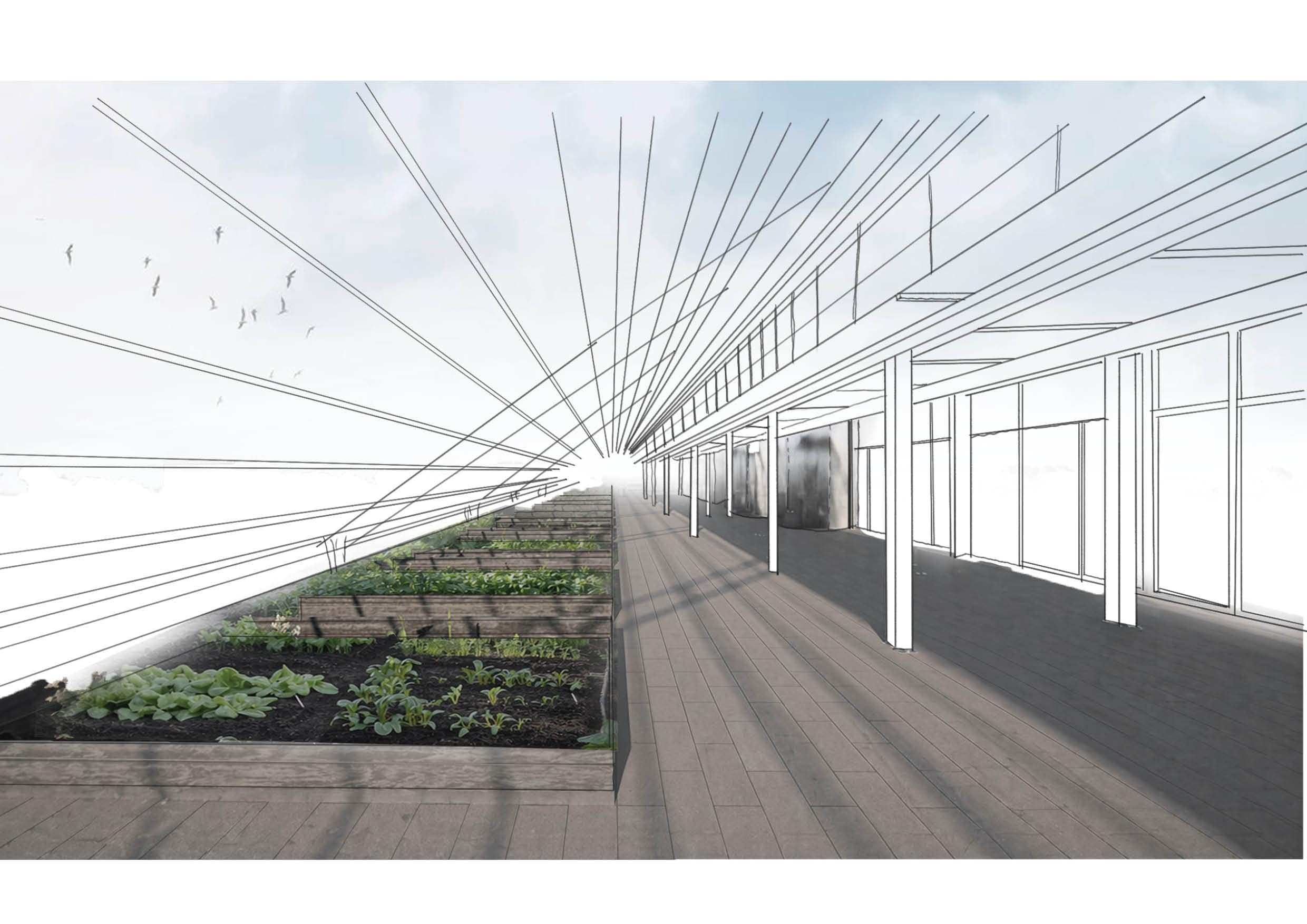
Social energy is how people get to the site and how they use it. The site provides opportunities for walking, learning, resting and observing through learning fields, rest spaces, boardwalks, viewing platforms and greenhouse education spaces. This central phytoremediation field is not only to repair the soil, but also becomes a learning landscape, where people can understand the industrial history and the ecological recovery process.

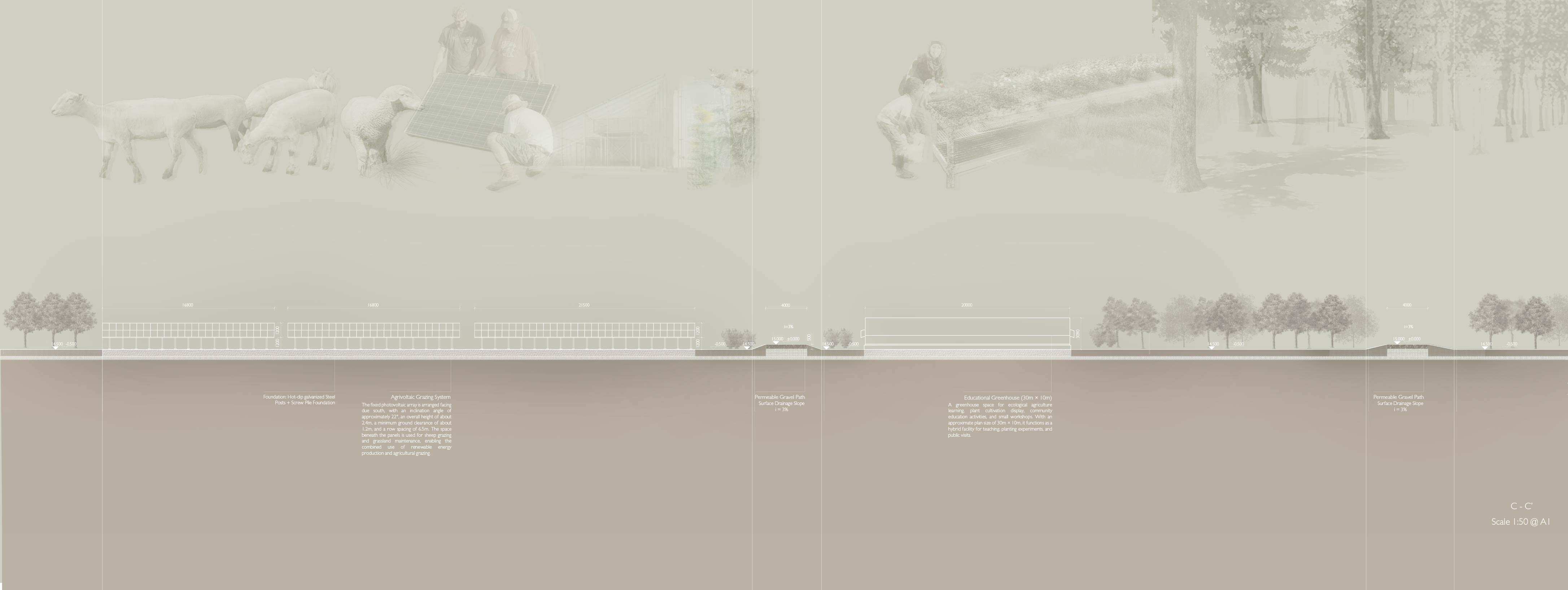
Renewable energy focuses on a small circular energy system within the site. The laboratory and greenhouse work as a learning and testing hub, collecting rainwater and organic waste and processing them through fermentation tanks to produce liquid fertiliser, heat and biogas. Next to this system, the agrivoltaic grazing area combines solar energy collection, sheep grazing and low groundcover planting, allowing energy production and ecological productivity to happen together.