Project description

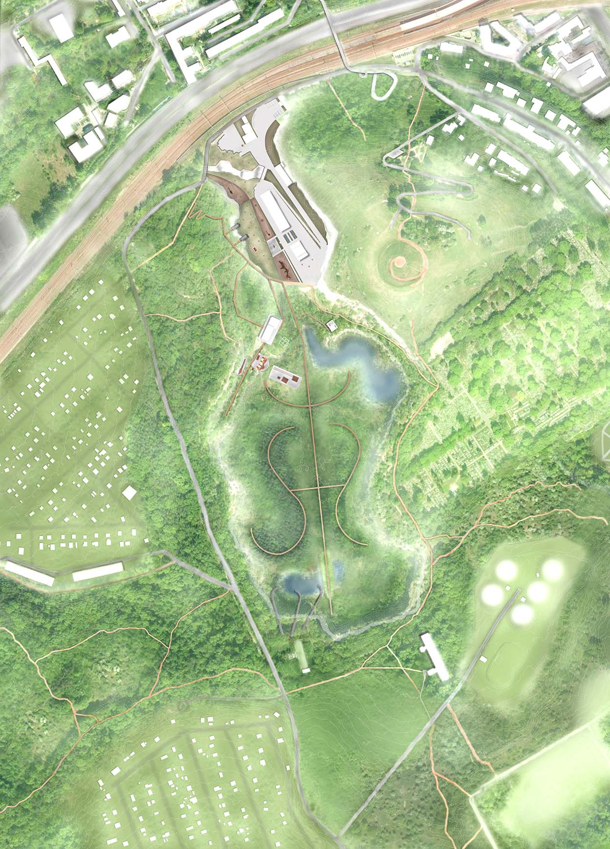
This project reimagines a decommissioned limestone quarry in the Krzemionki area of Kraków as a landscape where everyday life, memory, and nature coexist. It proposes two intertwined conditions: a welcoming post-industrial park at the entrance and a quieter basin where long-established ecological succession is supported and stewarded. At the threshold, accessible paths, memorial spaces, and climate-responsive reinterpretations of quarry infrastructure invite everyday use, allowing industrial traces to evolve through public engagement.

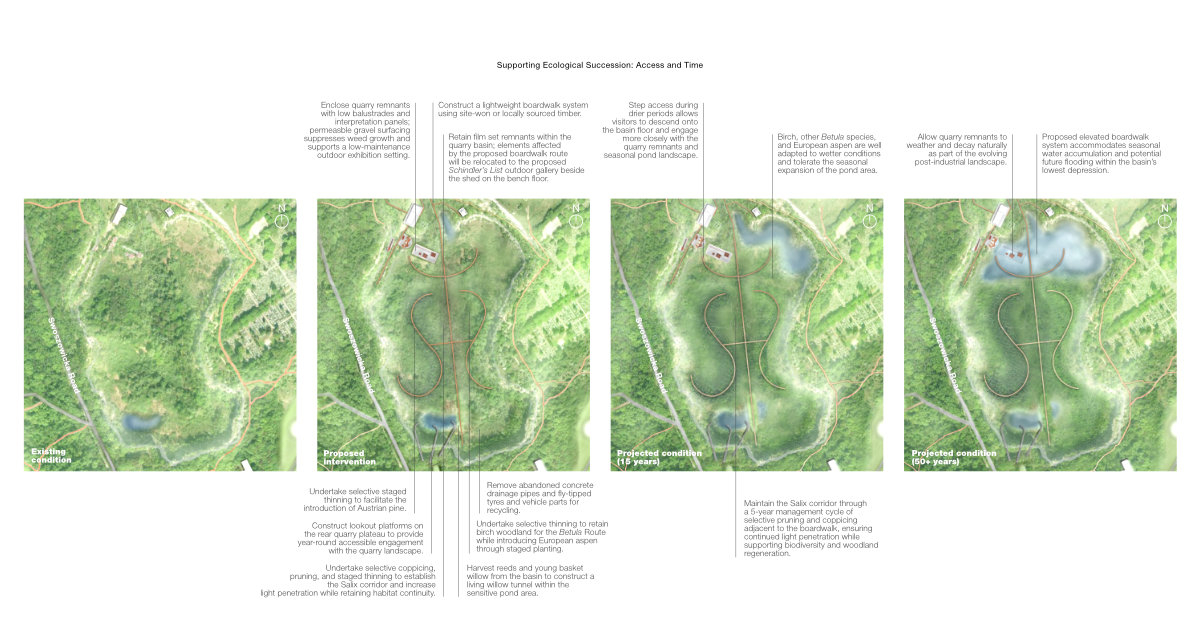
The park is structured around four routes—Empathise, Archive, Discover, and Gather—which guide movement through memorial, interpretive, exploratory, and social landscapes. Moving between these routes, visitors encounter different layers of cultural memory, industrial heritage, and ecological regeneration. The sequence gradually leads towards the living basin, where boardwalks provide light-touch access through birch, salix, and conifer landscapes, supporting ongoing natural succession while reframing the former site of extraction as a place of reflection, environmental learning, and sensory engagement.

01_Territorial Context
Territorial context

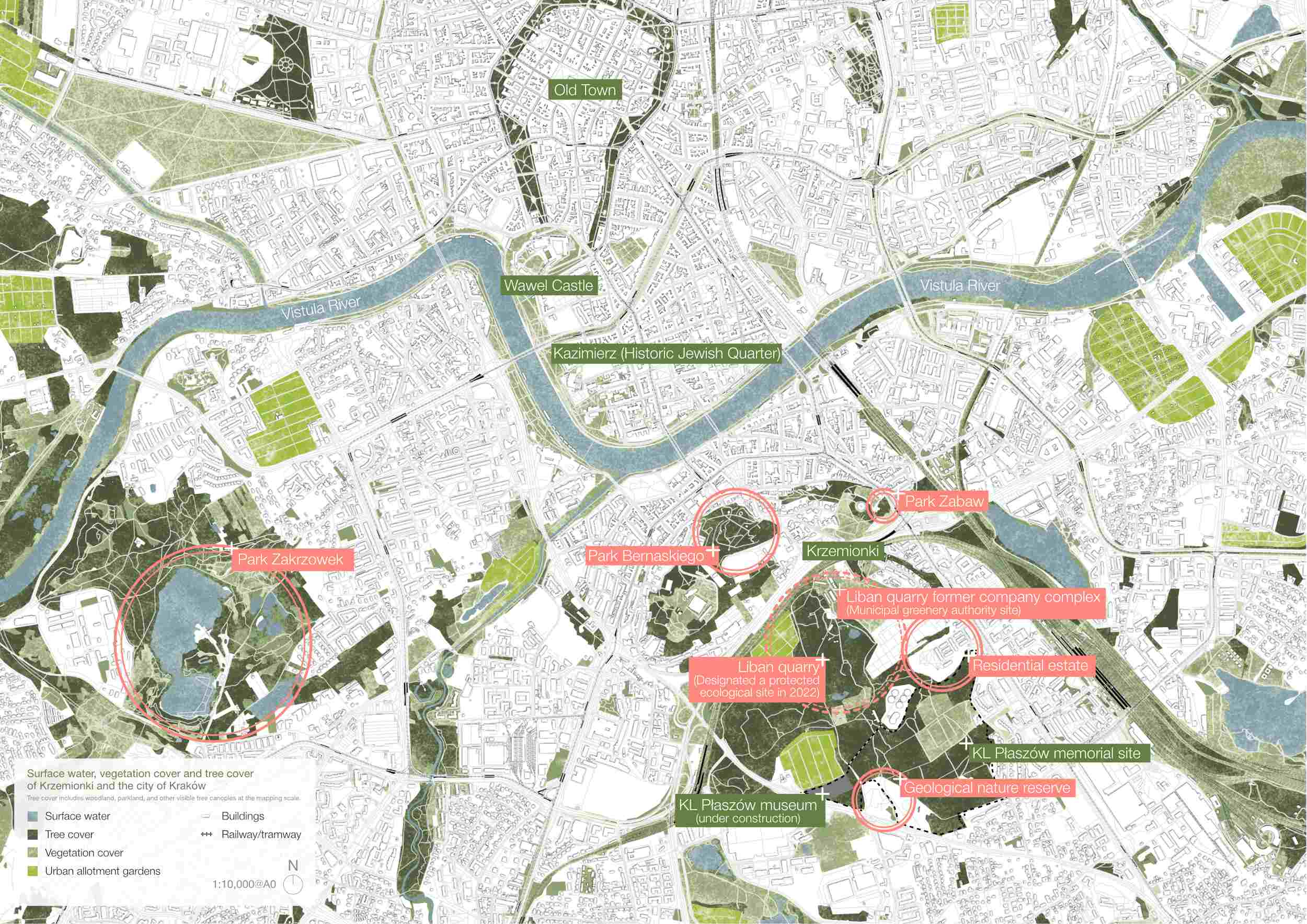
This project began within the wider territory of Krzemionki, a limestone landscape shaped by extraction, industry, war, and ecological succession. Having passed through Austro-Hungarian rule, Nazi occupation, and the communist era of post-war Poland, the area retains layered cultural and spatial remnants, including remnants of film sets from Schindler’s List within Liban Quarry.

While other decommissioned quarries within and around Krzemionki, including Zakrzówek Quarry, have been transformed into nature reserves, cultural parks, and residential landscapes, Liban Quarry remains comparatively inaccessible despite its significant ecological and cultural value. 

The project explores how its evolving landscapes might support new forms of public, ecological, and commemorative engagement within contemporary Kraków.

Transition from Territorial Strategy to Site-Scale Design

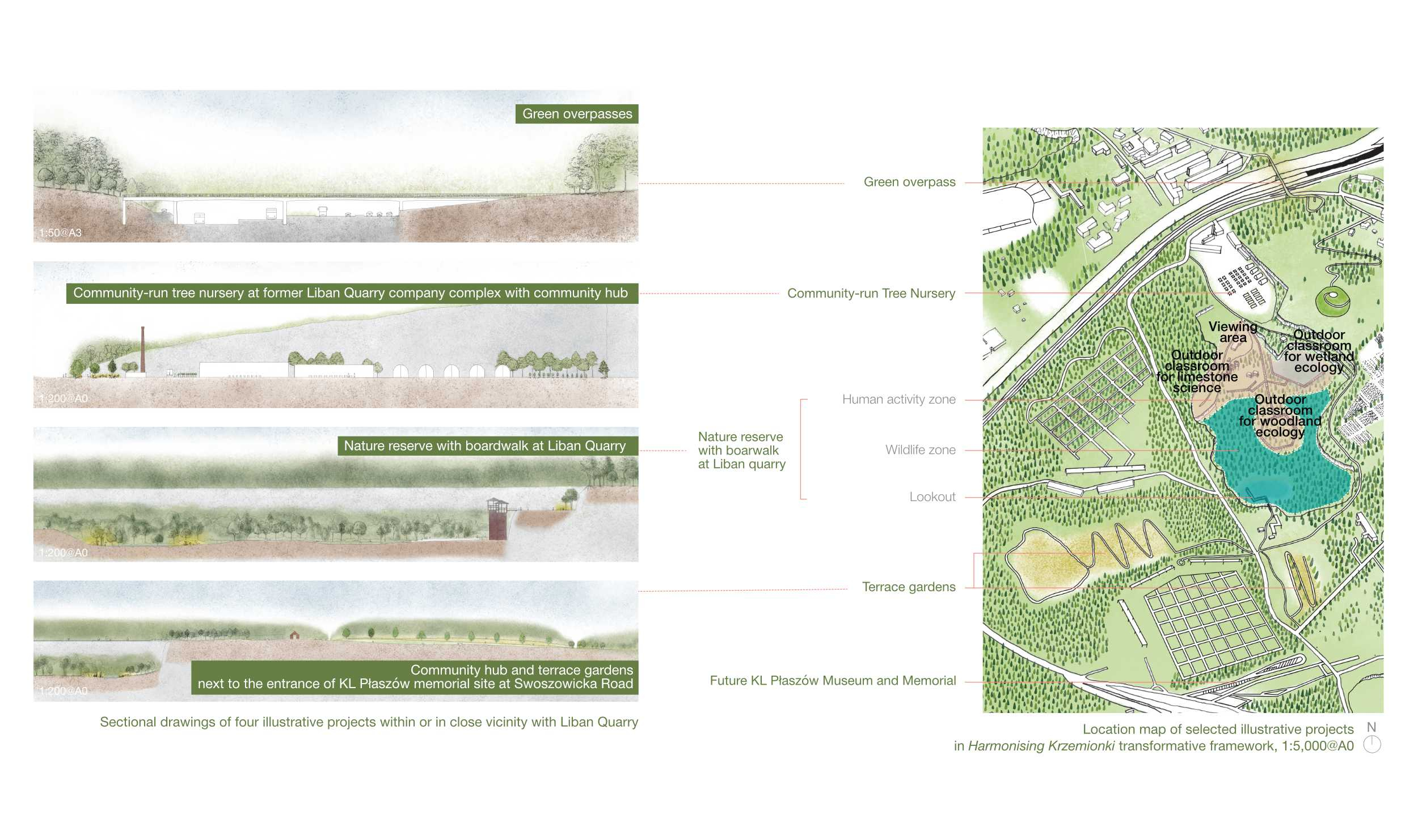
Building on the Harmonising Krzemionki framework developed in Semester 1, the project later shifted toward a focused investigation of Liban Quarry.

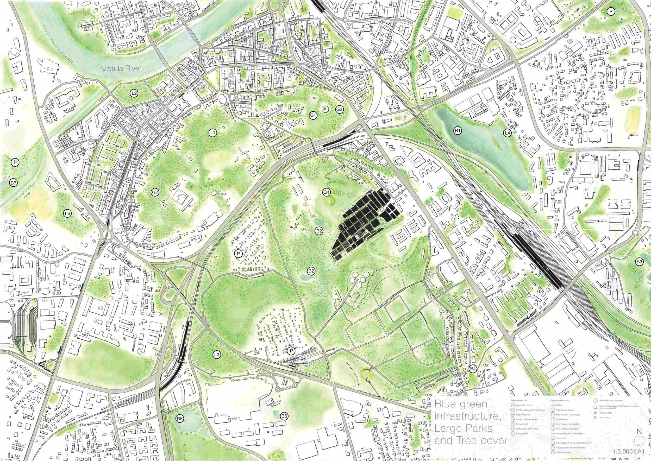
Initial investigations identified a series of socioecological conflicts across southern Krzemionki, including tensions between remembrance and everyday recreation around the KL Płaszów memorial landscape, alongside wider pressures from tourism, urban development, and environmental change. These challenges were examined through an integrated reading of land use, ecological networks, biodiversity, and ecosystem services, considering how urban allotment gardens, community-run tree nursery, public green spaces, and emerging habitats collectively contribute to human wellbeing and environmental resilience. In response, the Harmonising Krzemionki transformative framework was developed in alignment with the Kraków Metropolis 2030 strategy, establishing strategic directions for green infrastructure, public green space provision, ecological connectivity, and the balance between commemoration, community life, and landscape regeneration.

In Semester 2, the project focused on Liban Quarry, critically reinterpreting its role within the wider framework and exploring alternative relationships between ecological succession, post-industrial heritage, and public engagement.

Walking-based fieldwork: Creative Making and Multisensory Engagement

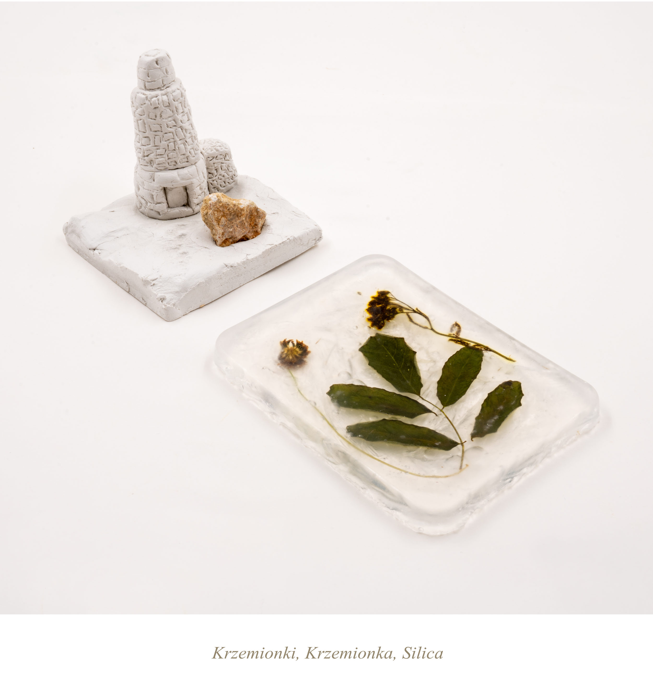
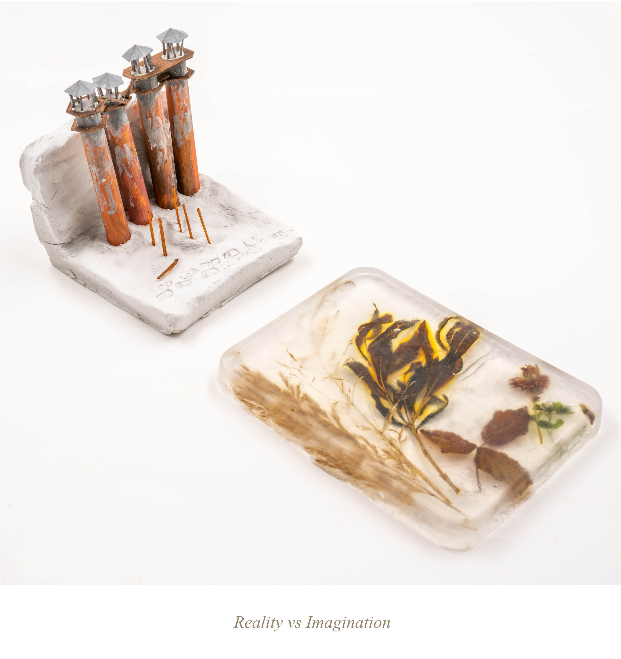
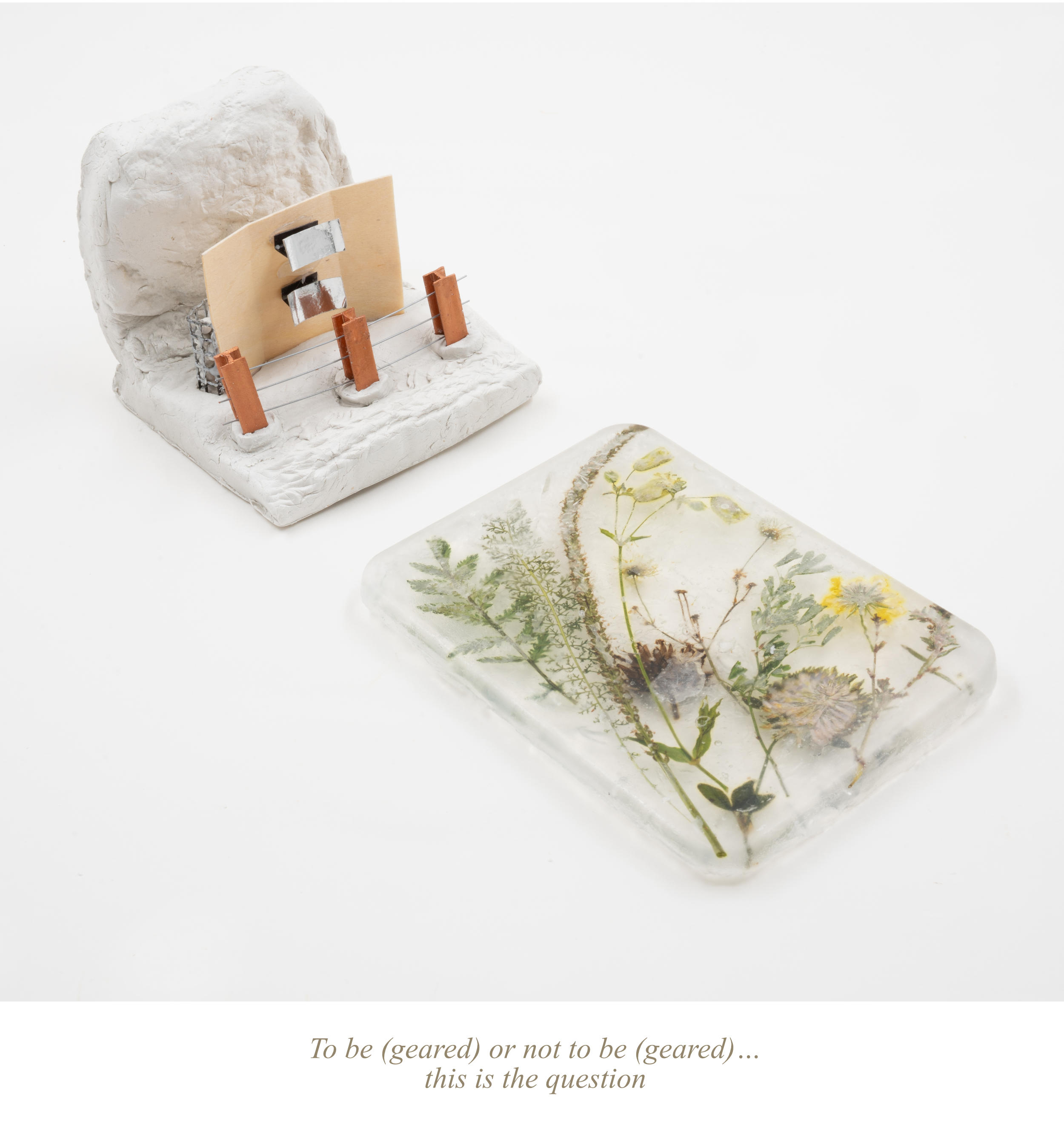
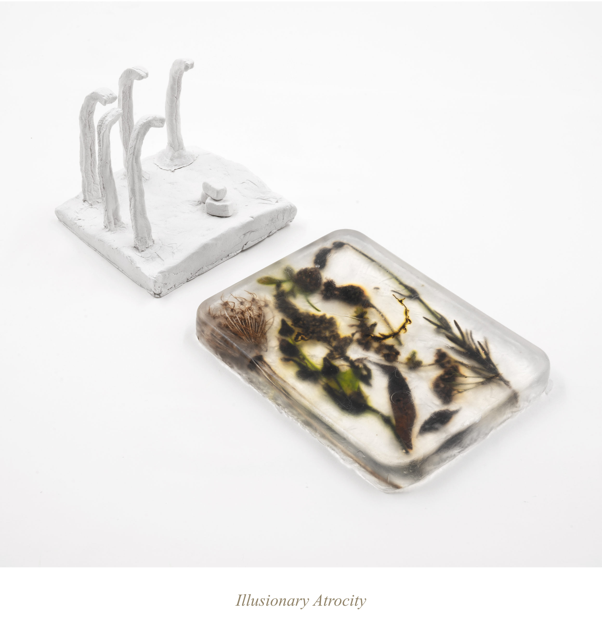
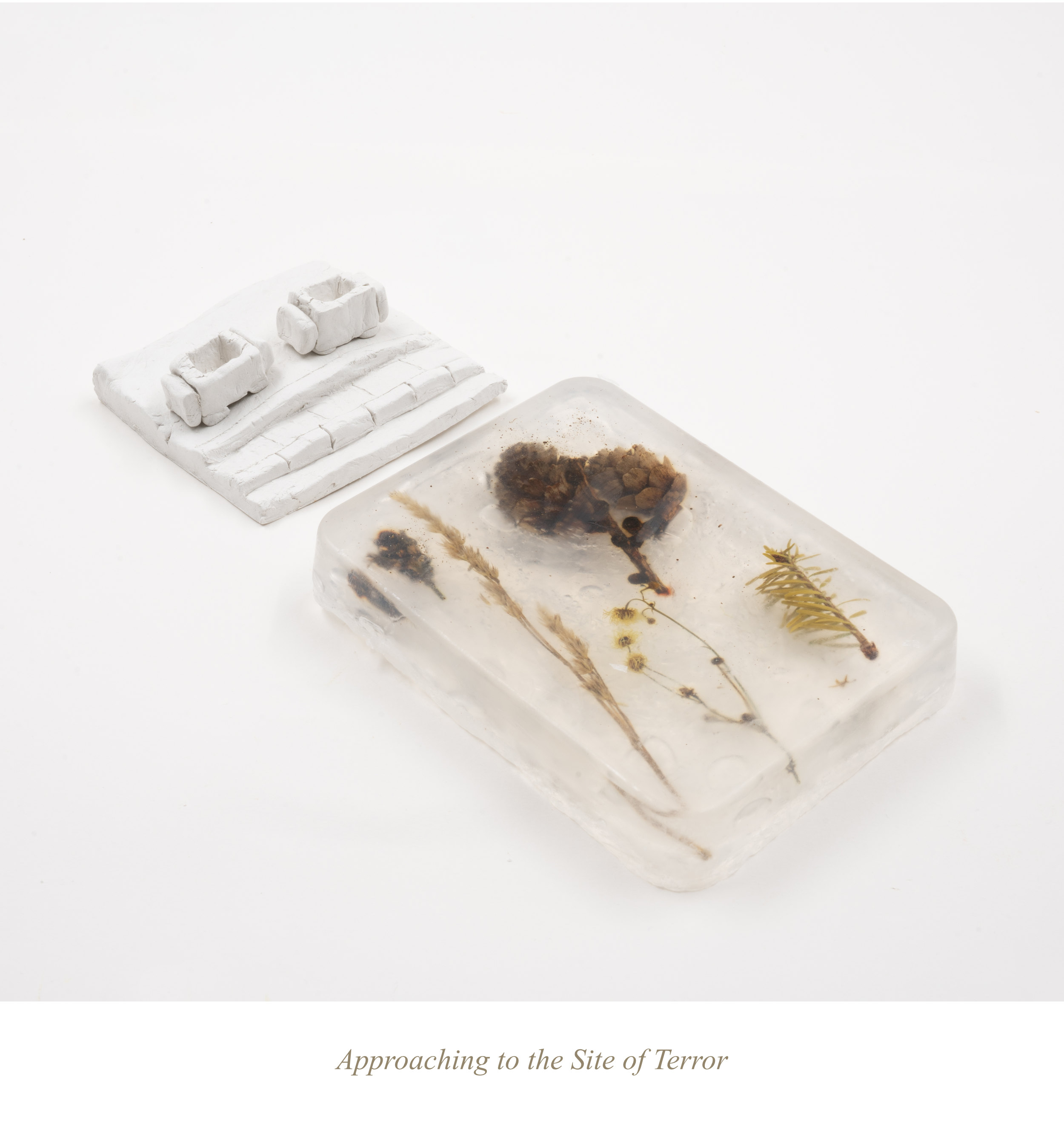
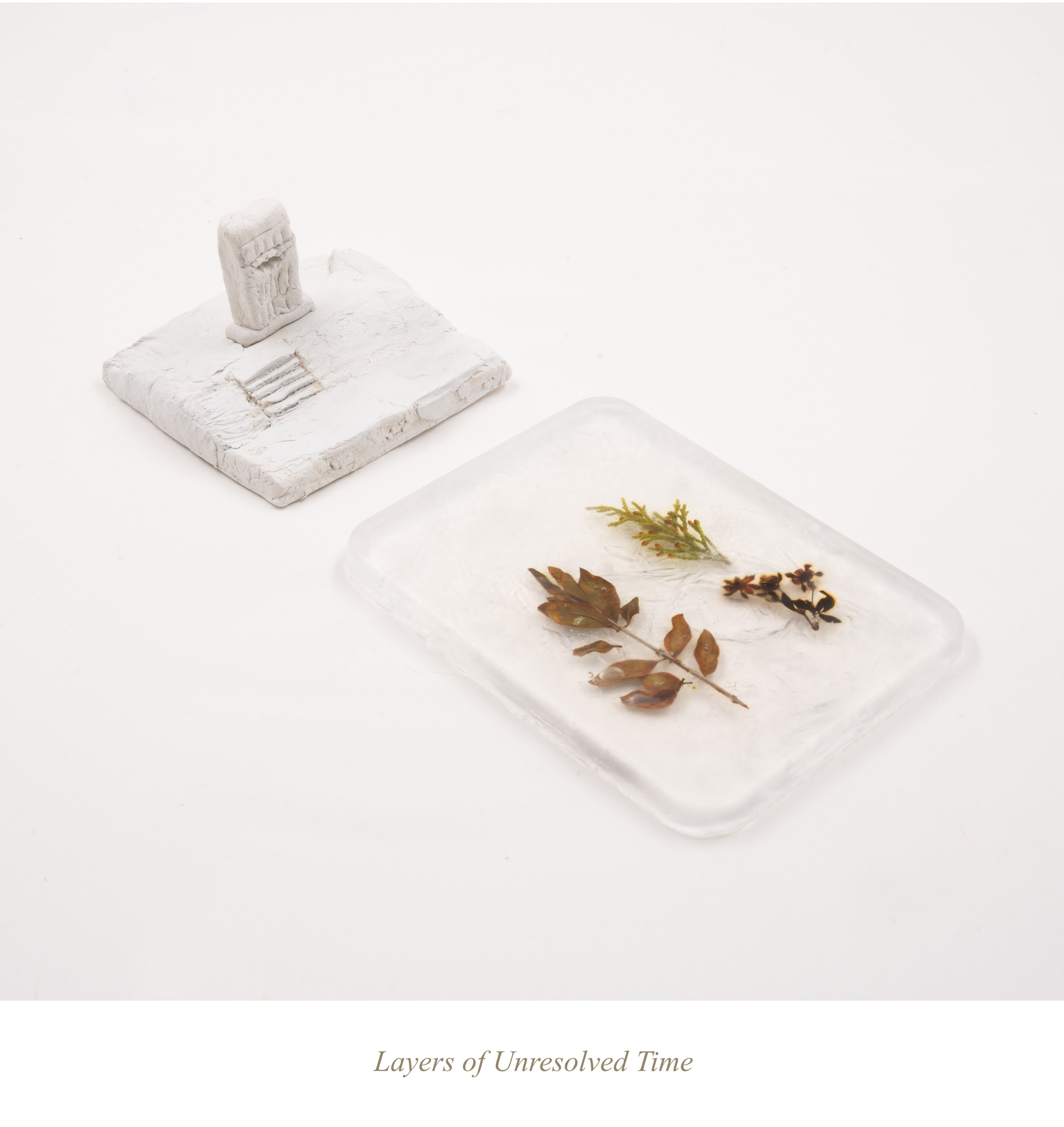
Drawing on Krzemionki’s sedimentary geology and Kraków’s material histories, the work translates walking-based fieldwork into site-specific clay models and botanical soaps made from collected plant communities. Each set forms a named, descriptive assemblage linking ecology, materiality, and making. Beyond physical conditions and multisensory dimensions, the process expands the depth of fieldwork, where writing and design thinking emerge through making, extending walking into a generative, process-driven practice.

Integrated site reading with walking-based fieldwork: Ecology

Ecological investigations across Kraków’s Krzemionki landscape revealed a dynamic post-industrial environment shaped by ongoing succession and habitat adaptation. 

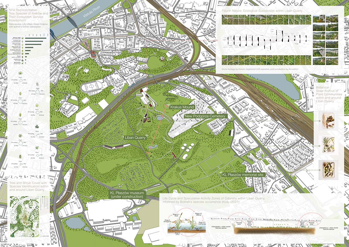
The study of representative tree species across Kraków identified their ecological characteristics and ecosystem services, informing a broader understanding of urban woodland resilience and biodiversity potential. 

Within and around Liban Quarry, mapping of existing tree and shrub communities, supported by drone observation, revealed patterns of spontaneous rewilding and fourth nature conditions emerging through natural succession. 

Investigation into odonata life cycles and speculative activity zones — informed by Bobrek’s species occurrence study (2021) — further highlighted the ecological importance of seasonal pond systems and low-disturbance habitats within the quarry basin.

IntegratedSiteReading_Ecology expand
Integrated site reading with walking-based fieldwork: Deep Time and Evolving Landscapes

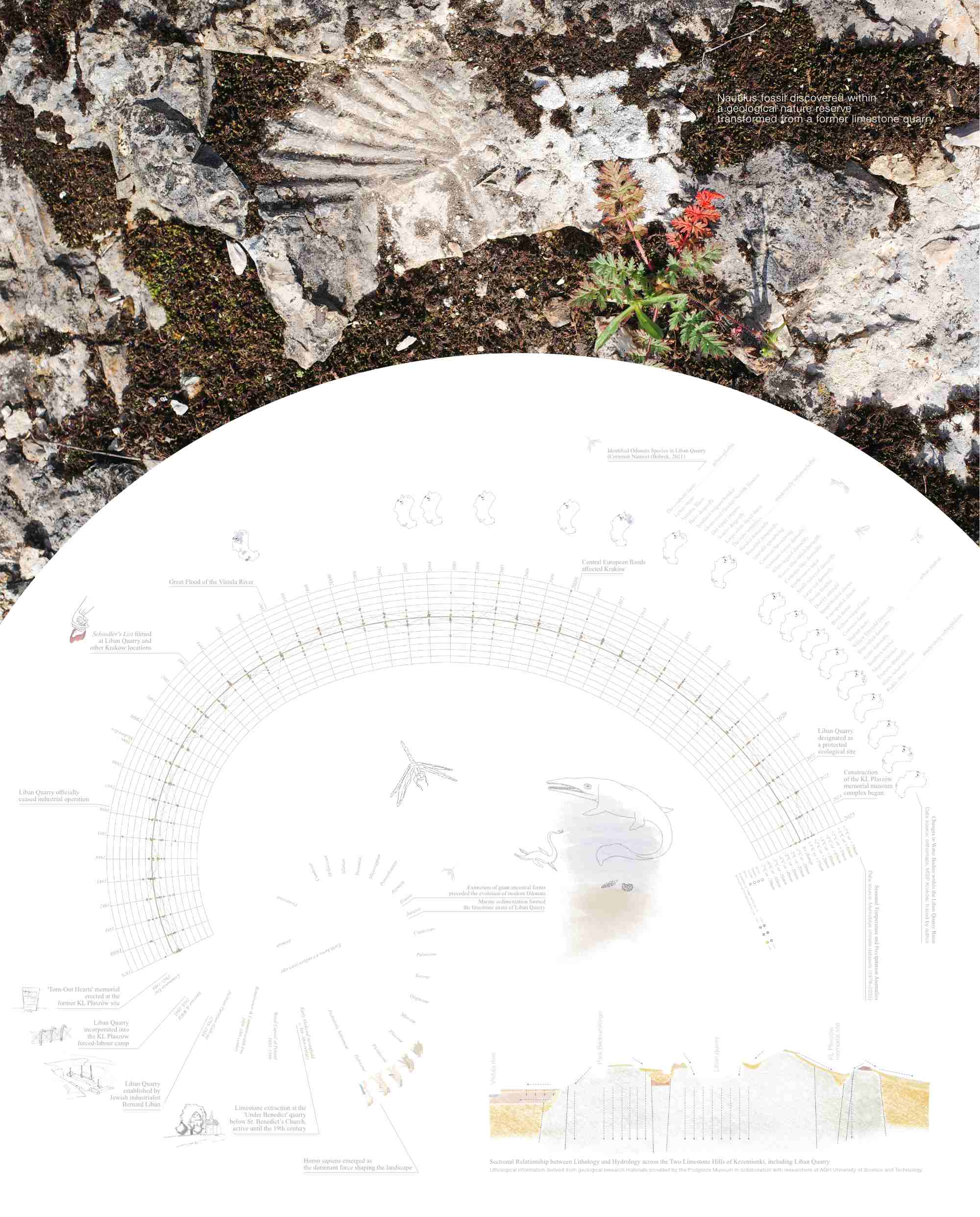
Investigations into geology, hydrology, climate, and cultural landscape revealed Liban Quarry as a territory shaped by geological formation, later transformed through quarrying and other human activities, and continually reworked by environmental change.

Fossil evidence records the site's origins in prehistoric marine sedimentation, while quarrying transformed the limestone hills of Krzemionki into a distinctive post-industrial landscape. Analysis of changing water bodies and seasonal climate anomalies highlighted the emergence of seasonal pond systems supporting odonata and other freshwater ecologies. As descendants of ancient evolutionary lineages that long predate the emergence of humans, the presence of odonata within Liban Quarry reflects the formation of new freshwater habitats shaped by water, climate, and low-disturbance conditions. Layered with histories of industry, wartime occupation, memorialisation, and cinematic representation, the quarry reveals an ongoing dialogue between deep time, ecological succession, and cultural memory.

These investigations informed the proposal's two intertwined landscape conditions. The living basin supports freshwater habitats and natural regeneration, while the post-industrial park incorporates water-sensitive and climate-responsive interventions that address stormwater management, thermal comfort, and public engagement.

IntegratedSiteReading_Deep Time and Evolving Landscapes expand
Integrated site reading with walking-based fieldwork: Cultural Landscape and Material Heritage

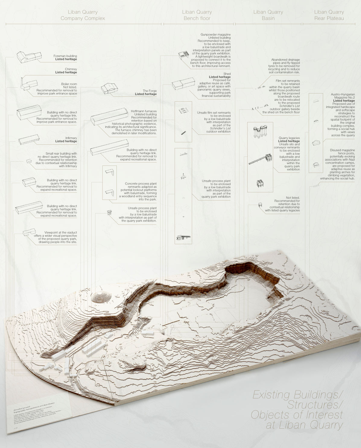
Investigation of Liban Quarry’s cultural landscape focused on its buildings, structures, and industrial remnants as evolving material traces of extraction, wartime occupation, abandonment, and subsequent reuse. The former quarry company complex area is now managed by the greenery authority, while other structures across the bench floor, basin, and rear plateau remain largely derelict. Through site measurements, photographic recording, and digital reconstruction, these elements were documented in relation to their historical significance, spatial roles, and potential for adaptation, interpretation, or long-term stewardship.

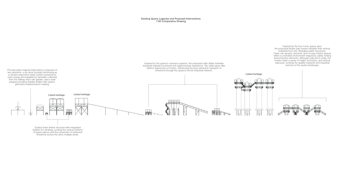
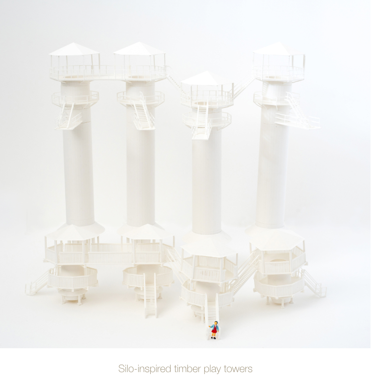
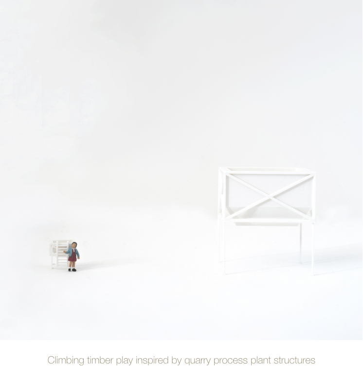
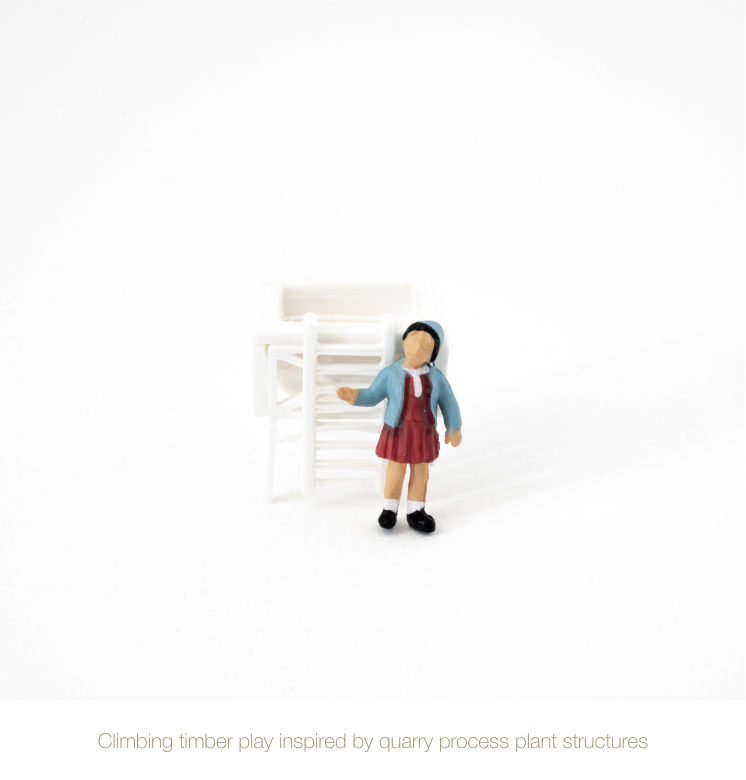
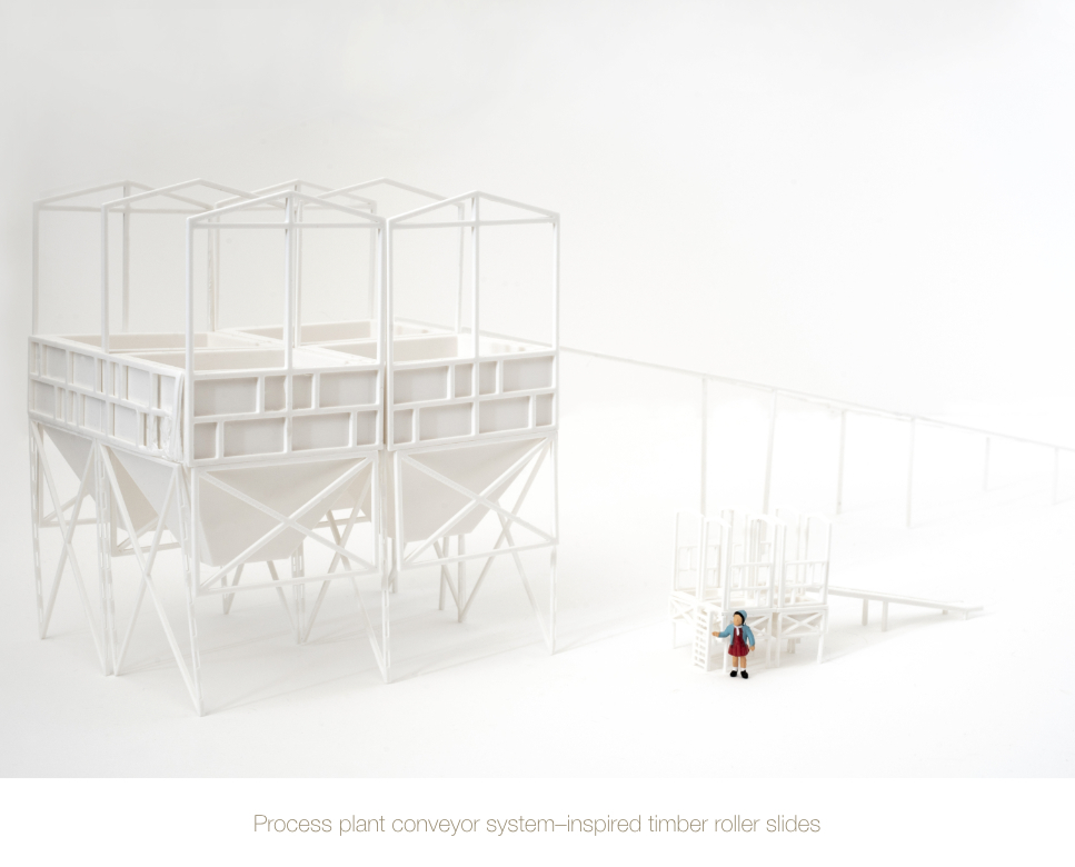
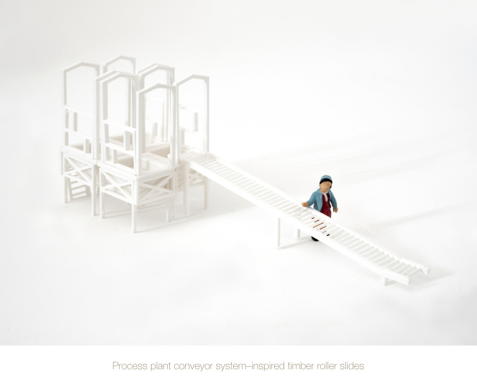
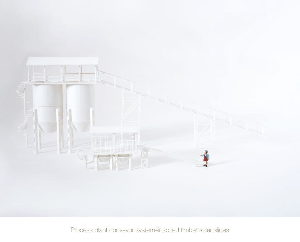
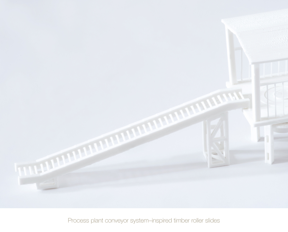
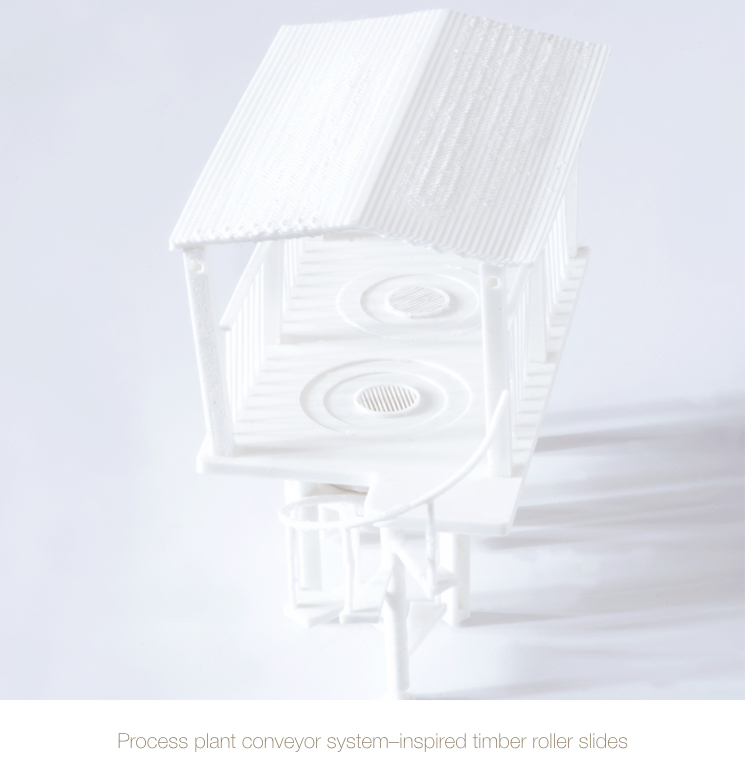
Beyond documentation, digitally modelling and physically making these material remnants became a form of design inquiry. Reconstructing quarry structures revealed their geometries, construction logic, and spatial character, informing decisions on retention, adaptation, and reinterpretation. The models also acted as catalysts for design development, inspiring a series of quarry-derived interventions including timber play elements, picnic furniture, and climate-responsive structures. Through this iterative process of measuring, modelling, and making, material heritage became not only a record of the past but also a generator of new spatial experiences and future landscape identities.

IntegratedSiteReading_Cultural Landscape and Material Heritage expand
Planning with Imagery and Metaphor

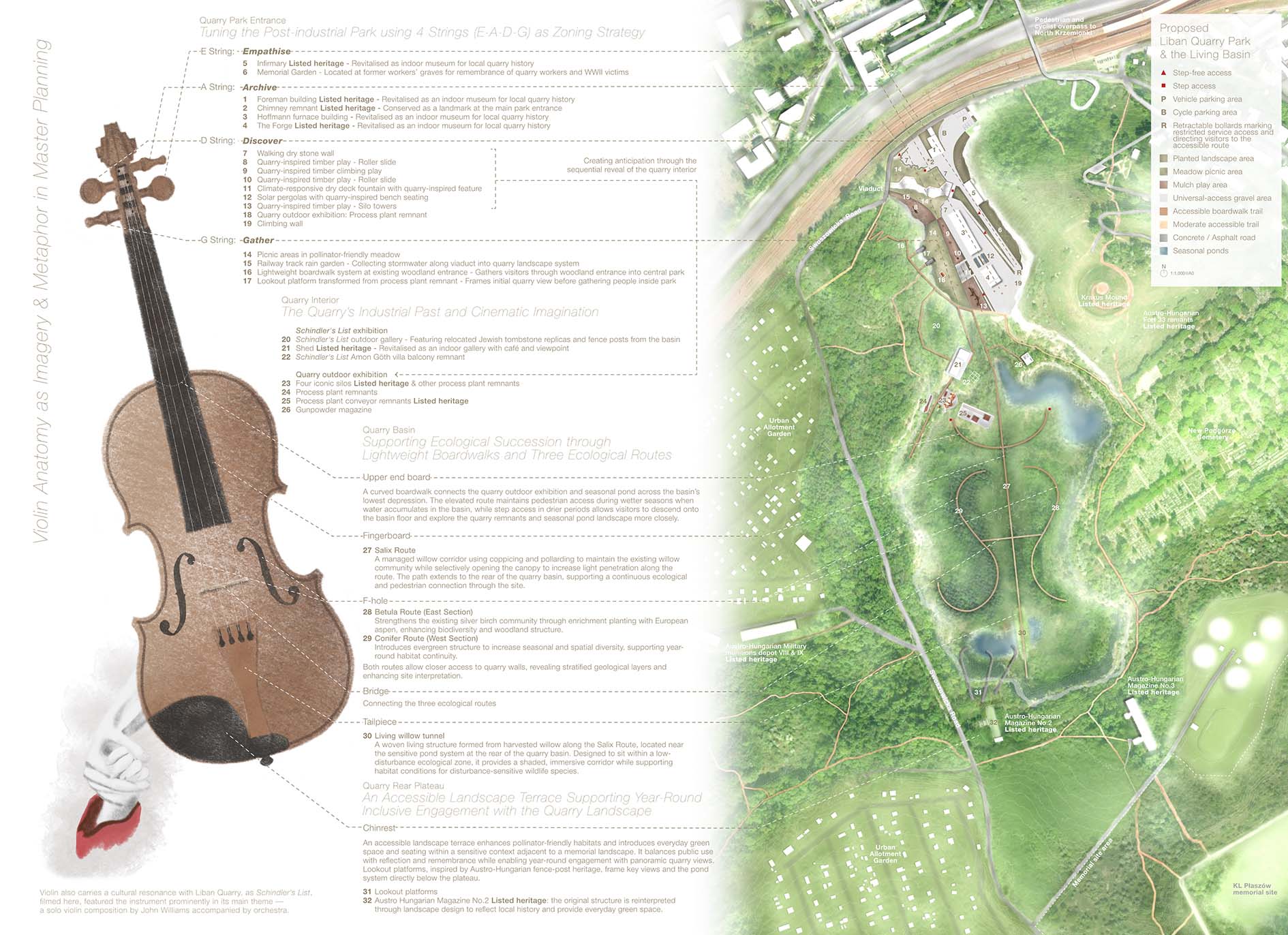
Through repeated tracing and iterative planning studies, certain features of Liban Quarry began to suggest aspects of a violin when viewed in plan. The opposing curves of the quarry walls near the centre of the site, loosely resembling an S-shape and its reverse, together with the elongated entrance sequence and rear plateau, prompted an exploration of the instrument's anatomy as a way of reading and organising the site. Key locations within the quarry were associated with different parts of the violin, providing a loose spatial framework that informed the arrangement of routes, programmes, and landscape experiences.

This interpretation is further enriched by the cultural associations of the violin within Schindler's List, parts of which were filmed at Liban Quarry. In John Williams' score, the violin carries the film's iconic main theme, its solo voice emerging from the wider orchestral texture to convey themes of memory, loss, and remembrance. Referencing the instrument therefore extends beyond its suggestive resemblance to the quarry, introducing an additional layer of cultural and commemorative meaning that connects the site's industrial, cinematic, and memorial histories.

Planning_Violin Anatomy as Imagery and Metaphor expand

Tuning the Post-industrial Park: A Violin-Based Zoning Strategy (E–A–D–G) 

E String — Empathise
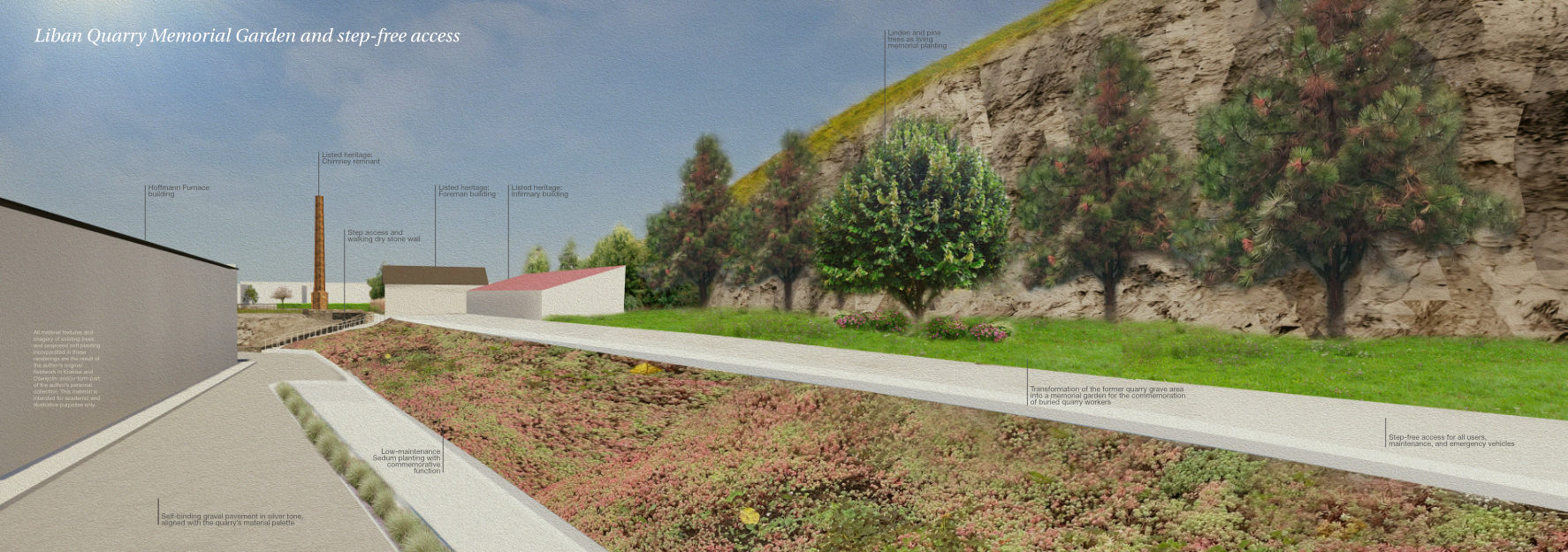
The E string corresponds to the area of the quarry worker graves, where the memorial garden is situated. This zone strengthens the site’s commemorative role by acknowledging both the quarry workers and victims of the Second World War associated with the quarry landscape, creating a space for reflection, remembrance, and quiet engagement with the site’s layered histories.

A String — Archive
The A string extends from the foreman’s building to the chimney and forge, preserving and revealing key industrial structures within the quarry. This zone communicates the site’s industrial heritage through the conservation, adaptation, and interpretation of surviving buildings, allowing visitors to engage with the material traces of extraction and production.

D String — Discover
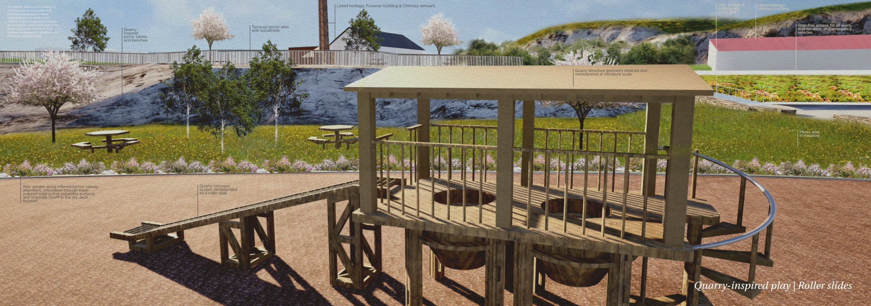
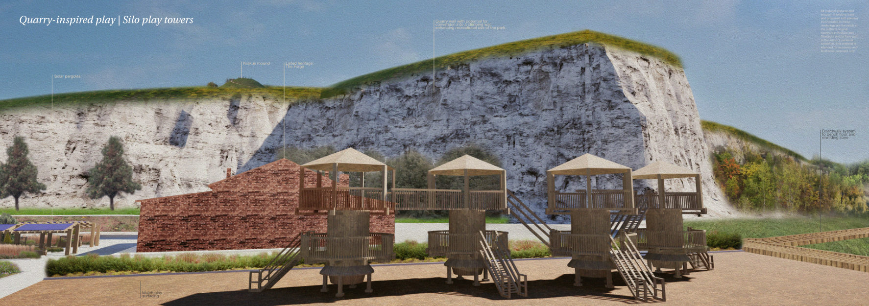
The D string creates opportunities for exploration and embodied engagement throughout the quarry. Through quarry-inspired play elements, interpretive features, and moments of anticipation, visitors are encouraged to discover the site’s industrial legacies, material qualities, and evolving landscape character through movement and interaction.

G String — Gather
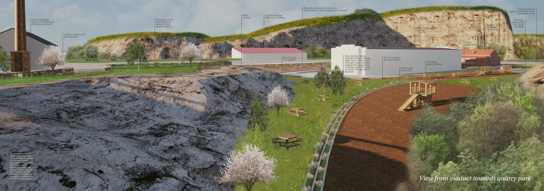
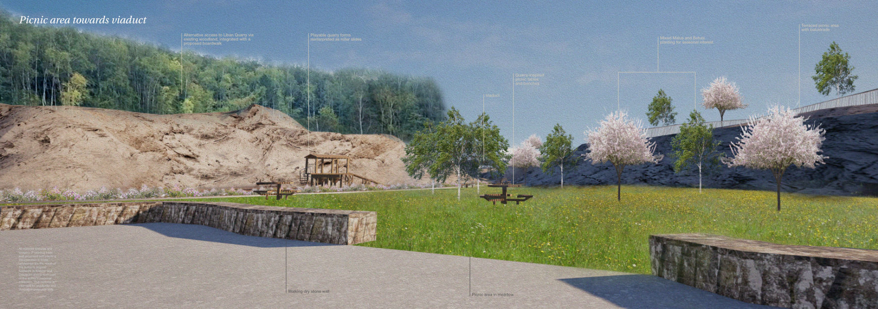
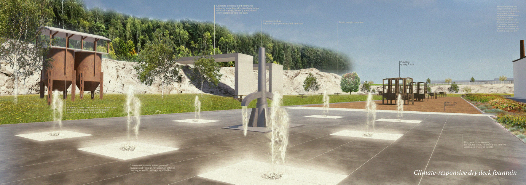
The G string brings together social gathering and water gathering within a shared landscape setting. Surface runoff is collected and directed towards a climate-responsive dry deck fountain, where water management becomes part of the visitor experience. Adjacent picnic spaces, lookout platforms, and an inclusive boardwalk network create opportunities for meeting, resting, and observing the quarry from different elevations. Positioned between woodland and quarry, this zone acts as a social heart of the park, connecting people, landscape, and environmental processes through everyday use.


Detailed Design

Walking Dry Stone Wall

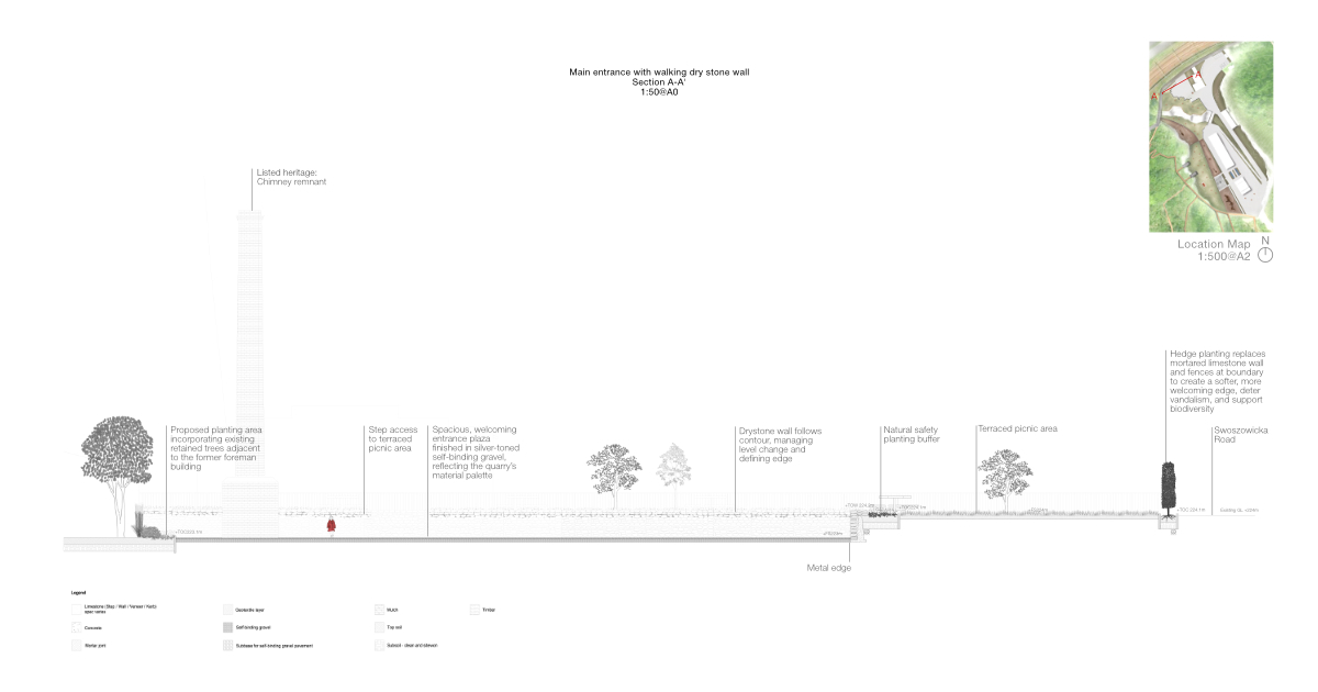
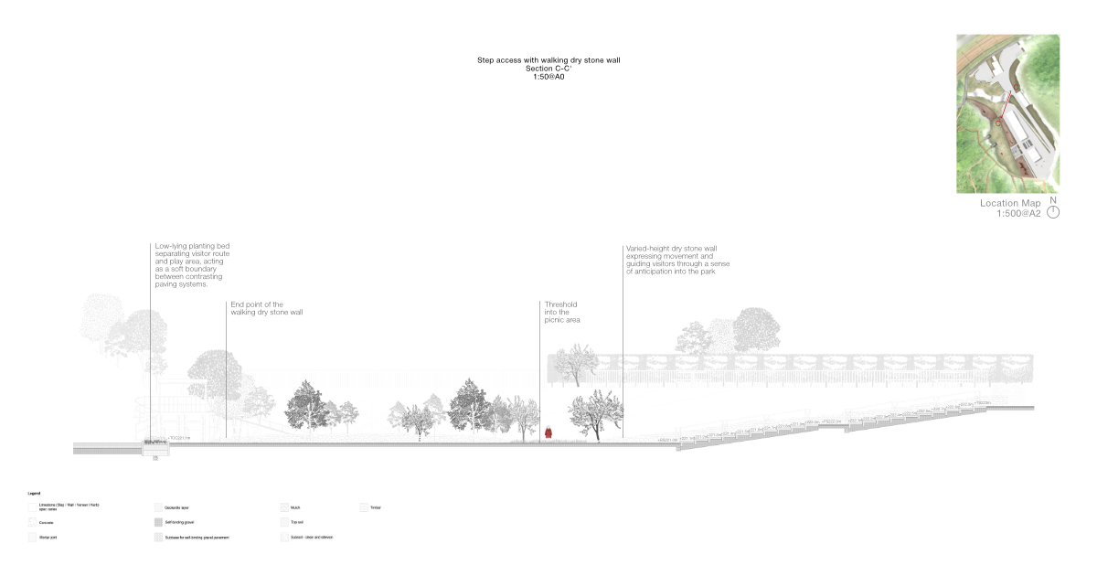
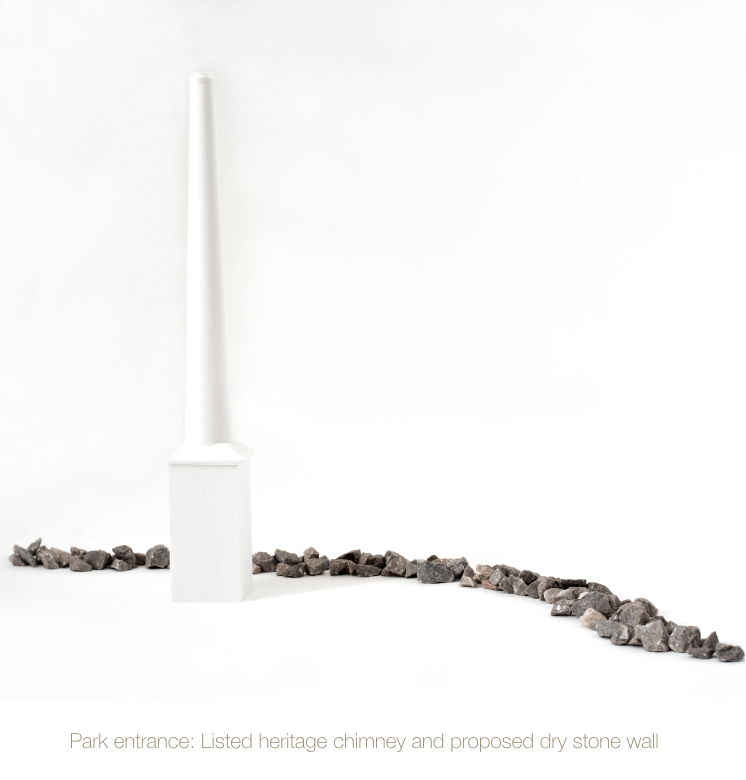
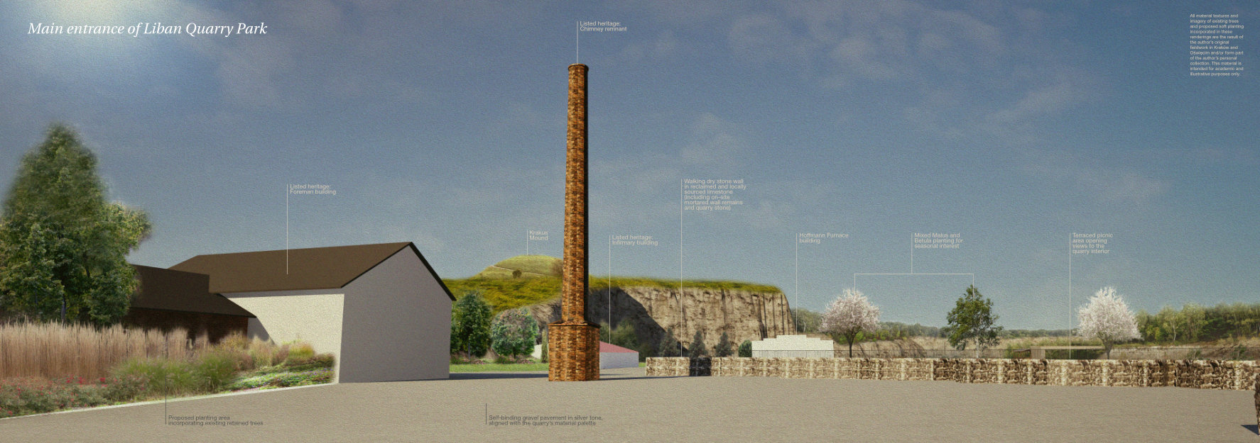
Inspired by Andy Goldsworthy’s Taking a Wall for a Walk and Walking Wall, the dry stone wall reinterprets limestone as a dynamic landscape element. Extending from the main entrance into the park alongside step access, it guides visitors through the first sequence of the post-industrial landscape and towards further exploration of the quarry.

By transforming an existing mortared wall into a dry stone structure, the intervention symbolically liberates limestone from fixed industrial form and reconnects it with natural processes. Set against the vertical brick chimney and former foreman’s building, the flowing wall highlights the contrast between stone and industry, while suggesting a metaphorical return of extracted material to the quarry landscape.

Placeful and Climate-Responsive Interventions

Drawing on the industrial heritage and spatial character of Liban Quarry, a series of interventions support comfort, social interaction, play, and environmental performance within the post-industrial park.

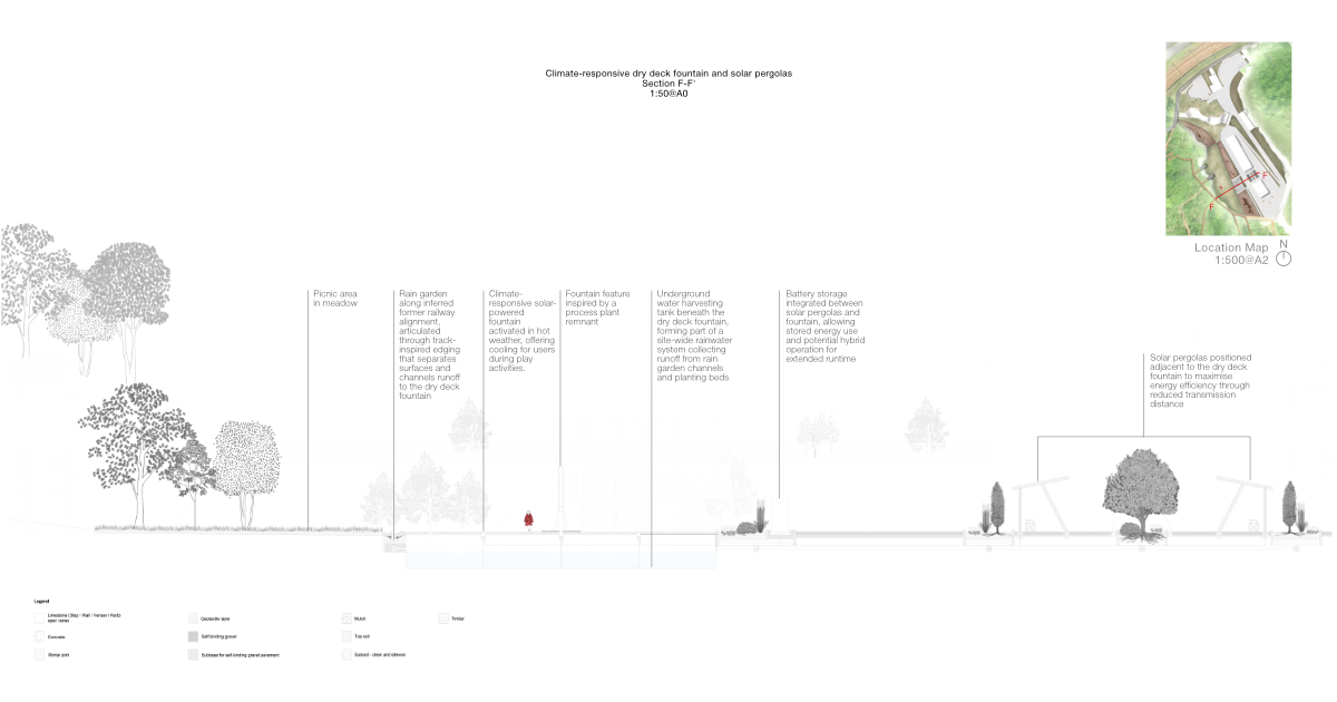
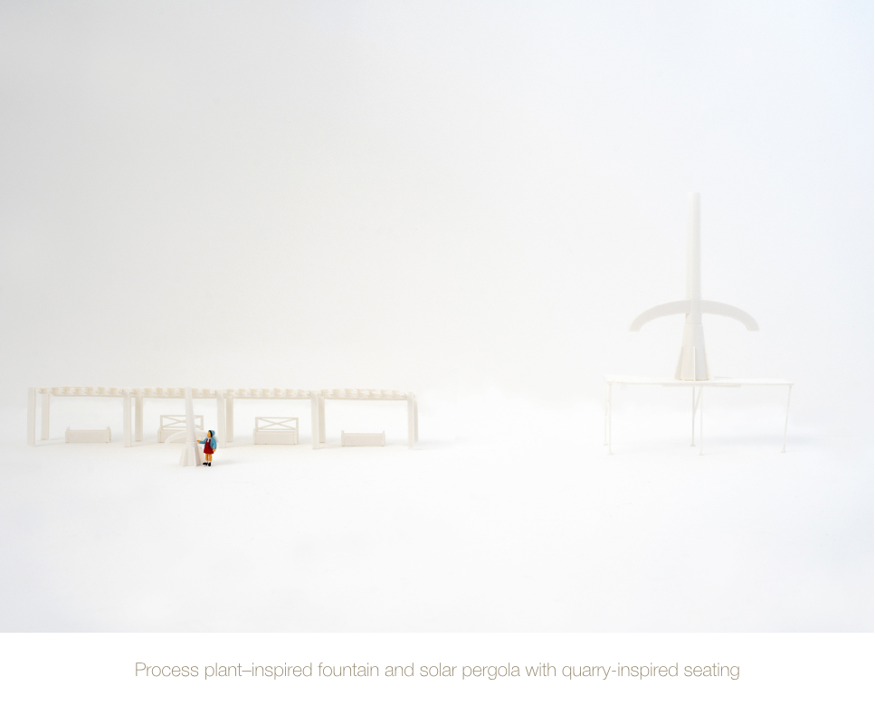
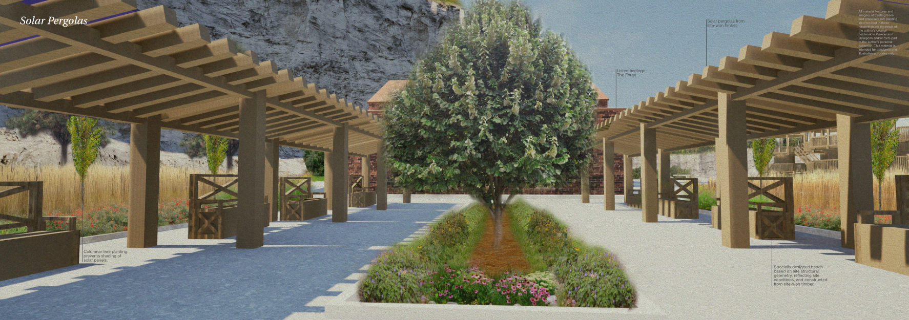
Solar pergolas provide shaded resting spaces and passive thermal comfort, while a solar-powered dry deck fountain offers evaporative cooling and interactive engagement during periods of hot weather. Quarry-inspired seating, timber play elements, and picnic furniture encourage everyday occupation and social gathering, extending the site's industrial language into contemporary landscape experiences.

The rain garden follows the presumed alignment of former quarry railway tracks, recalling the site's industrial history while functioning as part of the sustainable drainage strategy. Surface runoff is filtered and directed towards an underground storage tank beneath the fountain, enabling seasonal water reuse and supporting the park's climate adaptation objectives.

Resonant Trio: Three Ecological Routes in the Living Basin

The violin metaphor is extended into the living basin through three ecological routes that guide movement while responding to the site's evolving successional landscape.

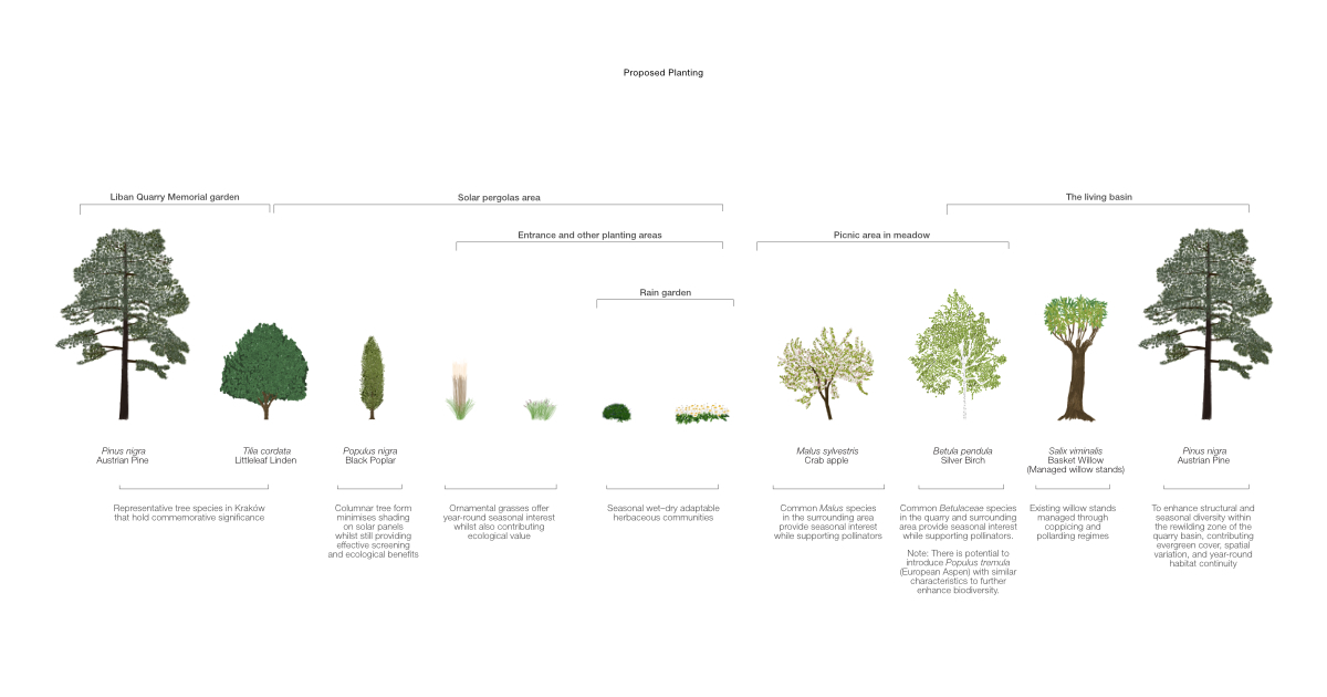
The Salix Route follows the wetter areas of the quarry basin, reinforcing existing willow-dominated habitats. Existing Salix stands are retained and managed through coppicing and pollarding to enhance habitat diversity and ecological resilience. A living willow tunnel provides a low-disturbance structure for visitors to experience sensitive pond habitats, allowing closer engagement with wildlife while minimising impacts on amphibians, odonata, and other species associated with these habitats.

The Birch Route follows areas of the quarry basin where Betula species have established through natural succession. Strengthening these existing woodland conditions, the route supports the continued development of pioneer woodland communities while responding to periodically wet ground influenced by nearby pond habitats. Movement through the birch landscape reveals the evolving relationship between woodland succession, water, and ecological change within the basin.

The Conifer Route introduces structured evergreen planting within selected areas of the basin, complementing existing successional habitats while adding a distinct woodland character. Providing year-round structure, shelter, and seasonal continuity, the route supports habitat diversity and strengthens the spatial identity of the living basin.

Instead of prescribing a fixed ecological end state, the three routes work with existing processes of succession and natural regeneration. Each offers a distinct encounter with the quarry landscape while contributing to its long-term ecological development and environmental learning.

Design Through Making: Walking the Quarry — An Embodied Exploration of Quarry Geometries through 1:50 Physical Models

Fragile quarry remnants within the former extraction zone remain unsafe and largely inaccessible. Through detailed site measurement, digital modelling, and 1:50 physical model making, key structures and industrial traces were documented, analysed, and reinterpreted as part of the design process.
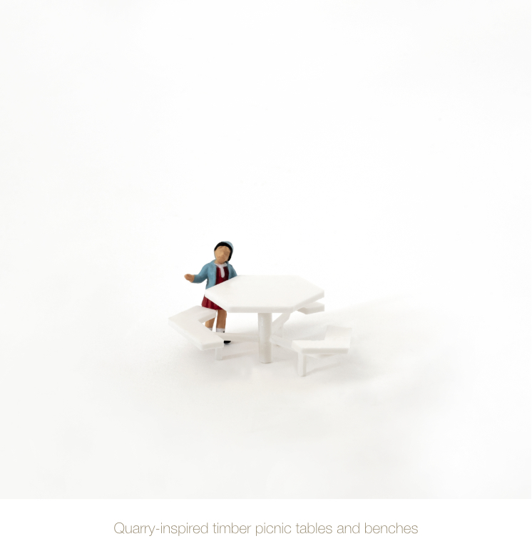
The 1:50 models bring together two complementary design approaches. The walking dry stone wall expresses the movement and transformation of limestone within the quarry landscape, while timber play features, park furniture, and climate-responsive fountain elements reinterpret the geometries of inaccessible quarry structures at a human scale. These interventions transform industrial legacies into spaces for movement, pause, exploration, and social encounter.

Note: Limestone gravel representing the walking wall is intentionally exaggerated in scale to emphasise material movement and texture. Quarry structures and proposed interventions are shown as 1:50 3D-printed models. A commercially available child scale figure is included solely to illustrate spatial scale and embodied experience.

Ki Yan Hung

Idyllic Neighbourhood: A site-scale proposal for Liban Quarry Park developed from the 'Harmonising Krzemionki' transformative framework