
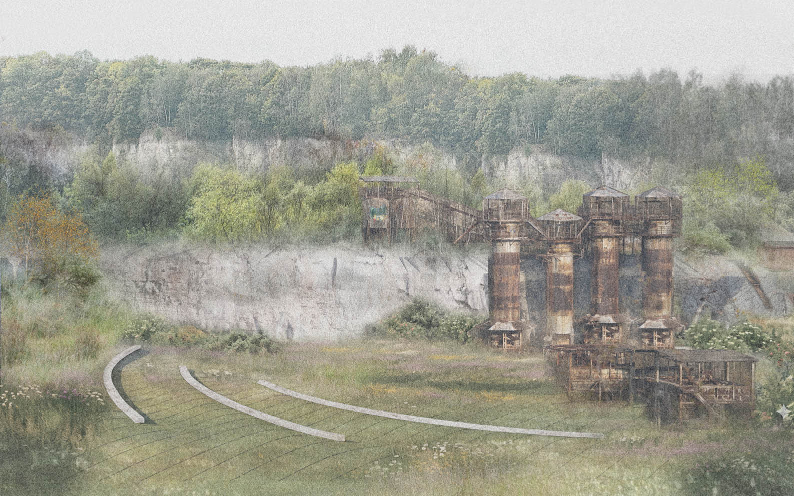
This project focuses on Liban Quarry in the Krzemionki area of southern Kraków, exploring how a post-industrial landscape with a complex history can be reimagined through memory, ecology and public use. Rather than transforming the quarry into a single unified park, the proposal understands it as a continuous landscape shaped by time and gradients of intervention: the north anchors memory, the middle connects people with natural habitats, and the south supports spontaneous succession through low-intervention ecological strategies.


Chenhao Han
A LANDSCAPE OF GRADIENTS
Project description
Krzemionki’s Scar
To speak of Krzemionki is almost inevitably to speak of history. Its industrial past and wartime violence have profoundly shaped this landscape. This is perhaps why I believe the site should be understood through more than one identity.

Liban Quarry: An Undecided Landscape
Liban Quarry has long been part of planning, conservation and revitalisation discussions, yet it has never become a conventional public park. Today, the site remains caught between historical memory, ecological protection, public access and spontaneous succession. Its key tension lies in how people can understand and enter this landscape without erasing the wildness that has emerged over time.
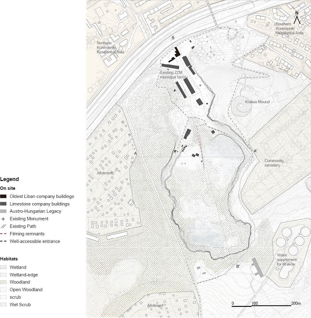
Liban Quarry
Liban Quarry was established in 1873 by the Jewish Liban and Ehrenpreis families and became one of Kraków’s important limestone quarries. During the Nazi occupation, it was turned into a forced labour camp, leaving the site deeply marked by wartime violence. After the war, quarrying continued under nationalised ownership until the limestone deposit was exhausted and operations ceased in 1986. Since then, Liban has remained largely unmanaged, carrying traces of industry, war memory and later ecological succession.

Ecological Succession
Liban Quarry is a land that has been through a great deal. It has been disturbed multiple times and undergone succession again and again. I selected three time points — 1970, 1997, and 2025 — and using satellite imagery as a base, produced hand-drawn maps of the site's condition at each stage.

A 1:2500 clay model divided into three parts to represent three phases of succession. The black pins mark trees that existed before 1970, while the remaining vegetation represents later growth.


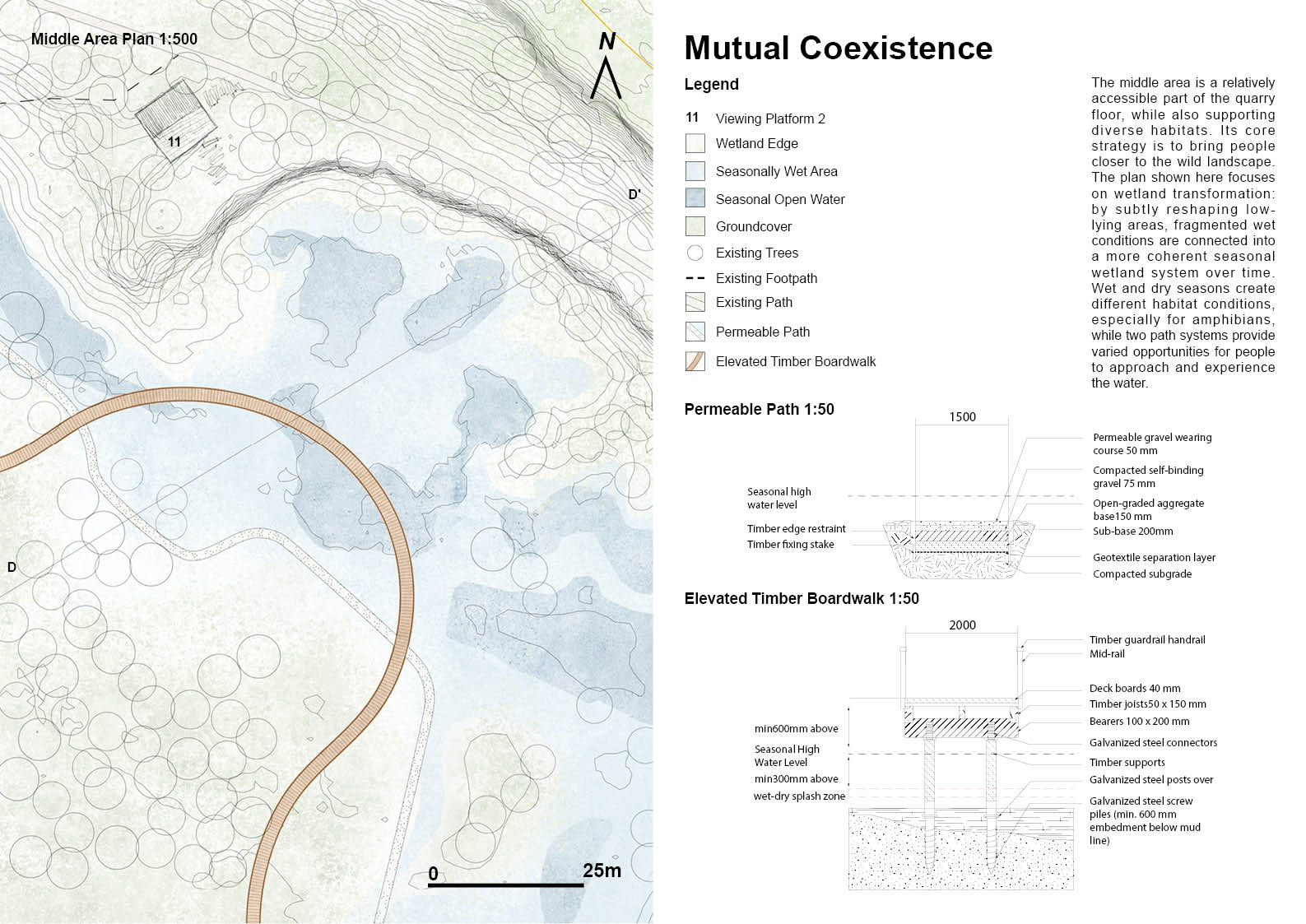
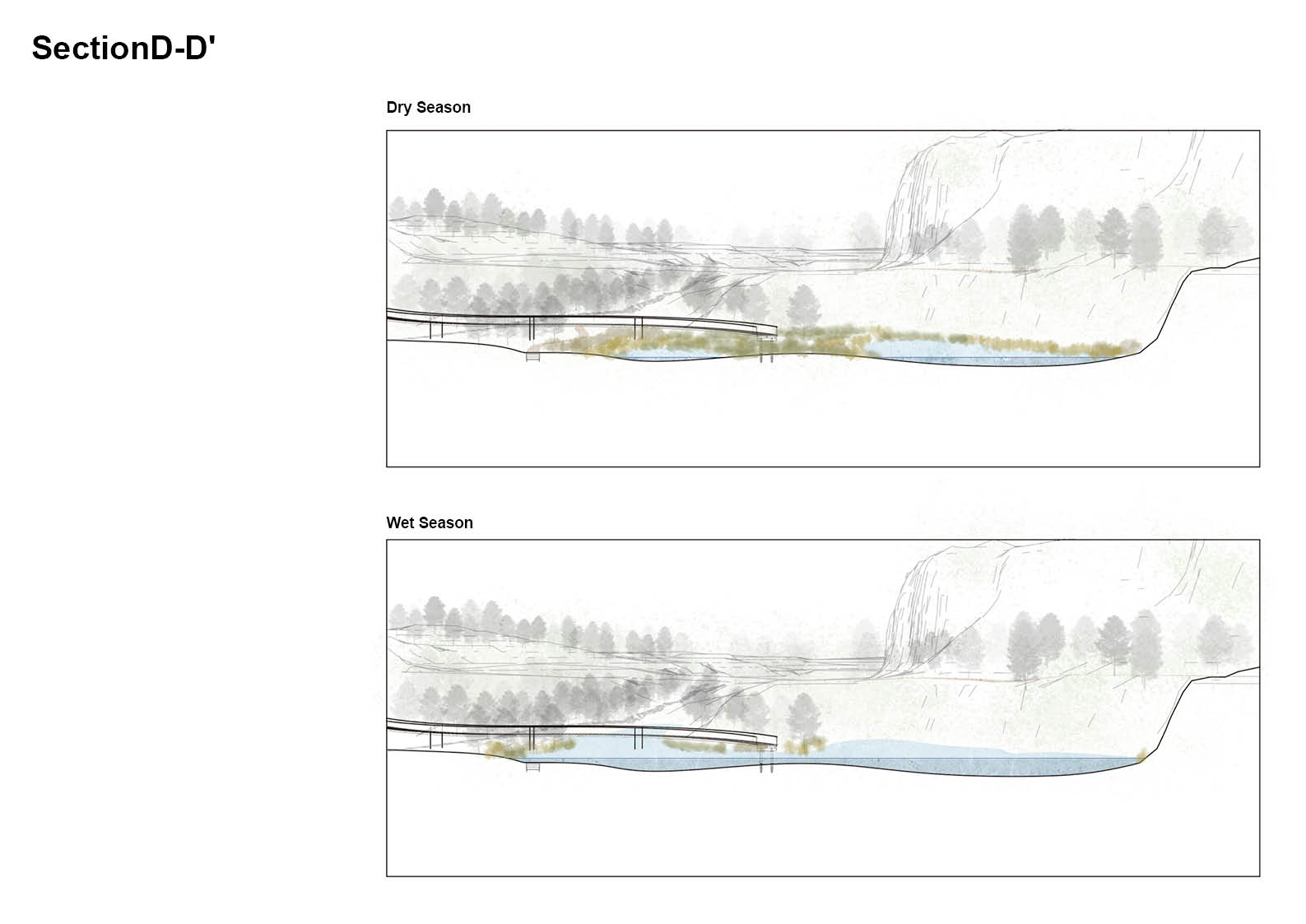
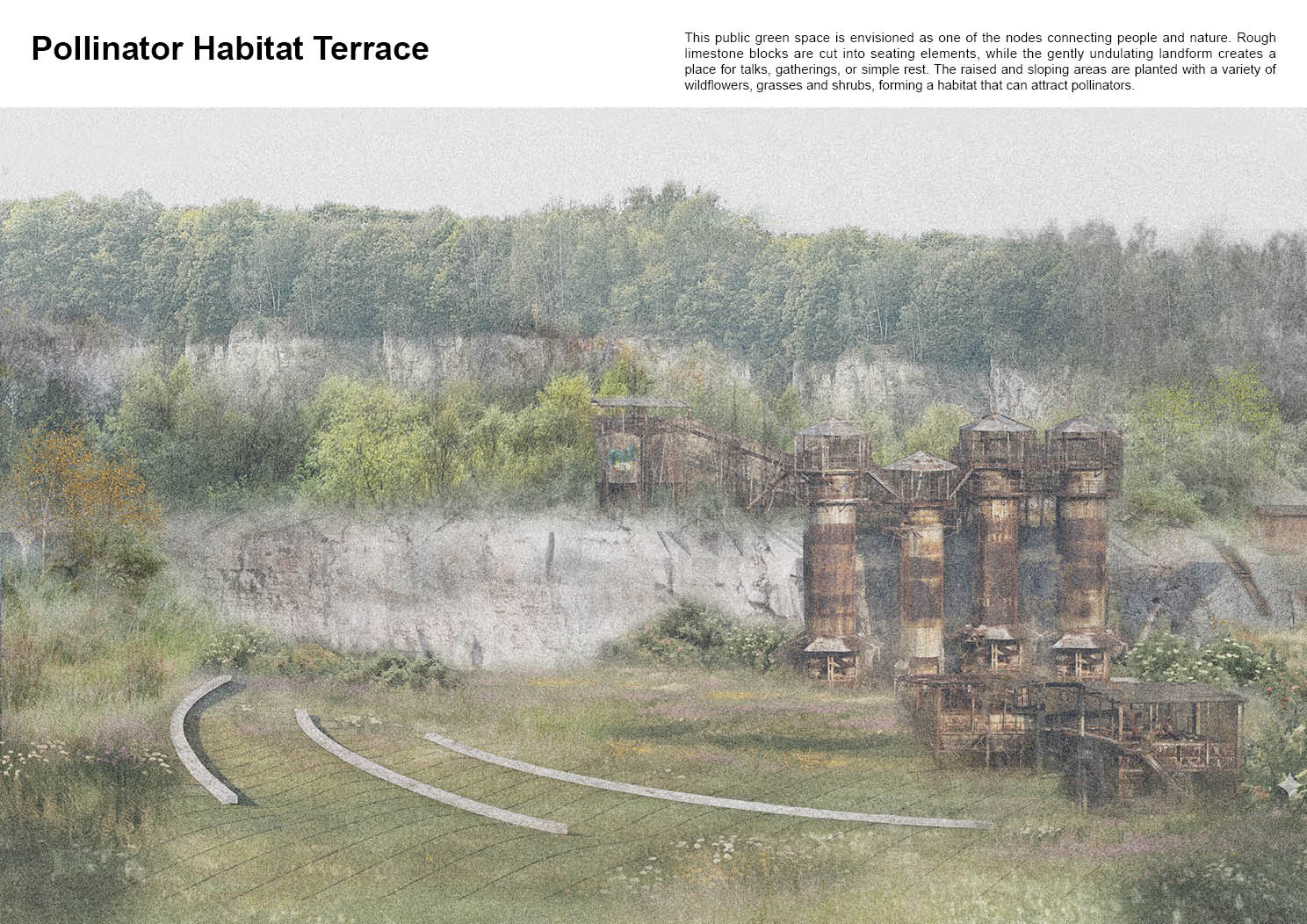
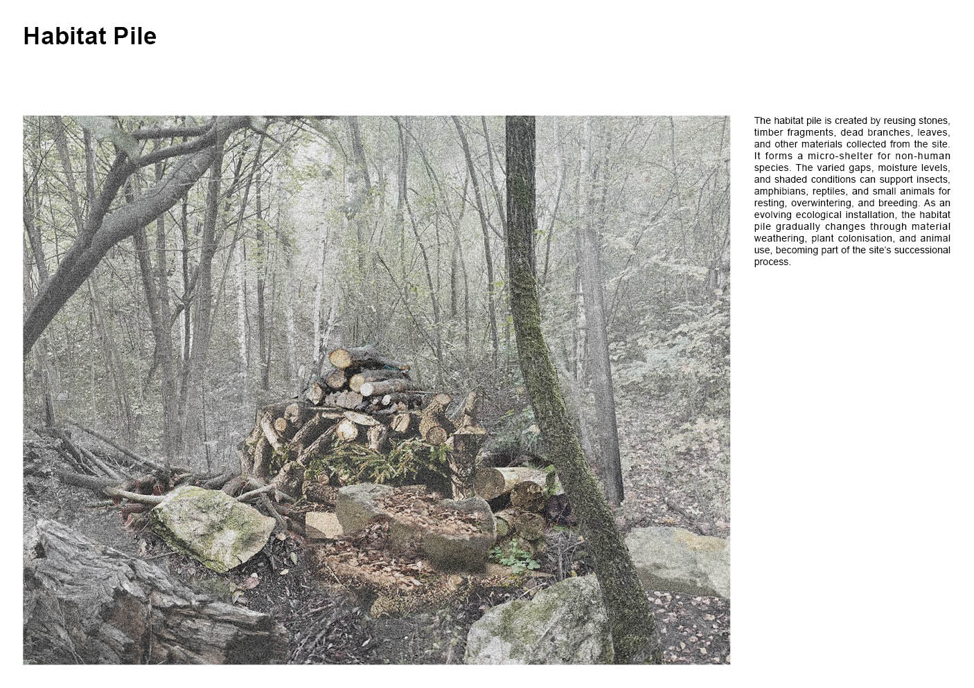
The proposal organises Liban Quarry as a continuous landscape shaped by different gradients of intervention. The north is defined as Anchoring Memory, where new public infrastructure, spatial narratives and memorial spaces make the site’s industrial and wartime histories more accessible. The middle becomes a zone of Mutual Coexistence, reconnecting people with the quarry through improved access, seasonal wetlands, pollinator habitats and boardwalks. The south is treated as Ecological Continuity, where low-disturbance access and ecological devices such as dead hedges, habitat piles and artificial perches support spontaneous succession. Together, these strategies respond to the site’s layered history, public use and ecological transformation.
Anchoring Memory


Mutual Coexistence
Ecological Continuity



Share: