Project Introduction

The site is located at the estuary of the Averon River and its surrounding areas in the Scottish Highlands. It is composed of many "edges" that constantly exchange energy, water and materials. Among them, three typical conditions stand out: first, the intertidal zone where the river meets the sea; second, the midstream whisky riverbank that is affected by river floods and shaped by sedimentation and water flow; third, the industrial belt along the coast. The site has a dual identity. On the one hand, it has sensitive estuarine wetlands and important blue carbon habitats; on the other hand, it retains the abandoned RAF Alness, a military airport from World War II. Therefore, it is both ecologically fragile and rich in history. However, today, this landscape is under multiple pressures: sea levels are rising, salt marsh space is being compressed, wave energy is eroding the gravel spit, and industrial wastewater and waste heat are flowing into the bay. Meanwhile, local resources within the site, such as oyster shells, river mud, construction waste, and waste heat from distilleries, are simply discarded as garbage. This project aims to build a blue carbon sink landscape network that supports each other from the watershed to the coast, from natural processes to industrial processes. It not only restores the wetlands themselves but also repairs the long-broken relationships between humans and nature, as well as between industry and ecology.

The core issue faced by this project is the contradiction between the developing town and the fragile estuary environment. The estuary area has long been affected by tides, floods, sea level rise, changes in salinity gradients, and variations in flood frequency, with increasing risks of salt marsh migration restrictions, weakened blue carbon functions, and biodiversity decline; the midstream and shoreline areas are constantly affected by wave energy, sand spit evolution, lagoon siltation, shoreline erosion, and sediment capture and loss; the coastal industrial fringe is confronted with problems such as discharge outlet temperature, nutrient input, algal bloom risks, and pollutants and heat flow from factory drainage and surface runoff entering natural water bodies. Meanwhile, the Almere town area is also under pressure from housing growth, traffic fragmentation, and insufficient public accessibility, while local resources such as oyster shells, silt, leftover construction materials, industrial waste heat, and wastewater within the site have not been effectively transformed and utilized.

动态

Taking tidal dynamics, sea level rise, salt marsh migration and carbon input pathways as the core problem framework, the design organically integrates protection, display, experience and service functions. Through salt marsh restoration, seagrass bed reconstruction and salt-tolerant plant community configuration, a complete habitat sequence from the low-tide zone to the high-tide zone is reconstructed, enhancing the continuity of the habitat and the capacity for blue carbon accumulation.

At the spatial protection level, an ecological embankment is set up along the outer edge of the sand spit to stabilize the shoreline morphology in a low-disturbance manner, providing a buffer barrier for the lagoon and mitigating the continuous erosion of the coastline by future sea level rise. Floating Aquaculture Structures and Vertical Suspended Aquaculture Systems are introduced into the lagoon water body, which not only restores blue carbon habitats and enriches marine biodiversity, but also provides new habitats and foraging spaces for birds and fish.

At the material circulation level, the sedimentation deposits in the estuary and midstream are locally converted into low-carbon building materials, and the remaining oyster shells are processed into permeable paving materials or ecological components, making the source, transformation and usage path of the materials fully visible and becoming an important part of the site education.

The analysis of the hydrological exchange system is ultimately transformed into a composite space that takes into account both ecological restoration and public perception - systematically restoring the intertidal zone gradient and blue carbon function, while allowing visitors to directly experience the operation logic of tidal rhythms and blue carbon mechanisms.

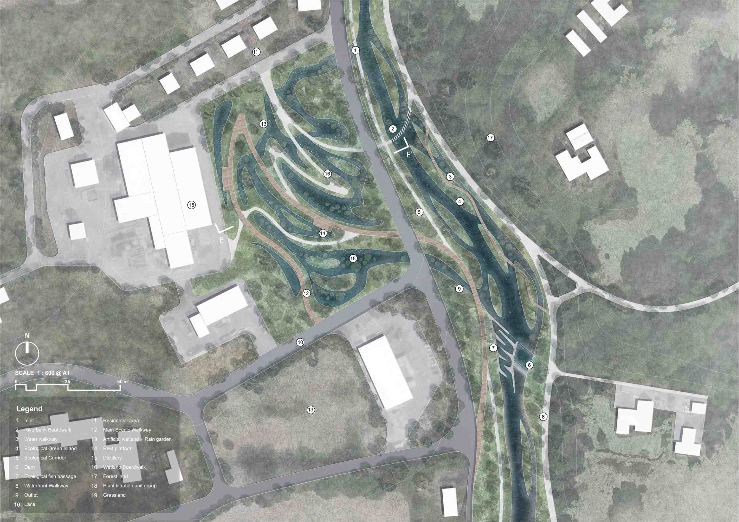
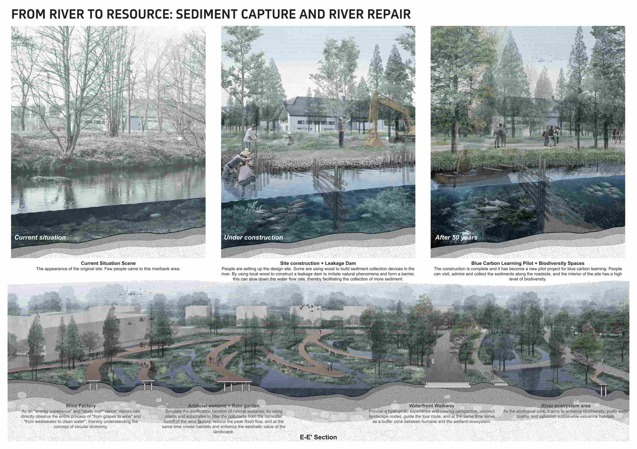
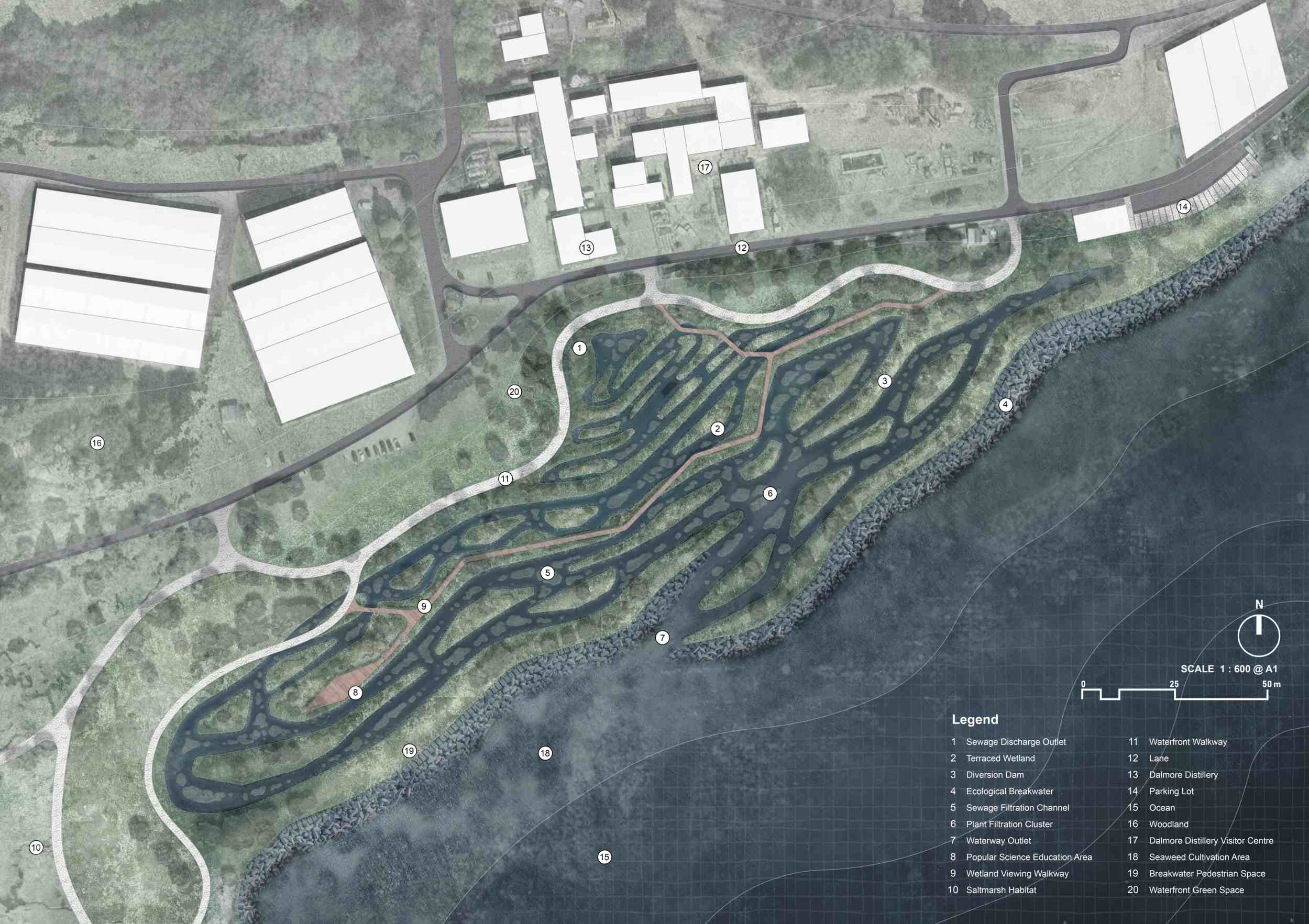
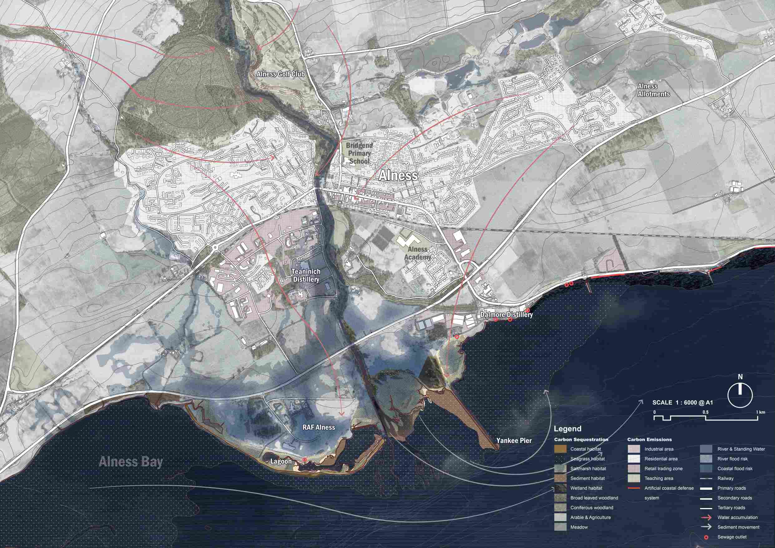
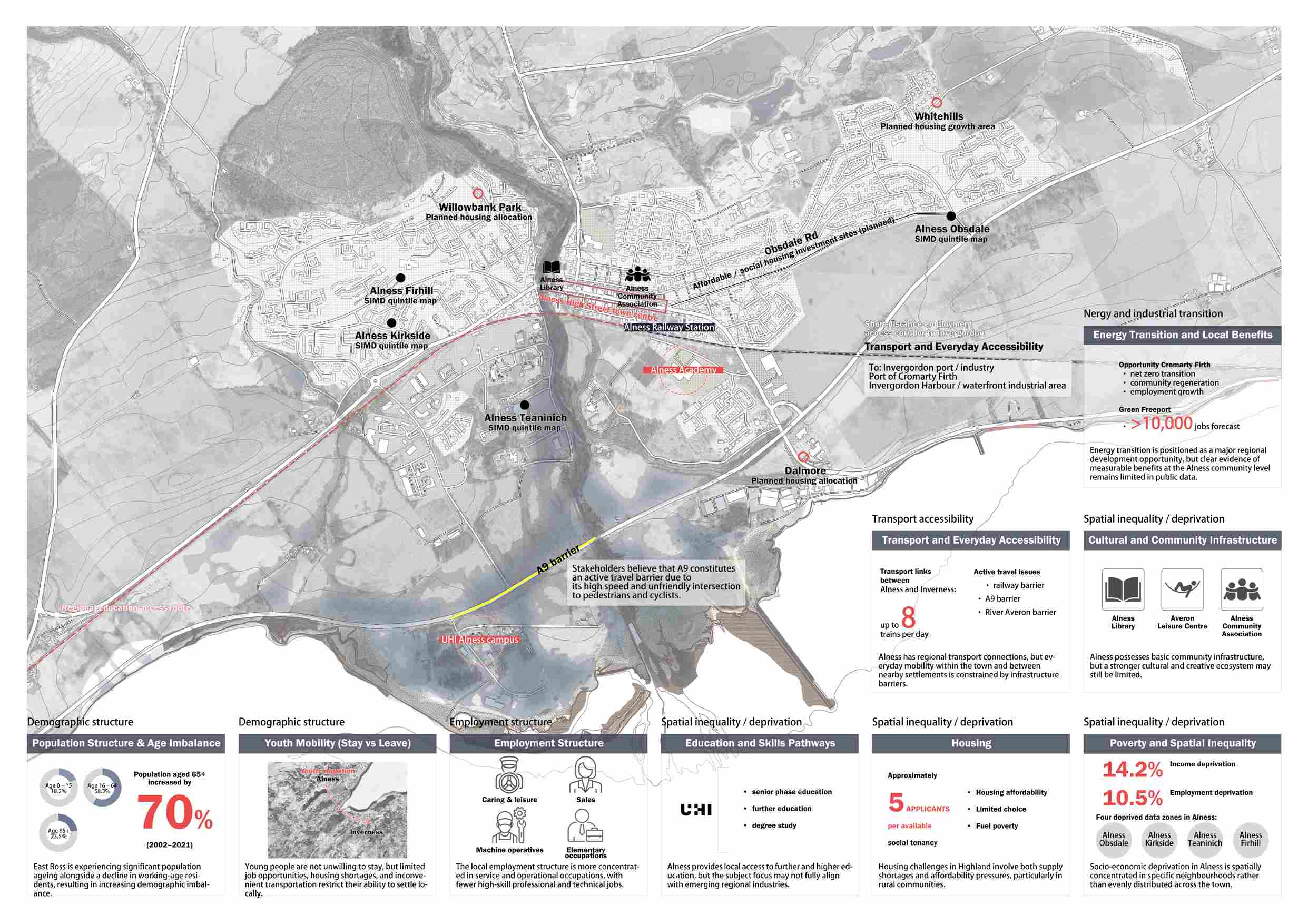
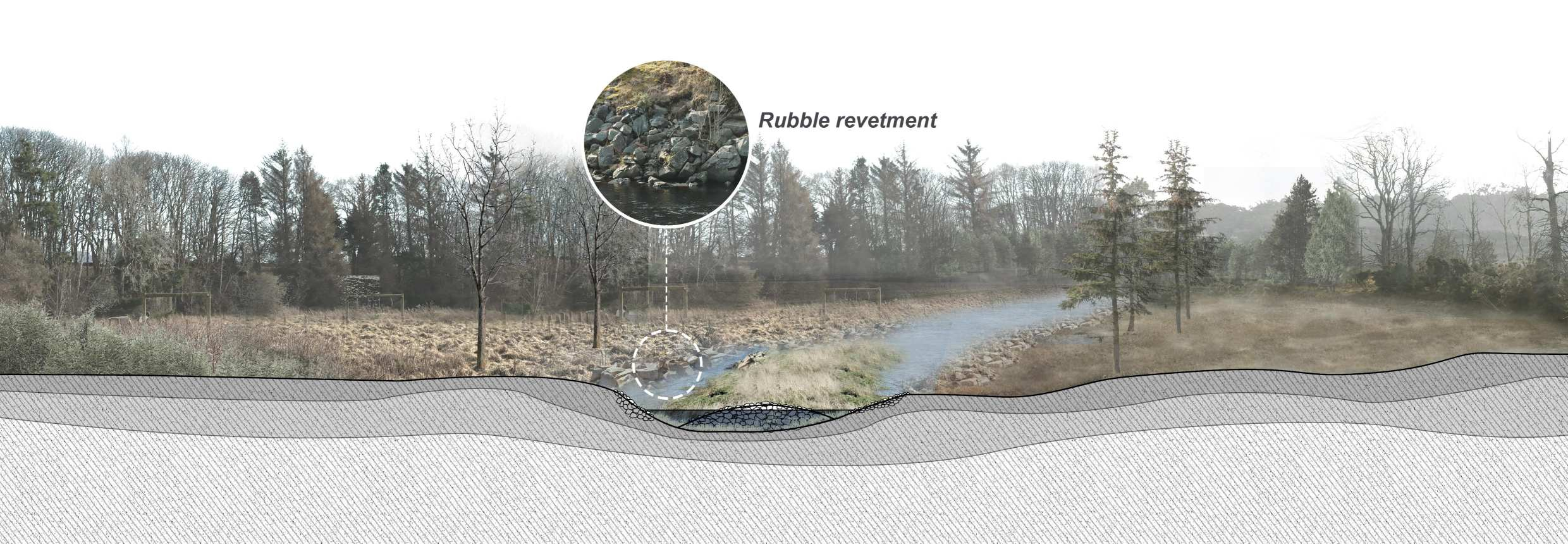
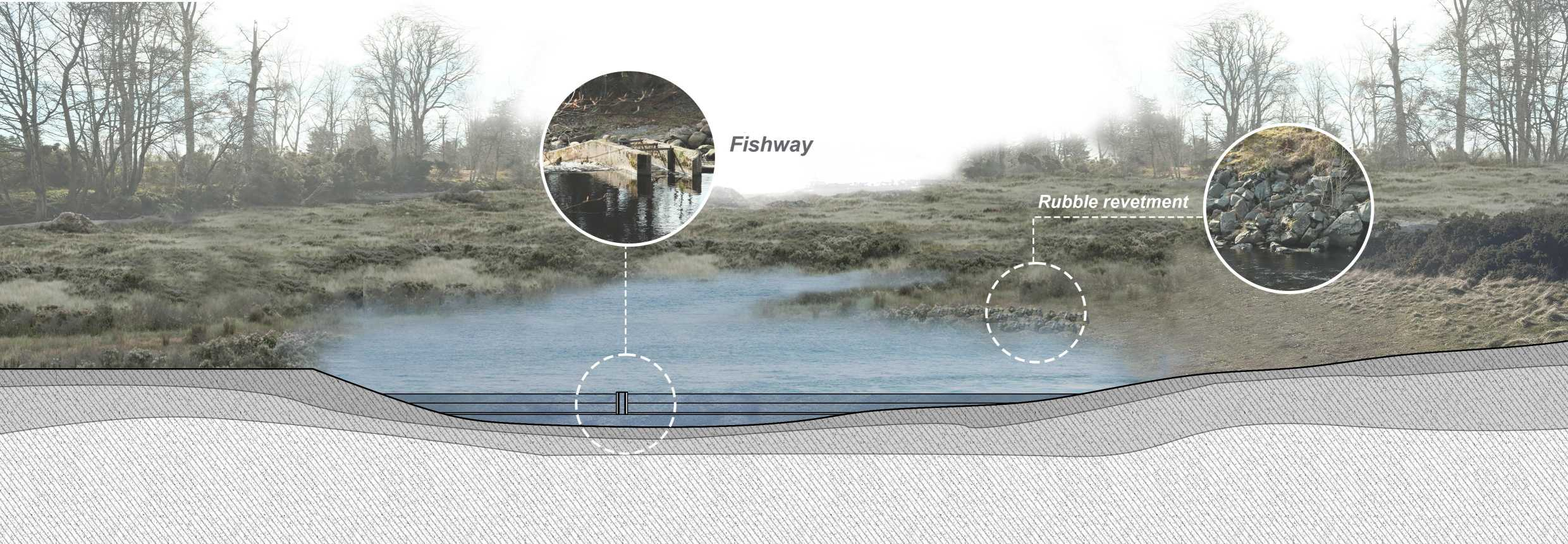
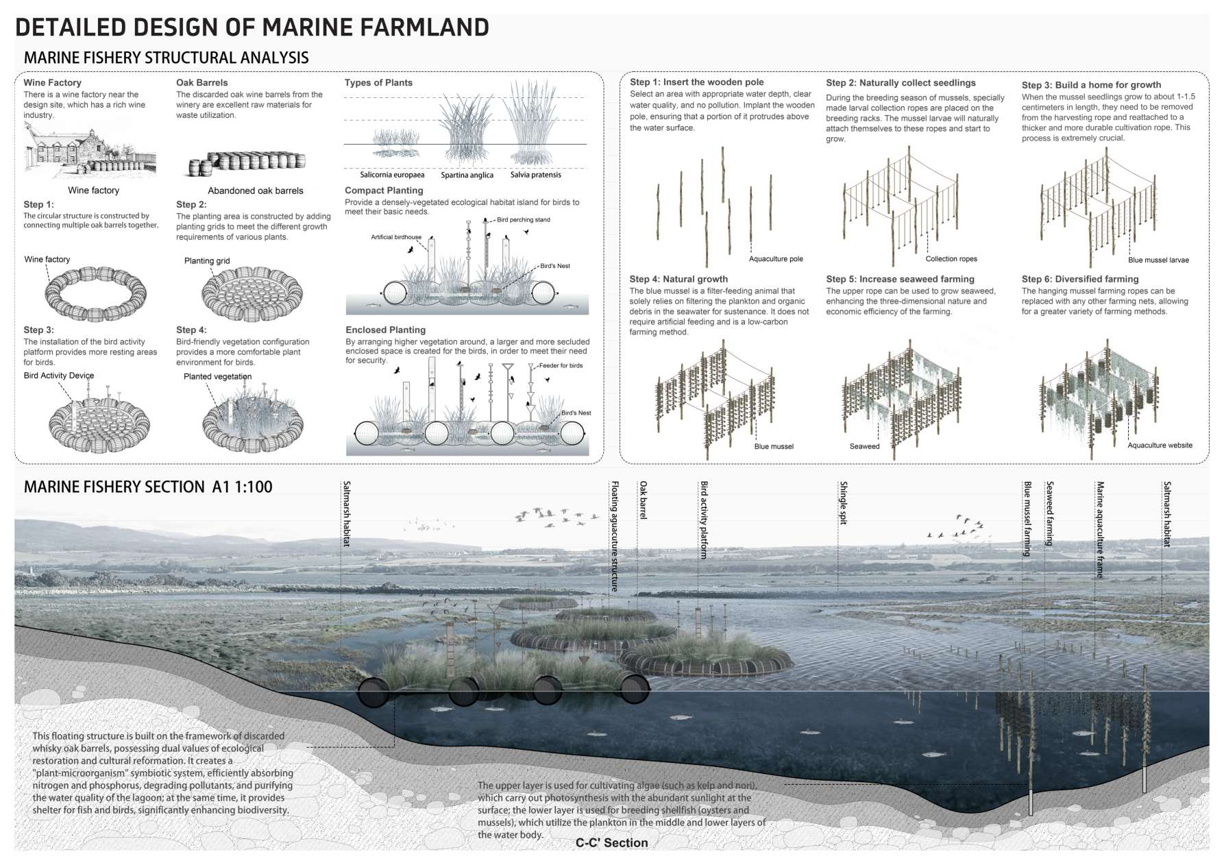
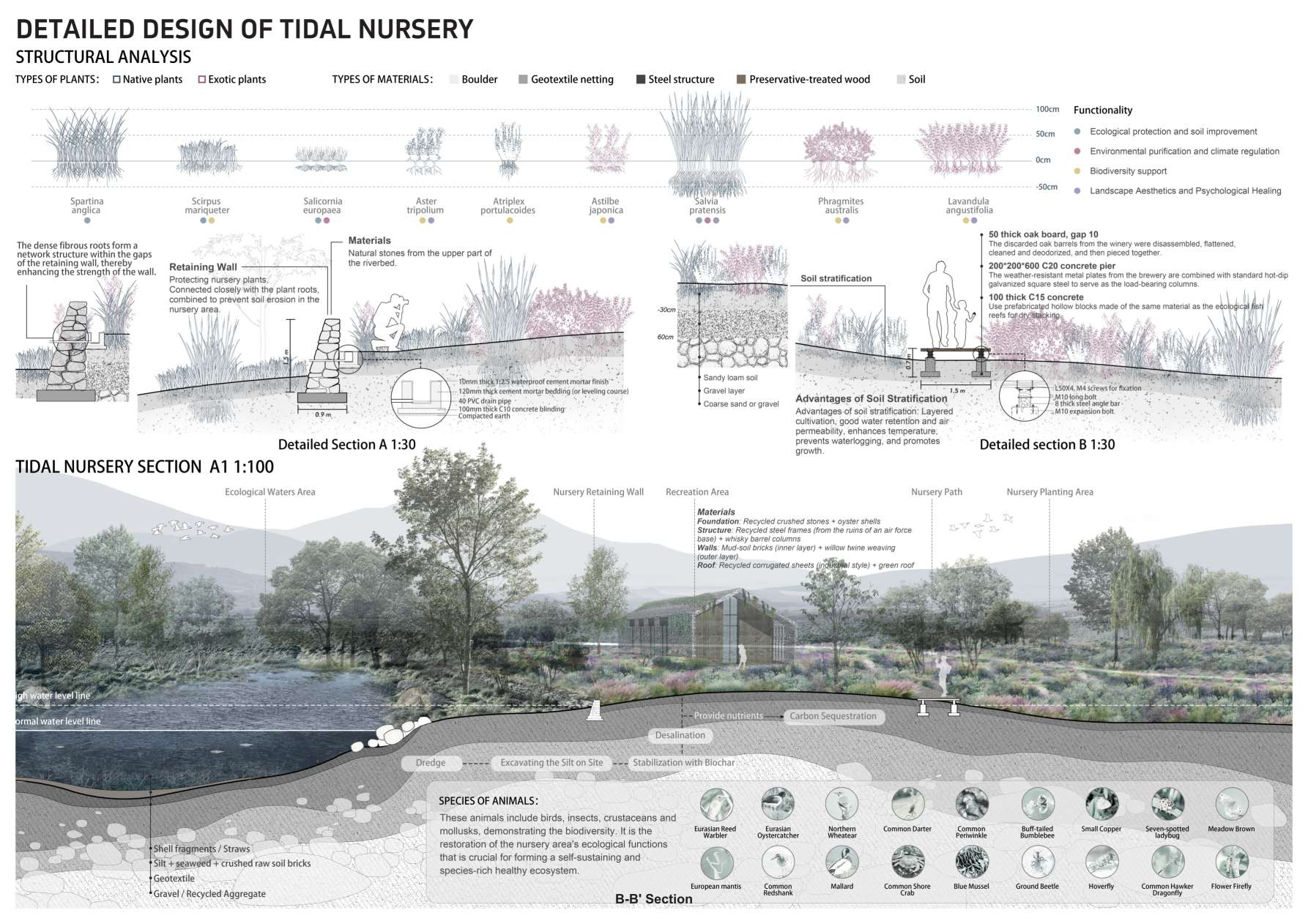
Geomorphic Feedback Edge: River Repair and Sediment Cycle Plan

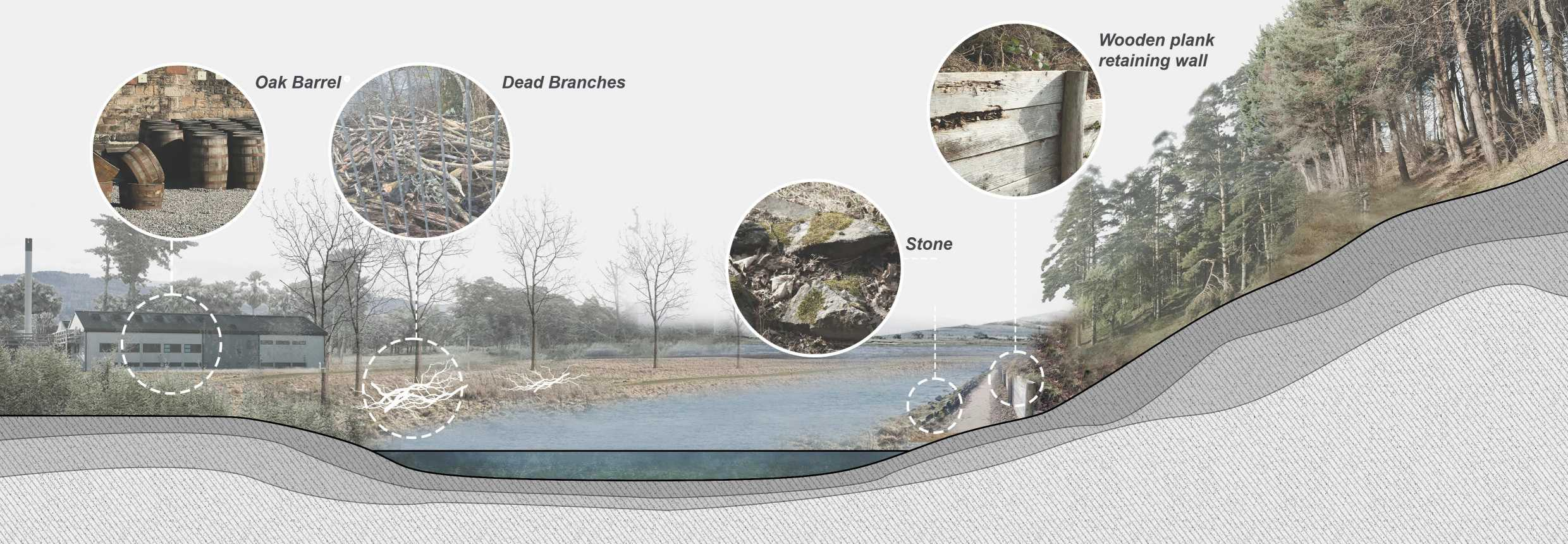
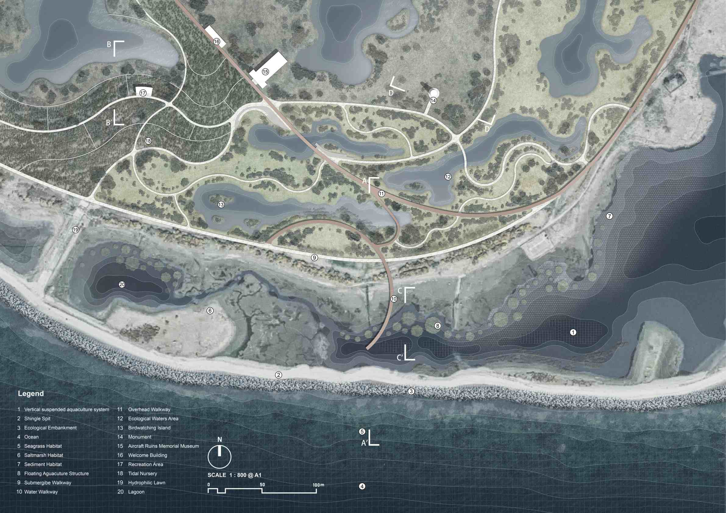
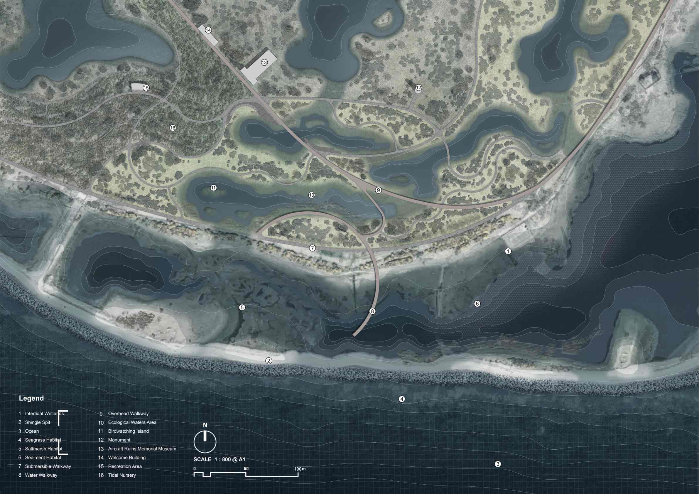
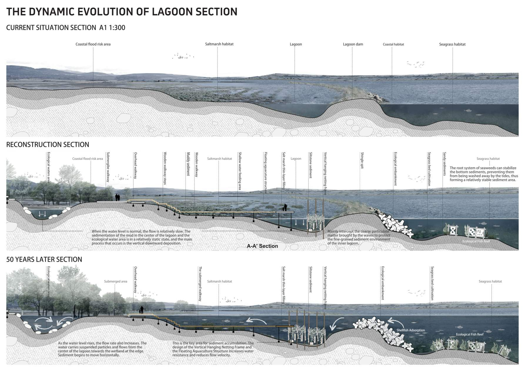
As a typical area of geomorphic feedback margins, it is mainly influenced by factors such as surface runoff, river flood, bank erosion, and sediment deposition and loss. This design scheme, on the one hand, enhances fish passage, improves river ecological connectivity and water quality; on the other hand, it transforms the vacant land in front of the whisky factory into a flood-resistant, inundable park, providing residents with space for walking, viewing and community activities under normal circumstances, and playing a role in flood storage, filtration and buffering during heavy rain. At the same time, this area also undertakes the collection, drainage, transportation and reuse of riverbed sediments, providing materials for the restoration of downstream lagoons and salt marshes, thus forming a closed sediment circulation system from upstream to downstream. In other words, the analysis of the geomorphic feedback system does not remain at the level of morphological research, but is transformed into an integrated design scheme that combines river restoration, flood-resistant landscape design and sediment flow management.

plan2
效果
Infrastructure Metabolism Edge: Waste Heat Recovery and Wetland Purification Plan

As a typical area of the metabolic boundary of infrastructure, the focus is on addressing issues related to "heat, pollution and energy exchange", specifically including the temperature of the discharge outlet, the input of nutrients, the risk of algal blooms, the drainage system of the distillery site, and the inflow of pollutants and heat from surface runoff into natural water bodies. To address these problems, the design proposal suggests recovering waste heat from wastewater and recycling it within the distillery and the surrounding community to reduce energy waste; at the same time, terraced artificial wetlands are adopted to cool and purify wastewater, reducing the load of organic pollutants and nutrients. Ultimately, an energy landscape system integrating purification, power generation and educational display functions is formed. The industrial process is transformed from a one-way consumption and discharge to an observable, experiential and recyclable ecological metabolic system.

plan3
鸟瞰

Xinrui You

Reframing the Averon Estuary: A Blue Carbon Landscape Across Dynamic Edges