Project Introduction

The Dunbar Coastal Trail is the terminus section of the John Muir Way and an important connecting section of the Forth to Farne Way, carrying multiple functions such as access, ecological transition and cultural tourism for coastal communities. However, with the increasing of sea level rise, tidal erosion, the wholeness of the coastal landscape has been gradually weakened, and the functional stability and long-term resilience of the entire coastline is under threat.

Taking a 200-year time horizon, the project proposes a highly adaptive, ecologically resilient, and community-oriented composite waterfront system across five distinct zones: Belhaven Bay, Cliff Tops, Rocky Trail, Harbour, and East Beach. Each zone faces unique challenges—ranging from coastal erosion and the loss of water-related functionality to spatial fragmentation caused by conflicting tourism and fishing activities. Instead of applying a uniform solution, the project adopts a differentiated, site-specific strategy that addresses the particular tensions within each zone, resulting in a “multi-coastal” framework that integrates ecological restoration with community engagement.

Overall, I hope that through my design, which can guide the Dunbar Trail towards generating a new and unique coastal narrative of its own.

Site-Specific Focus

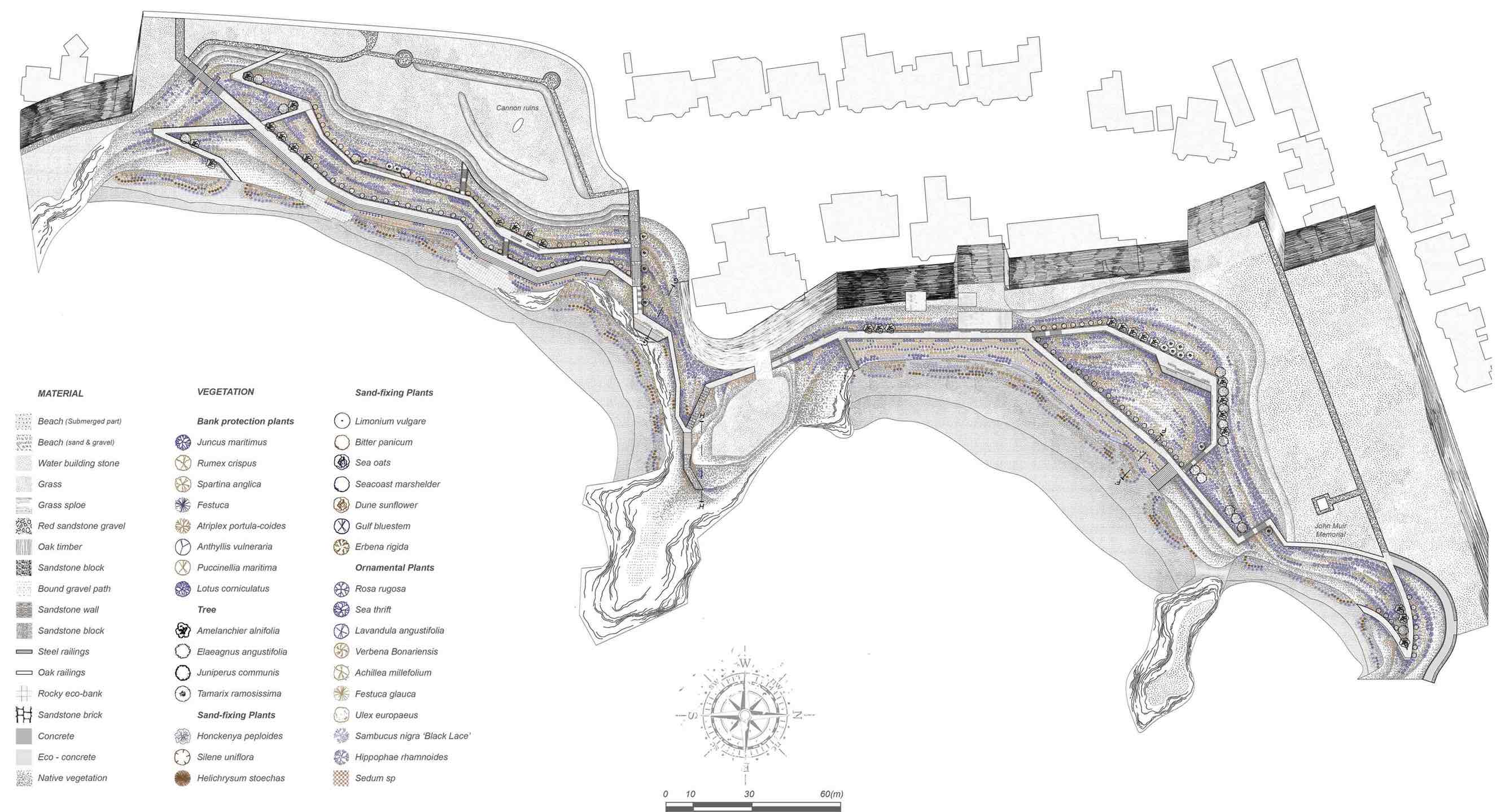
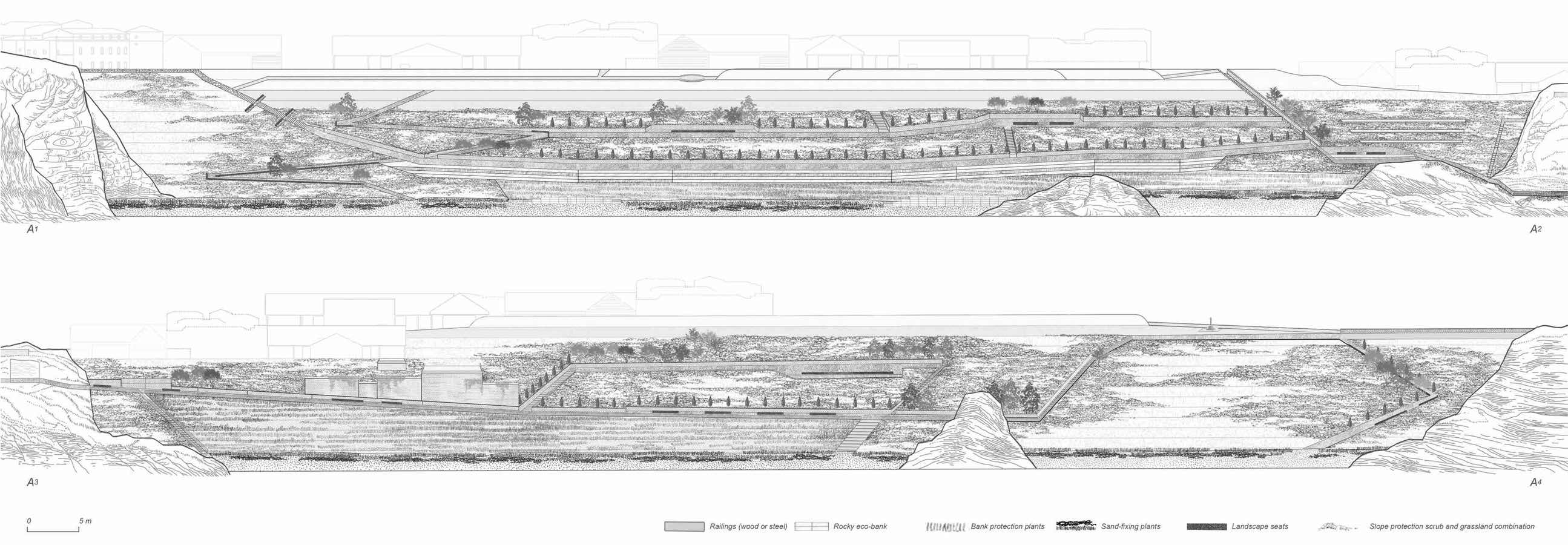
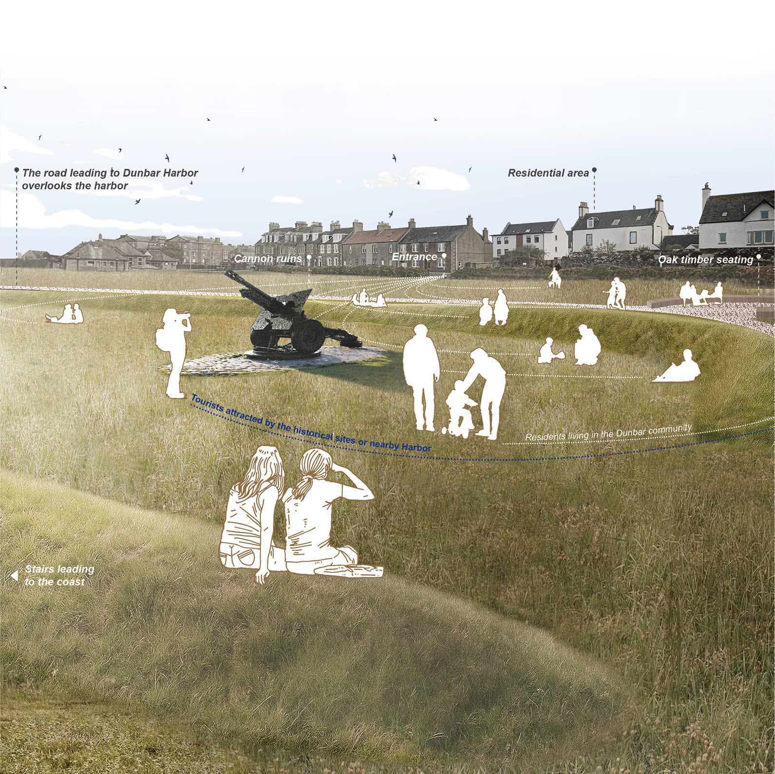
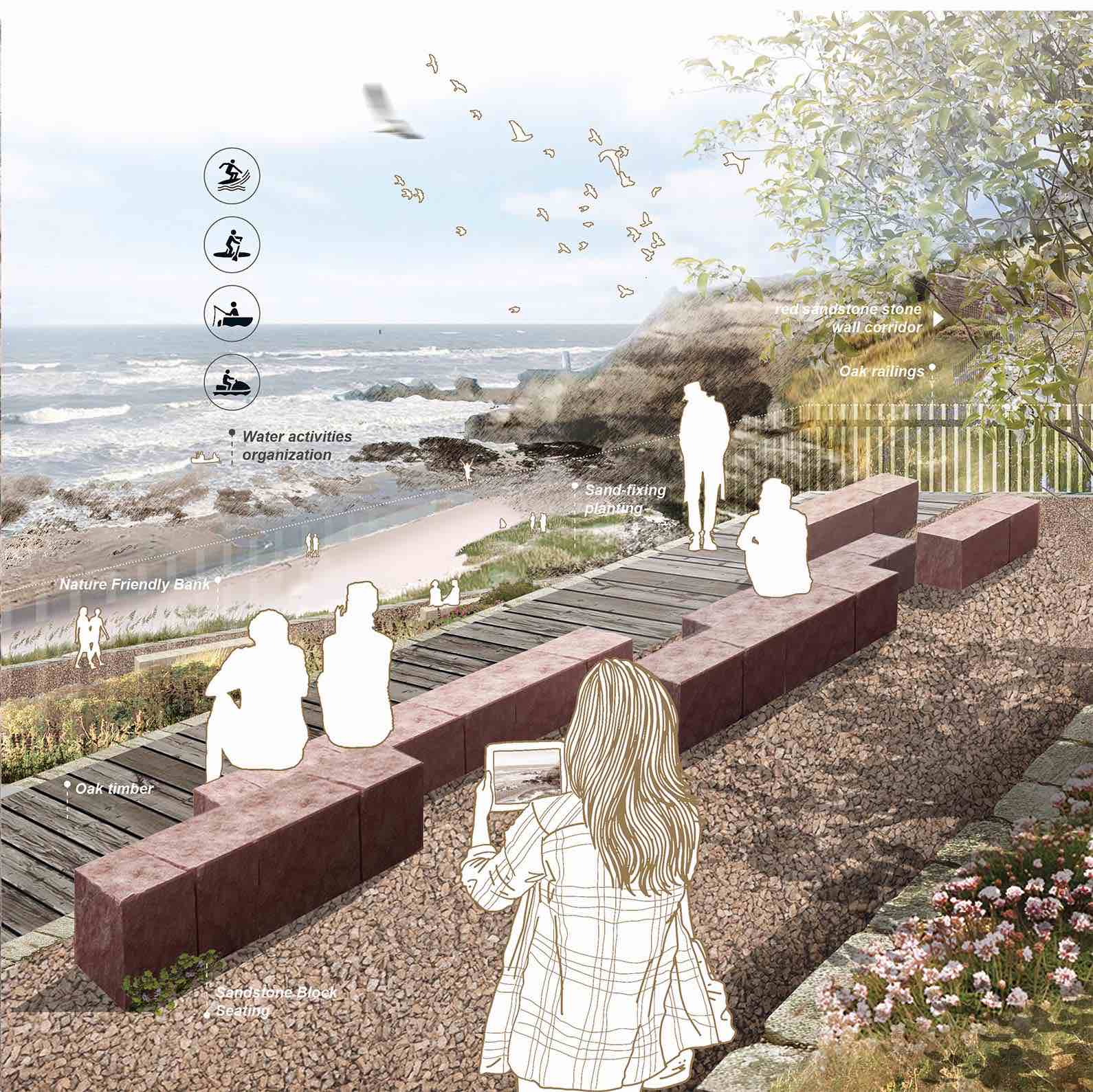
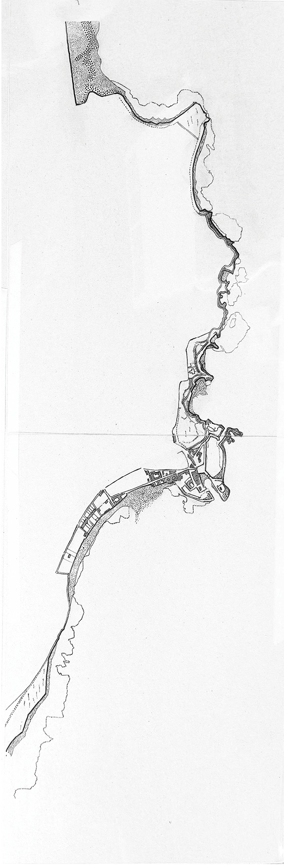
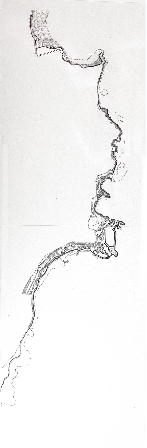
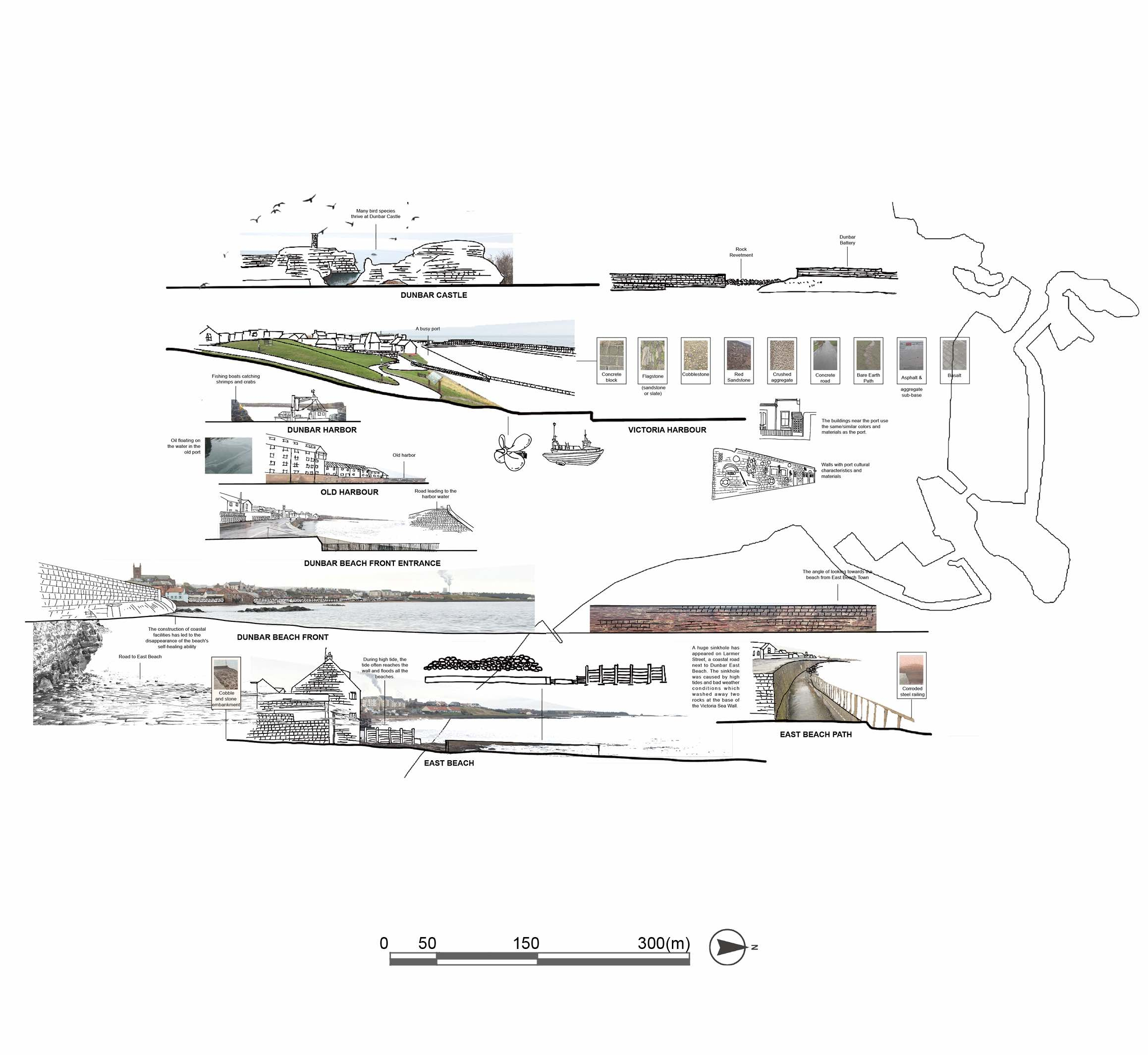
Rocky Coastal Path in the middle of Dunbar trail—— A seaside garden partially damaged by tidal waves that has lost some of its hydrophilicity and accessibility through collapsed paths and overgrown vegetation. I redefine it as a coastal garden integrating ecological protection and community experience, and propose a systematic spatial redevelopment strategy:

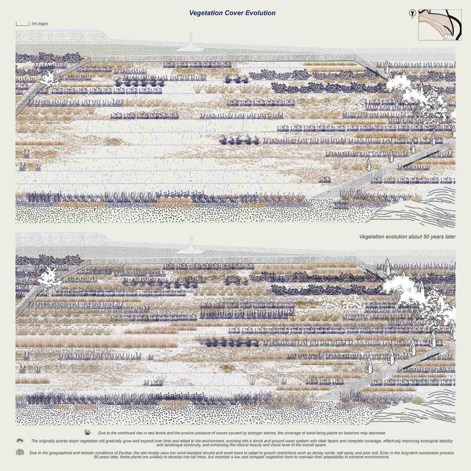
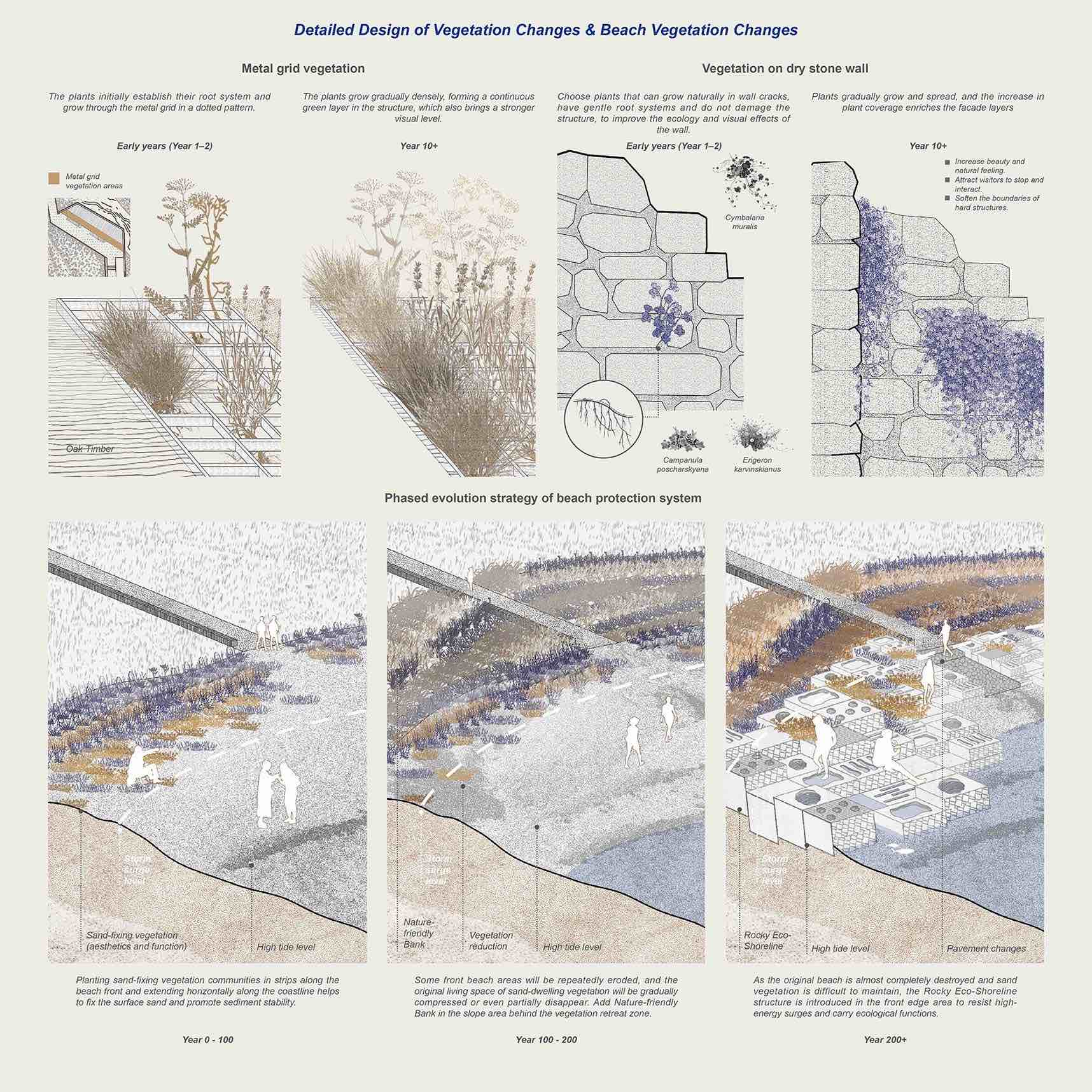
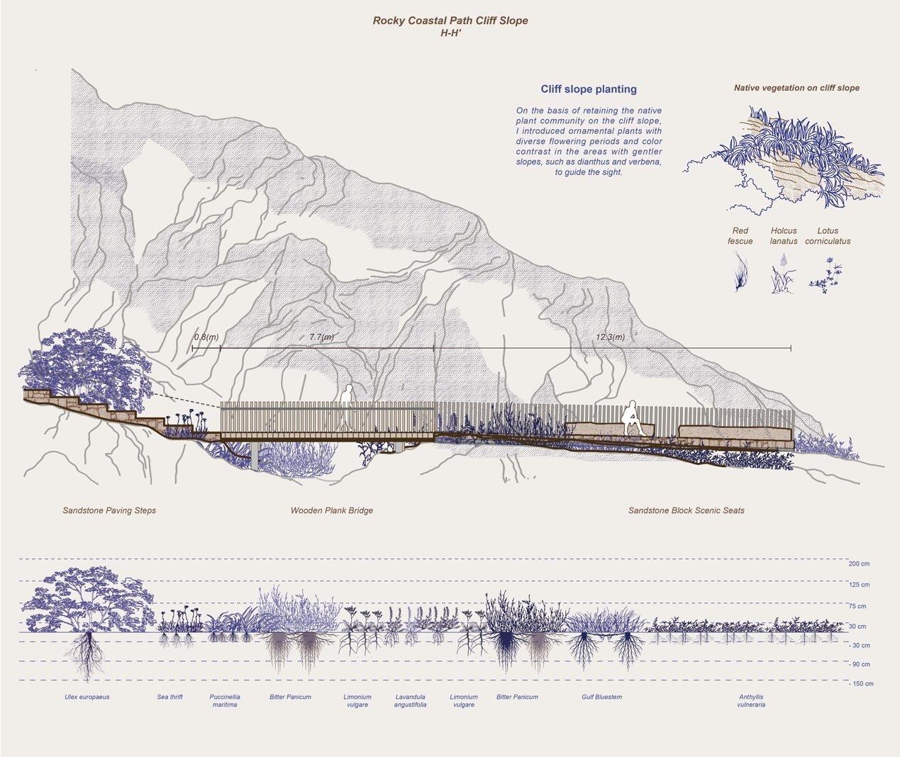
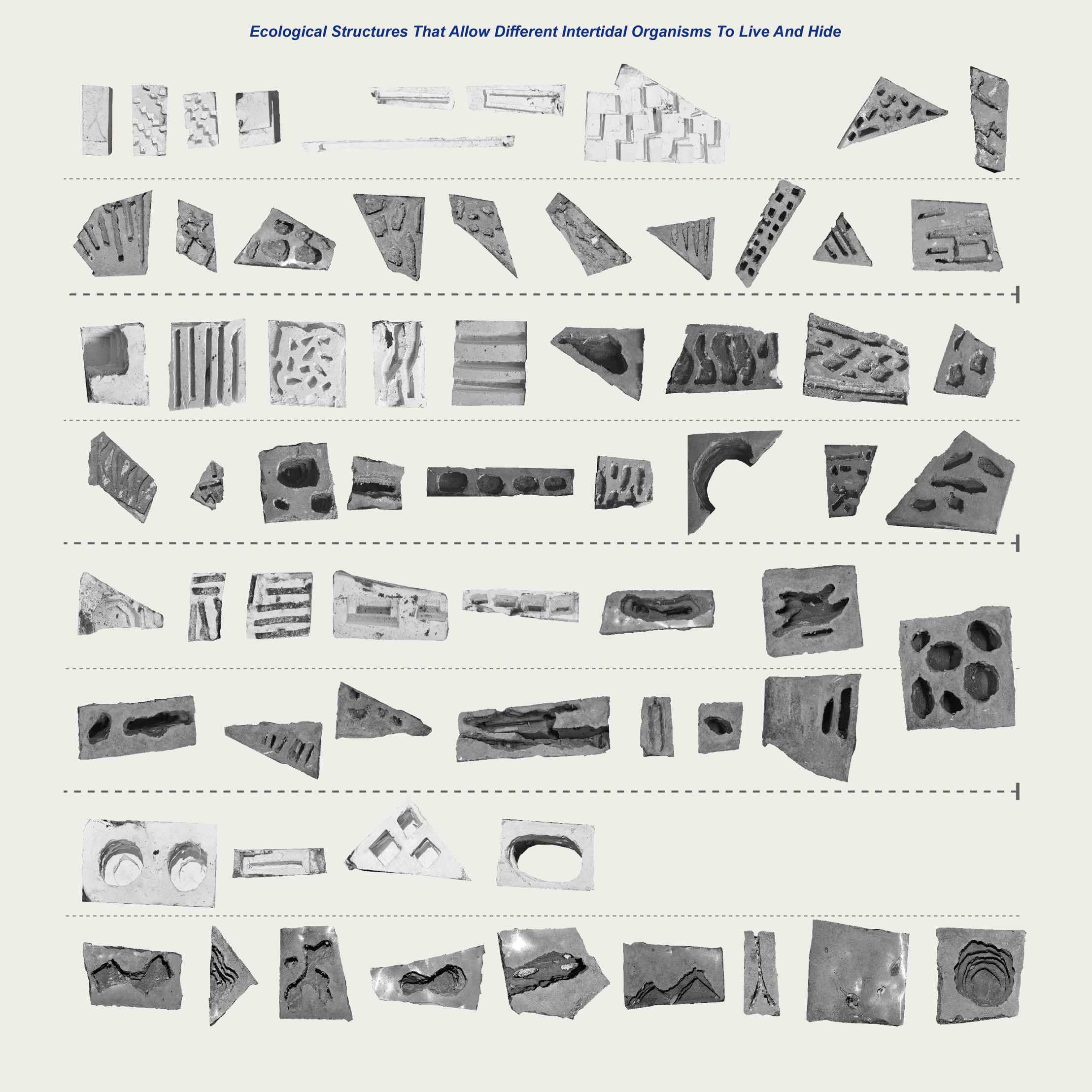
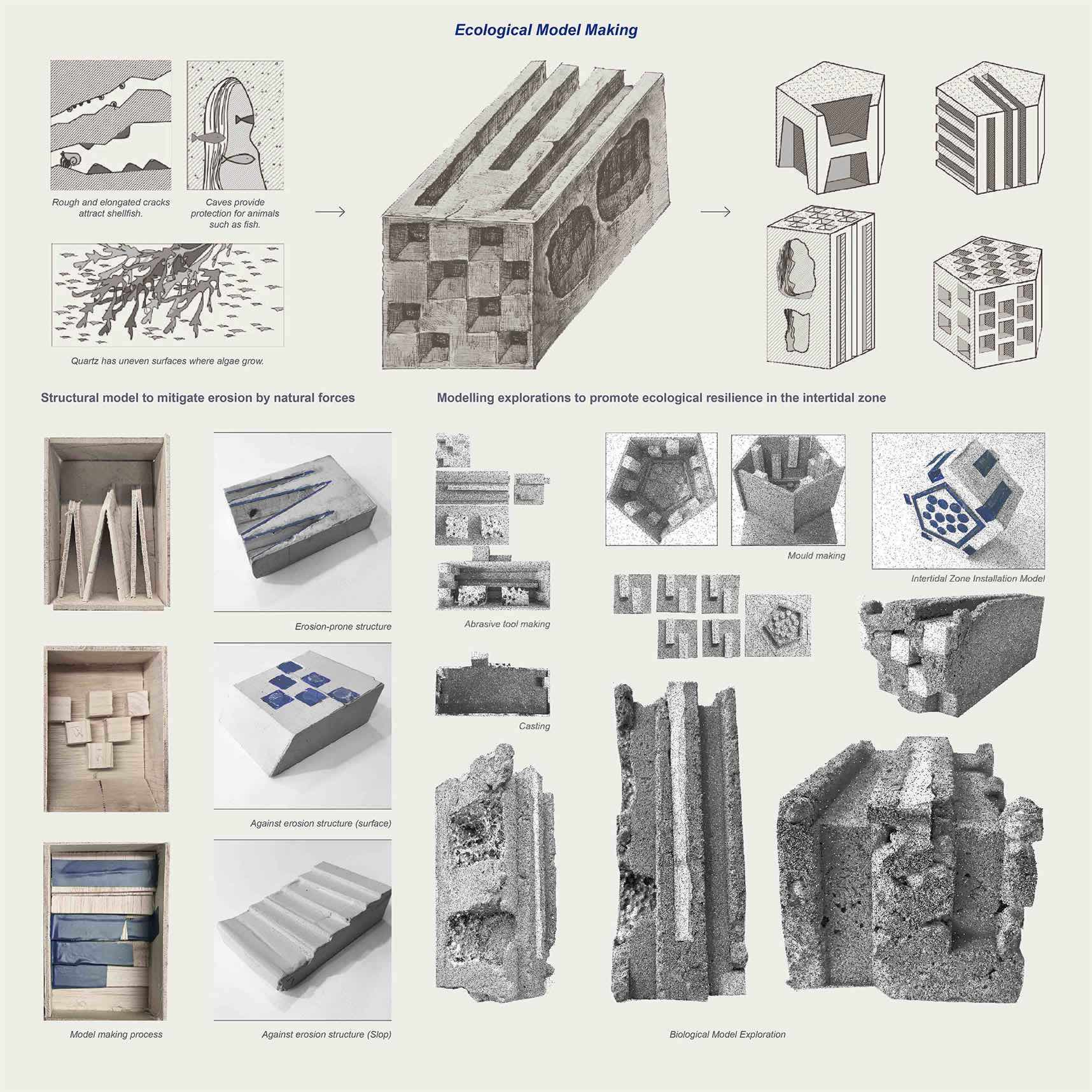
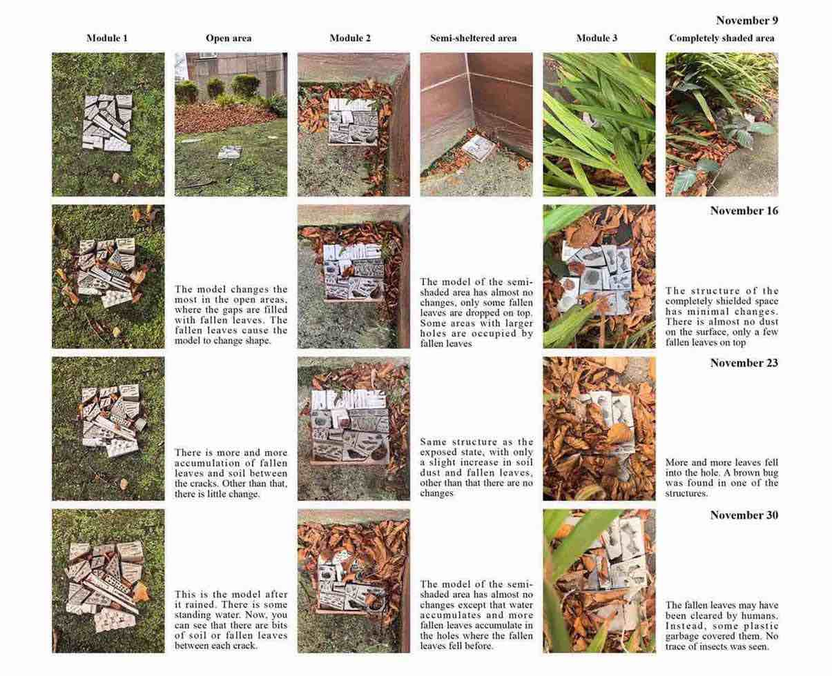
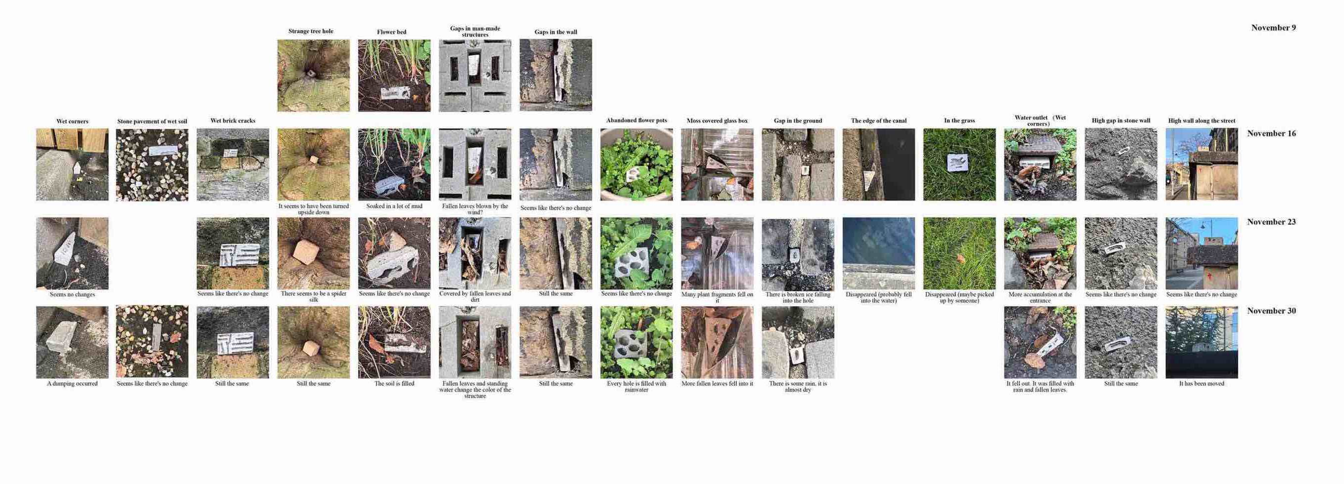
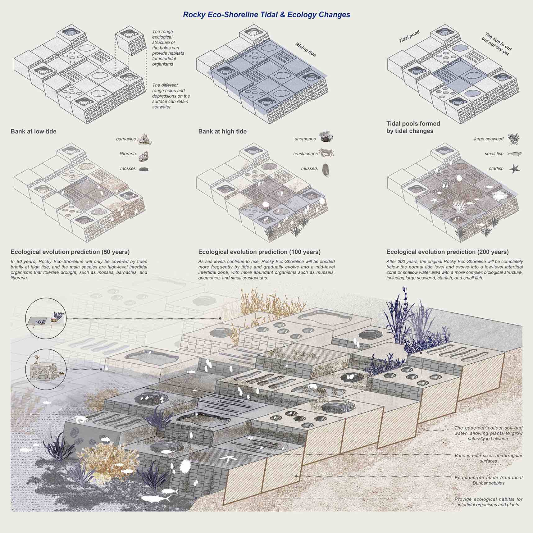
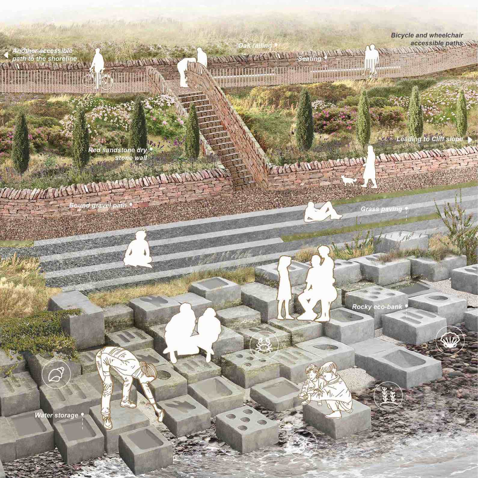
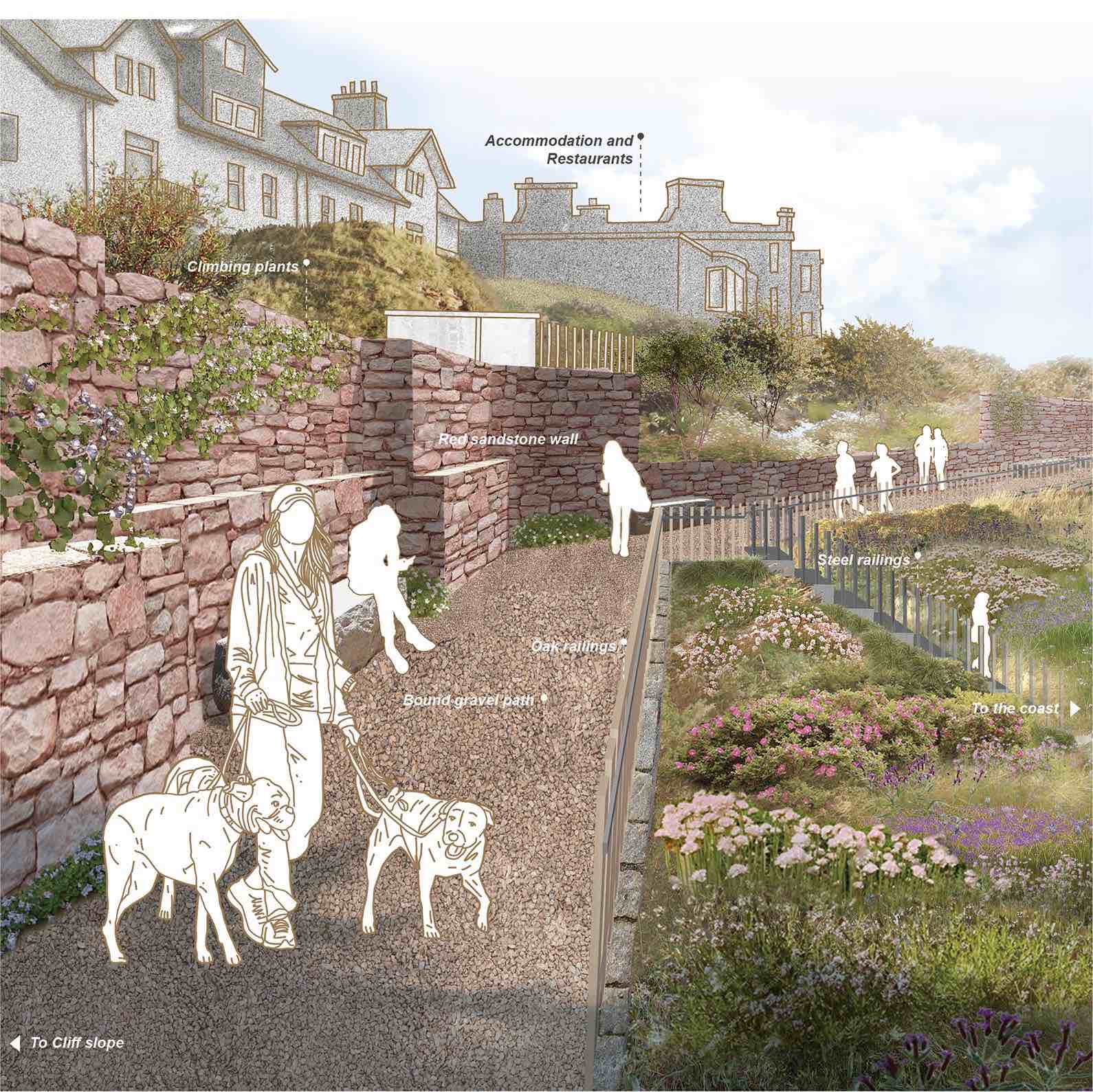
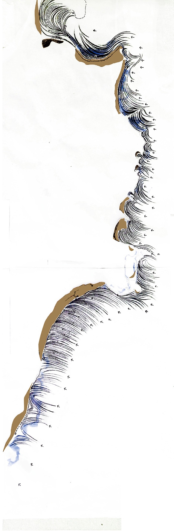
By raising the original path and adding steps and gentle slopes, it can adapt to the undulating terrain and the access requirement of different groups of people; at the same time, with the help of terrain changes and the original trail traces, a multi-level landscape system is reconstructed, connecting ecological nodes, vegetation and a dynamic trail network. In response to tidal and wave erosion, I set up a triple ecological defence along the Rocky Coastal Path: A combination of sand-retaining vegetation, nature-friendly berms, and Rocky Eco-banks, which respond to different elevation differences and erosion intensities.

The site is more than just a “restoration project”; it turns a forgotten coastal corner into a link between the community and the coast.

Detail Section - Rocky Coastal Path expand
Detail Section - Rocky Coastal Path
Rocky Coastal Path Detail Focus Area Master Plan expand
Master Plan
Longitudinal Section expand
Longitudinal Section
Model Application expand
Rocky Eco-Shoreline Tidal & Ecology Changes

Mengqi Xing

‘The Adaptive Fringe’ Reimagining Dunbar’s Coastal Trail
Student list
open list
close list