


Dust is often seen as a byproduct of severe land degradation. But when we look at dust affected regions from a different perspective, we can begin to recognize the unique and critical role that Iceland’s sandy terrain plays in the global dust cycle.
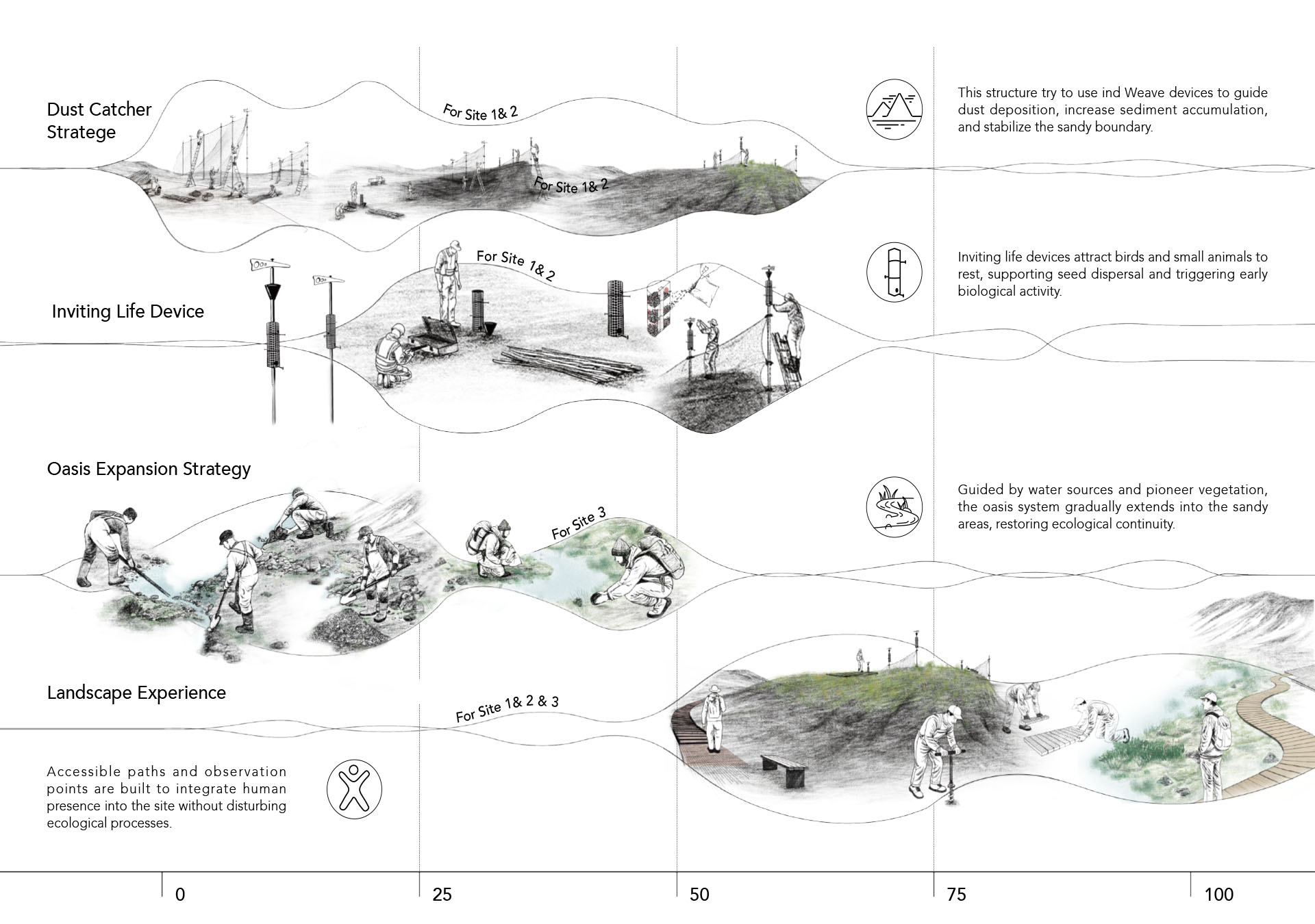
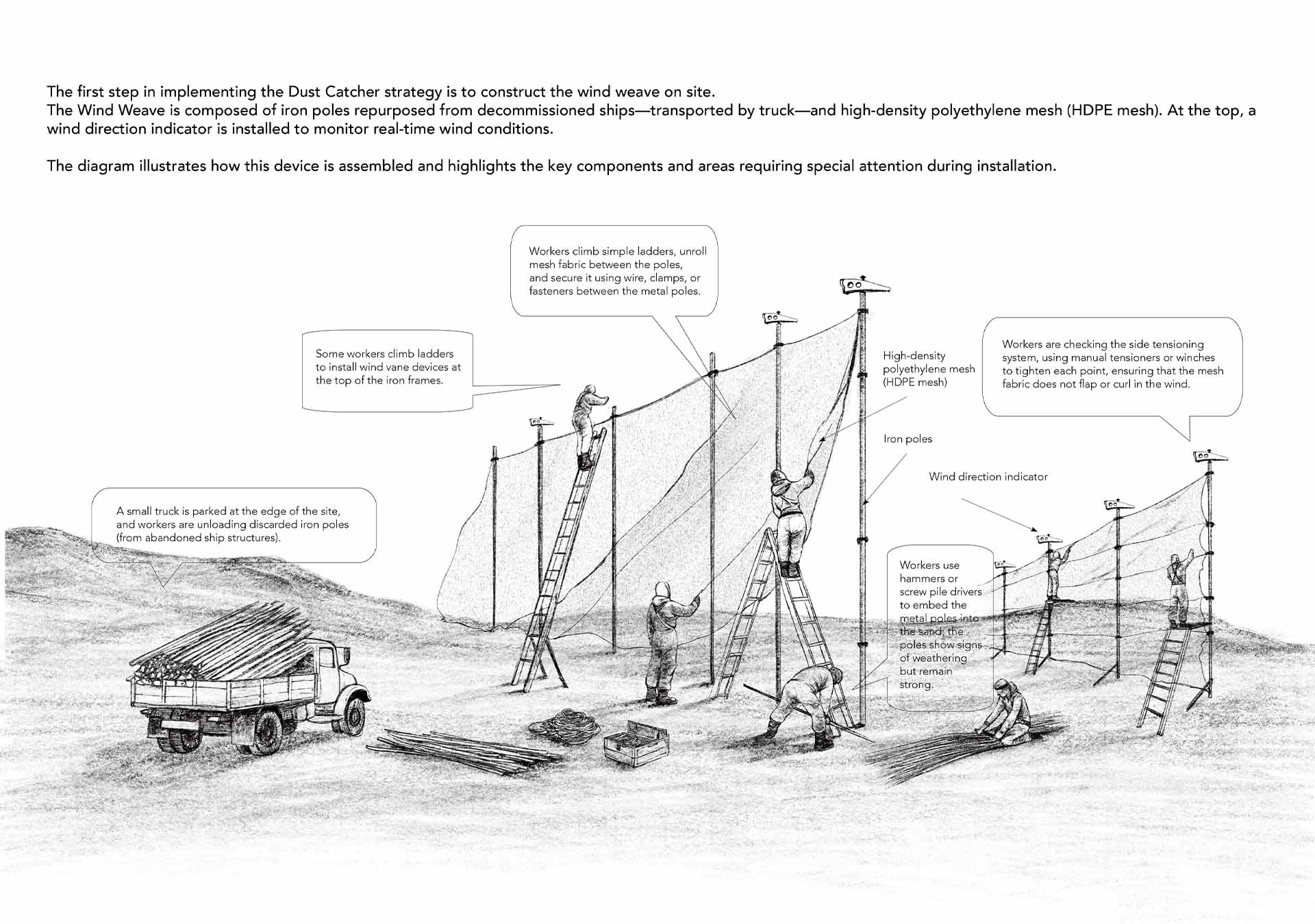
Trough this project, I hope to explore how to reimagine the potential of this dusty highland. By utilizing wind patterns, setting up windbreak and sedimentation structures, releasing seeds, and shaping dunes through phased interventions, I aim to construct a sand landscape system that can evolve dynamically and respond to emerging challenges.
On one hand, the goal is to preserve the natural fluidity of DUST so that it can continue contributing to global ecosystems; on the other hand, design strategies are employed to mitigate its negative impacts on the local environment.
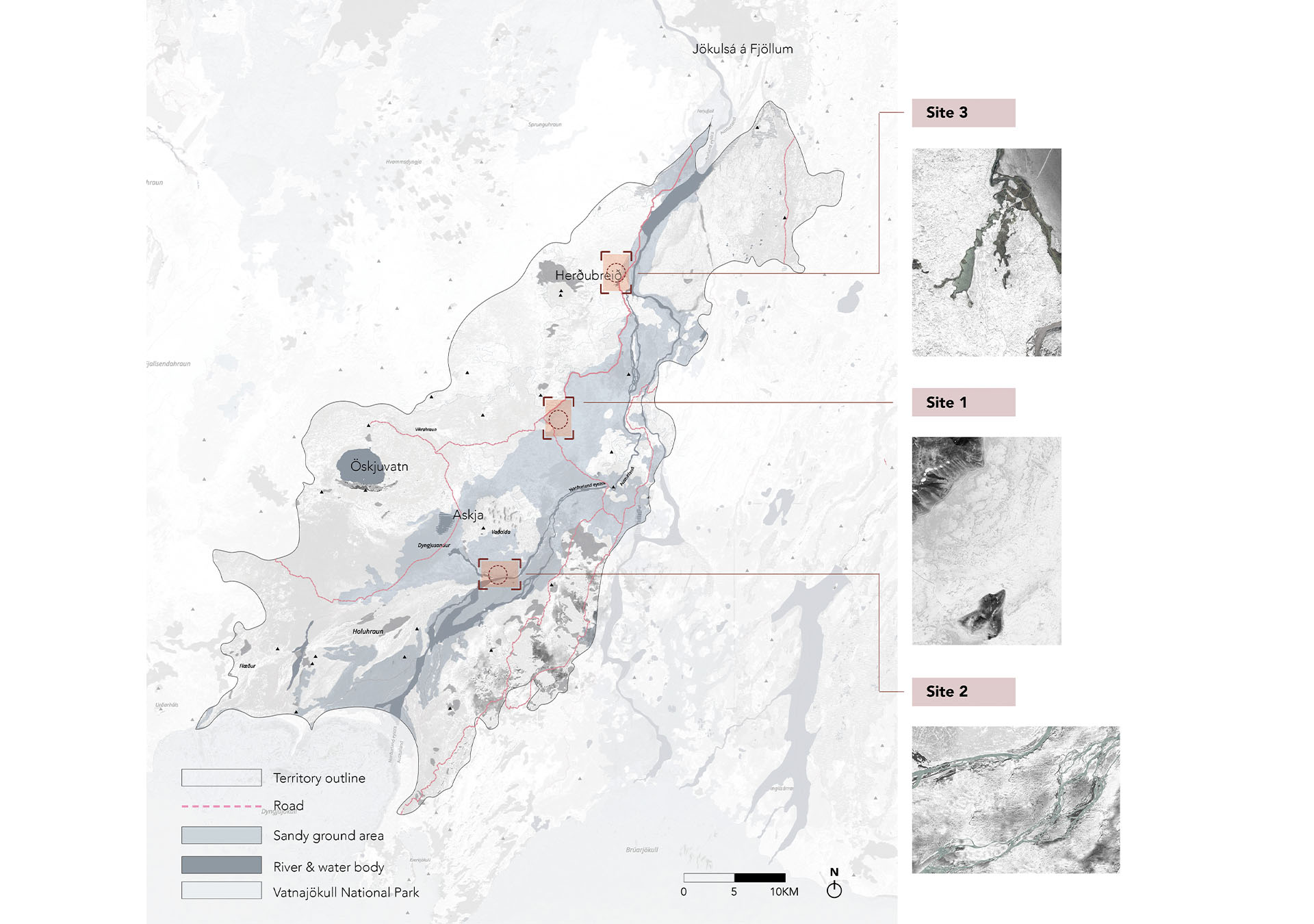
This territory extends from the northern edge of Vatnajökull National Park to the outer zone of the Herðubreiðarlindir oasis, traversing a representative ecological transition zone of the Icelandic highlands. The landscape and ecological conditions gradually shift from south to north—ranging from glacier-influenced dust plains, to wind-eroded lava fields and seasonal stream beds, eventually transitioning into the moist peripheral zone of the oasis—forming a terrain with rich spatial layering.
Moreover, the territory is remote and largely free from urban disturbance, maintaining a high degree of natural integrity. It is not only an ideal site for observing the self-evolution of natural systems, but also a promising ground for developing a distinct landscape identity. Its unique topography, active dust-wind dynamics, and ecological gradients offer vast potential for exploring ecological restoration mechanisms, understanding landscape succession, and reimagining dynamic relationships between humans and nature.
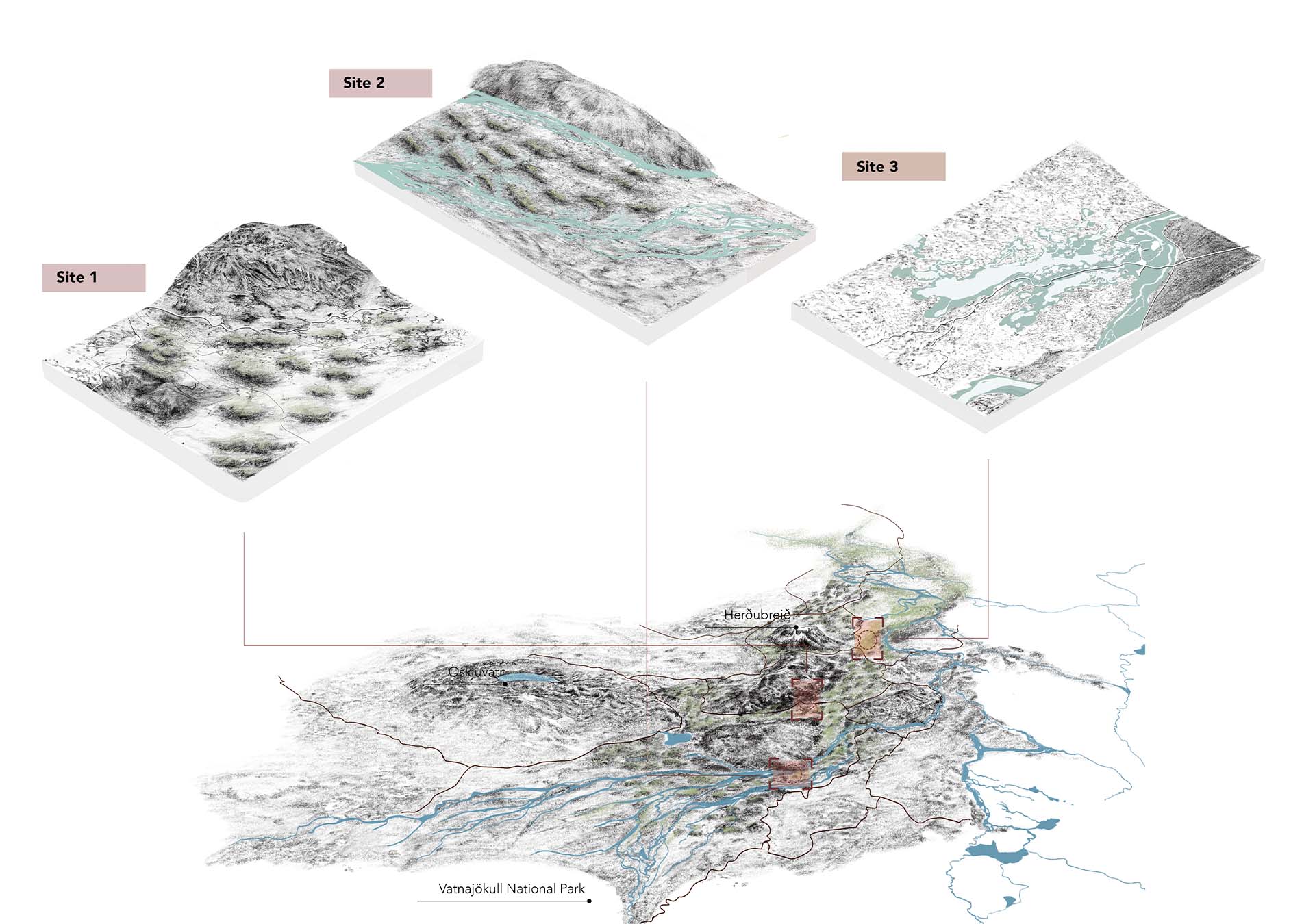
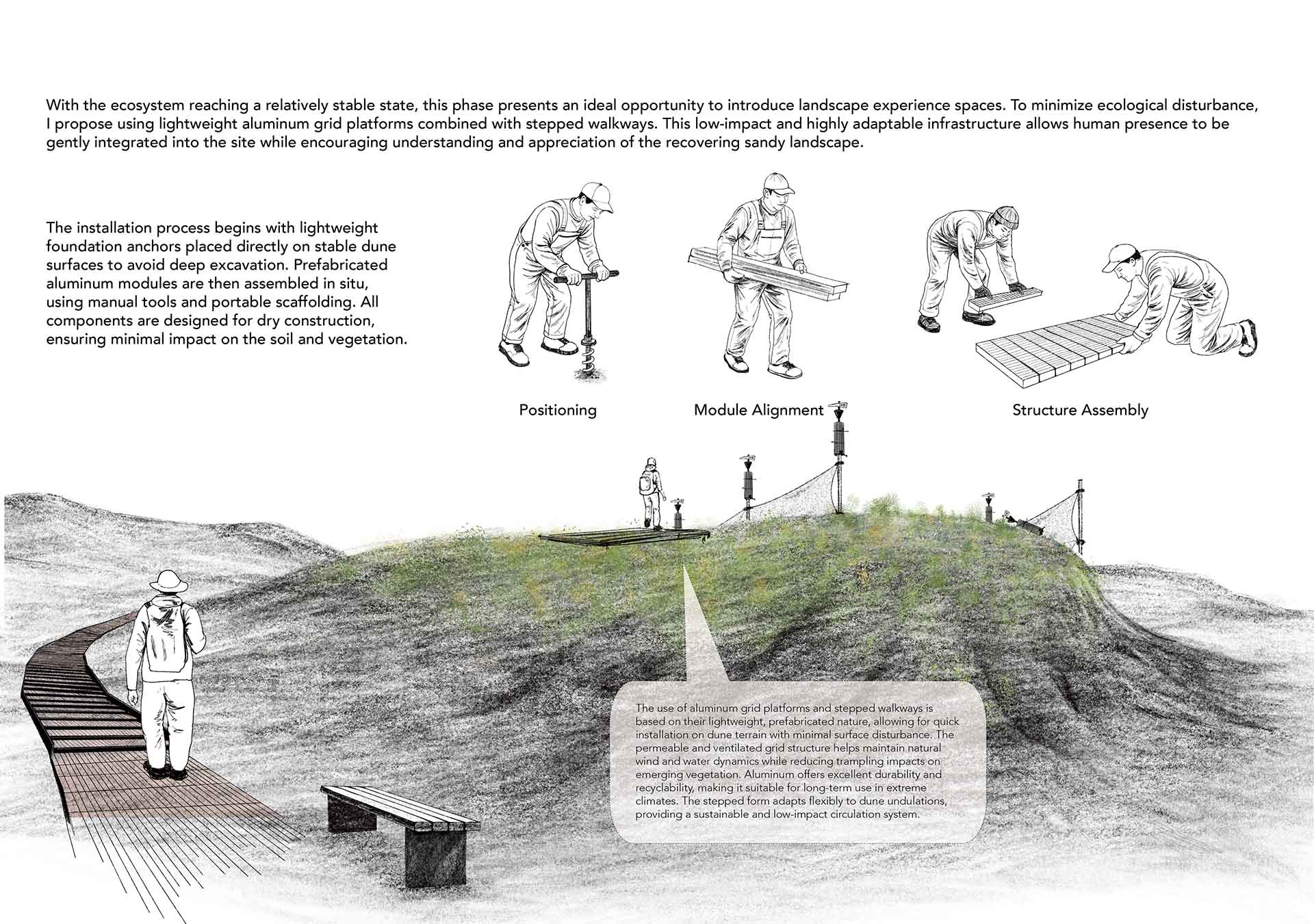
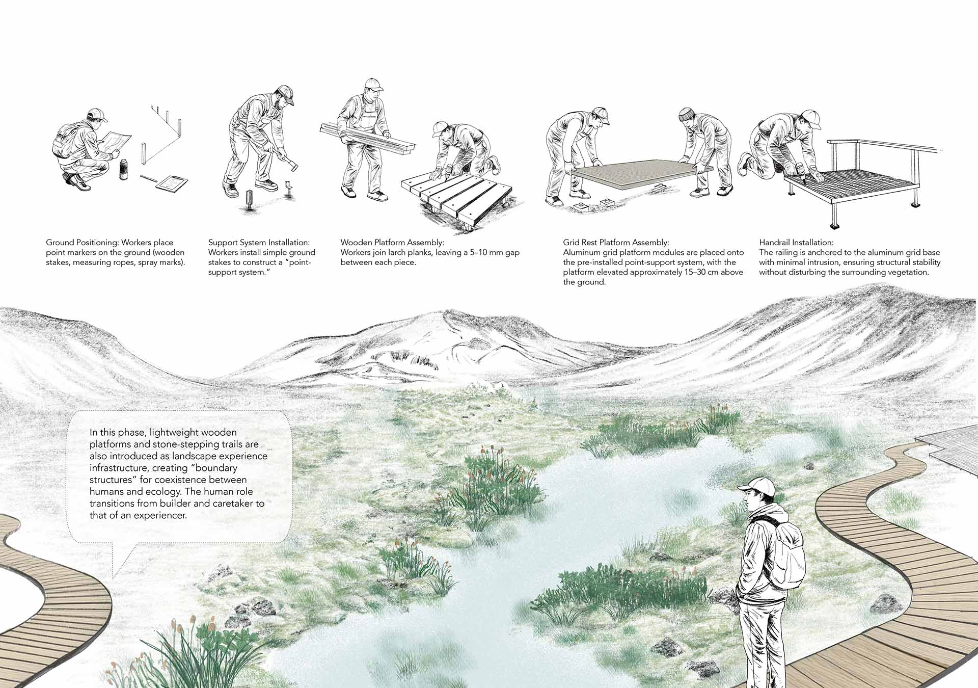
Site 3 is located on the edge of the northern Herðubreiðarlindir oasis and enjoys relatively favorable ecological conditions. The soil here is stable and retains moisture well, creating a suitable environment for plant growth. Existing vegetation includes typical Icelandic species such as mosses and lichens. As a transitional zone between the oasis and the surrounding desert, Site 3 possesses natural advantages for ecological expansion and is a key area for future species migration and biodiversity accumulation.
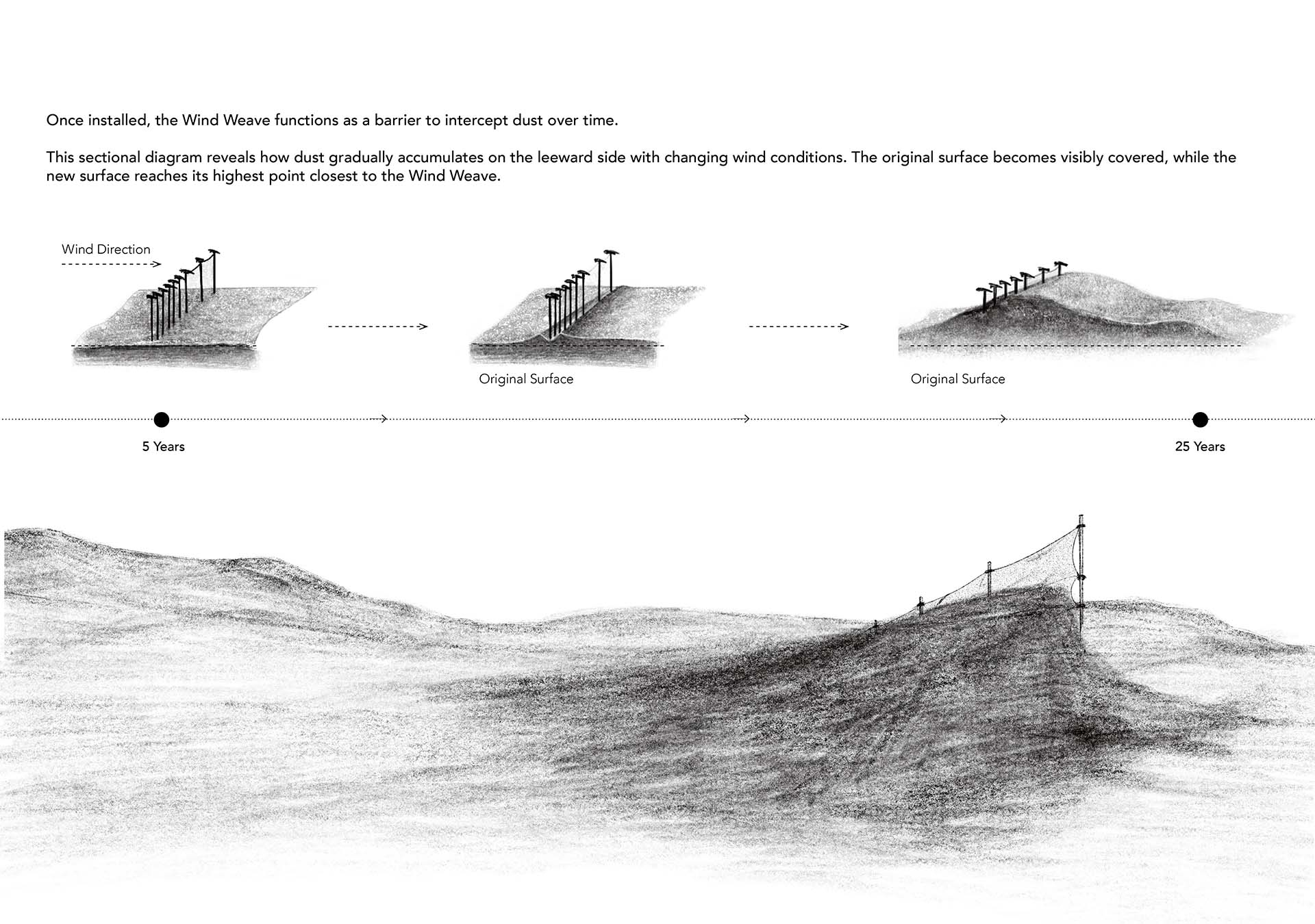
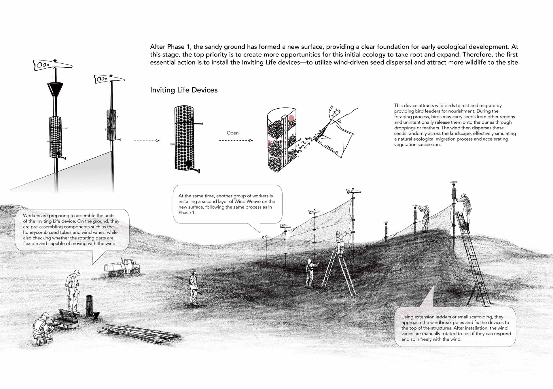
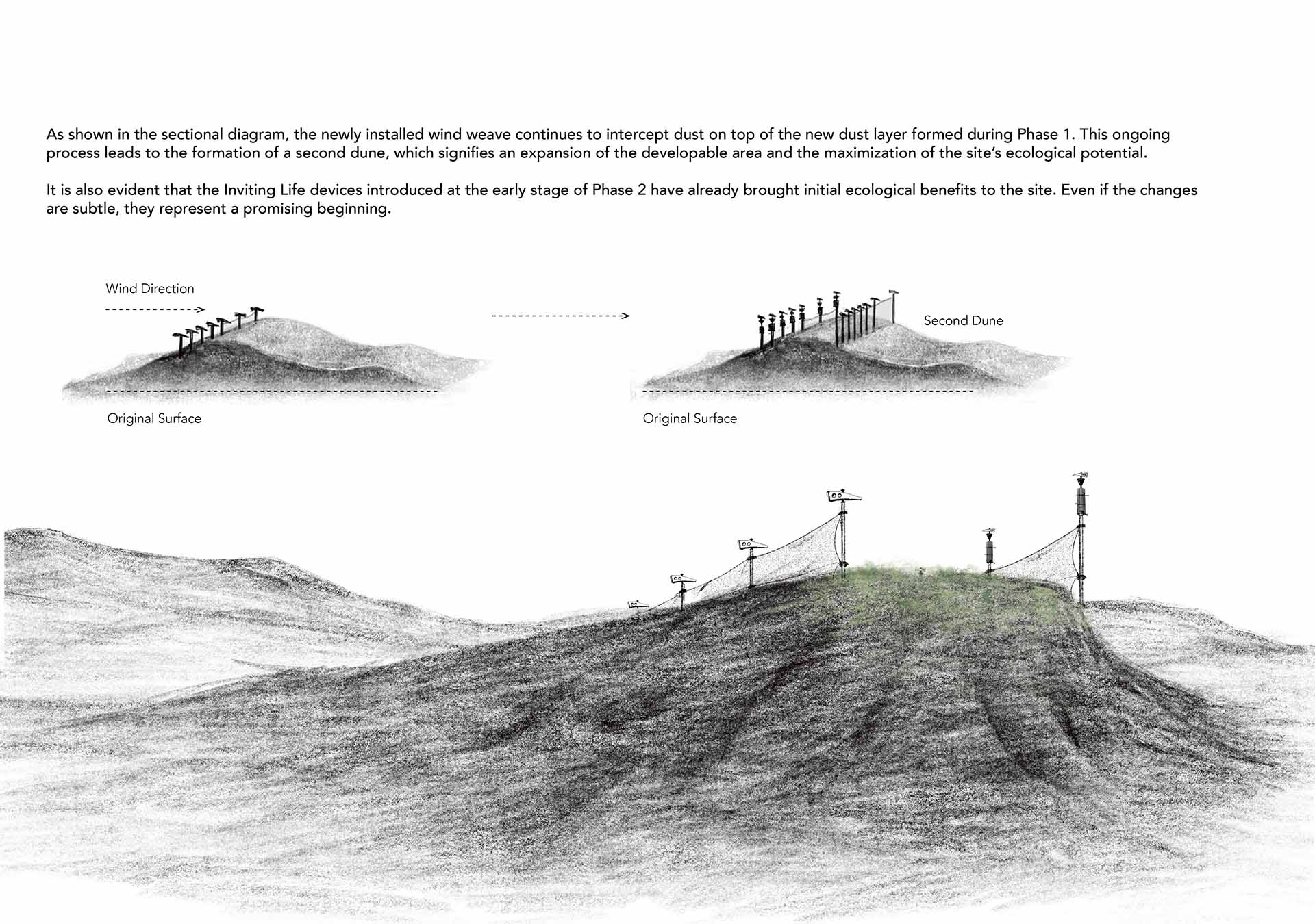
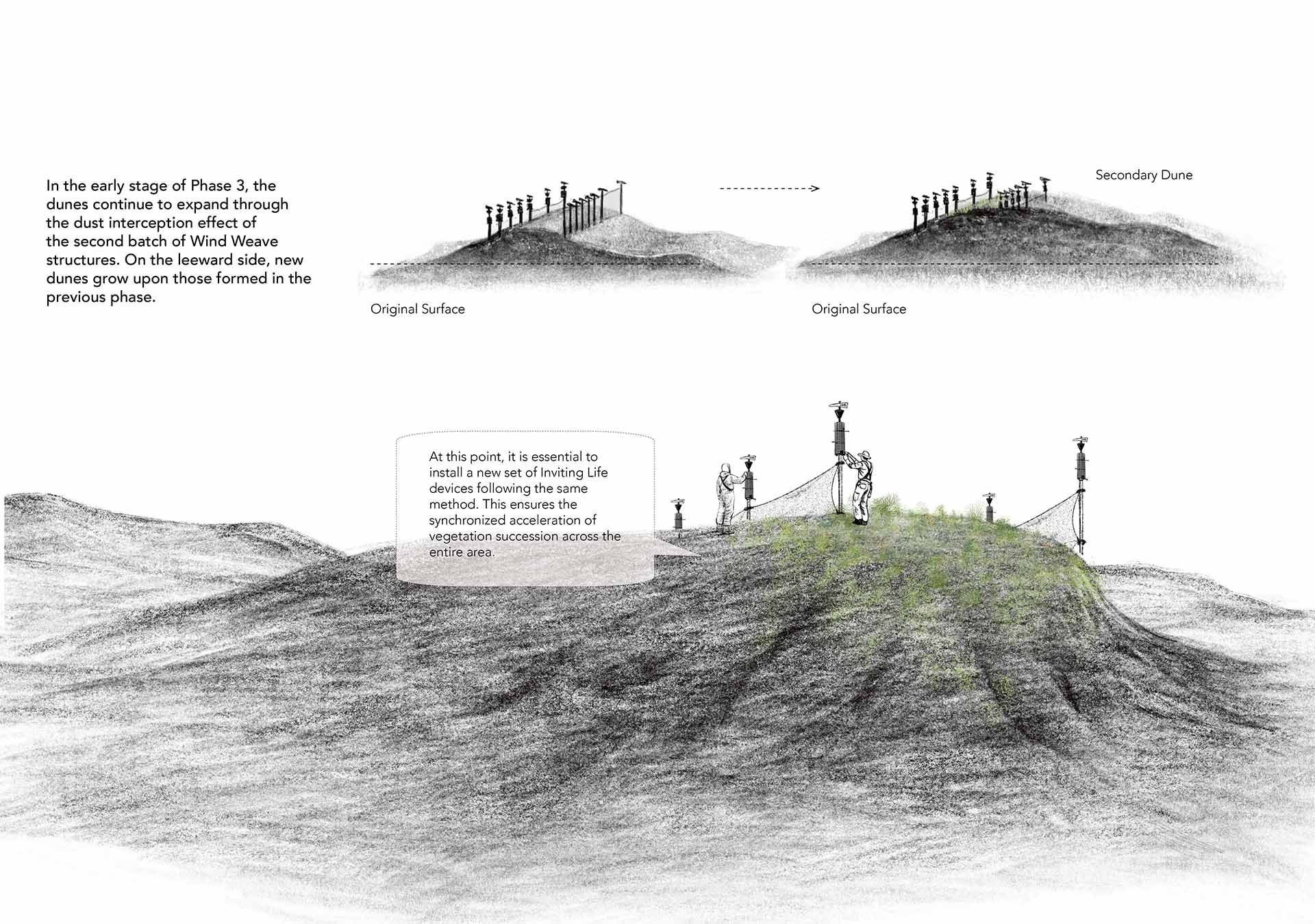
Site 1 lies in the region with the strongest winds and the most intense dust activity, representing a typical transition zone from Iceland’s volcanic highland sands to the glacier foreland. The soil is primarily composed of coarse volcanic sand and wind-blown sediments, with a loose structure and low water retention. While the site is almost entirely devoid of sustained vegetation, it has excellent potential for dust deposition. Its exposed condition also provides a clear foundation for early ecological establishment, offering significant opportunities for ecological development.
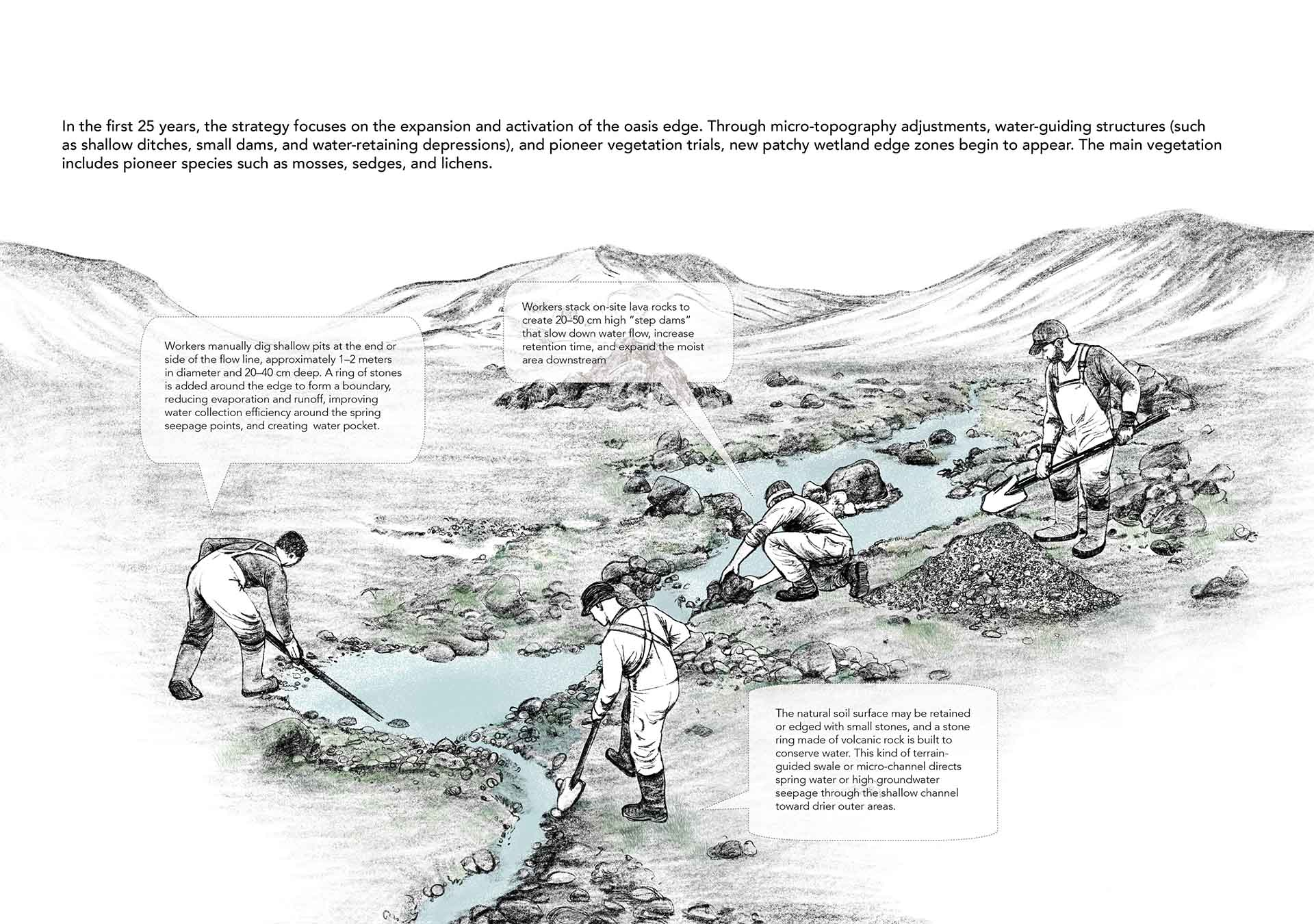
Site 2 is situated at the convergence of several ephemeral water channels and displays distinct patterns of wetdry fluctuation. Surface soils consist of fine sediments formed by water erosion, and certain areas are seasonally moist or even waterlogged, giving the site a modest hydrological advantage. Although water conditions are unstable, the scattered presence of hydrophilic plant species suggests the potential for nurturing unique ecological communities.
After all this process, we can see the change form those three sites, Parts of the Wind Weave in Site 1 are now buried in dunes, forming new landforms. Moss and shrubs interweave into a resilient, modest sandy landscape.
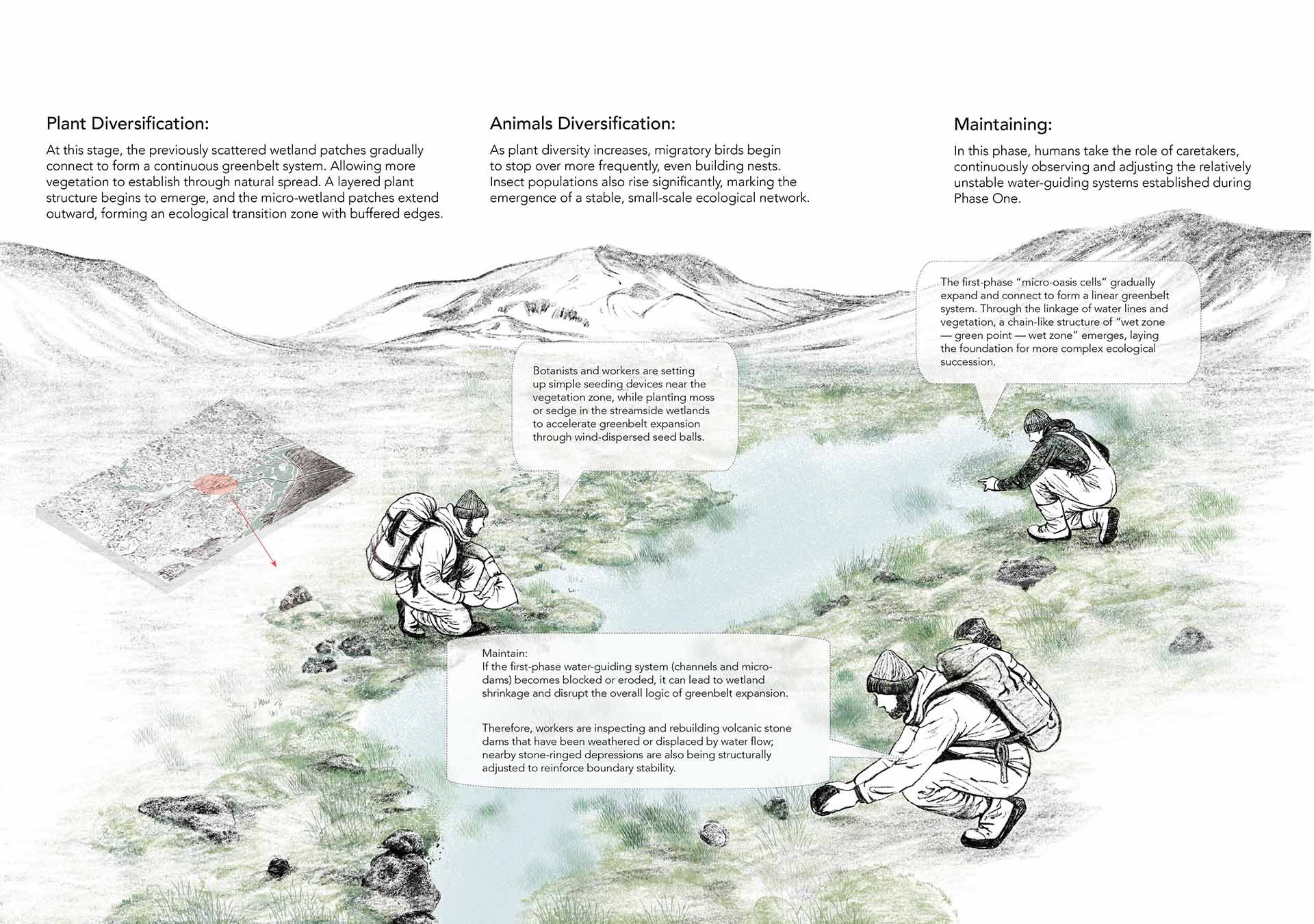
Site 3 develops into a biodiversity-rich ecological core—acting as the source of species for the whole system, guided by water sources and pioneer species, the oasis system gradually advances into sandy zones.
This shift in ecological connectivity is clearly visible in the 100-year axonometric view of the territory.
These changes reflect what was previously discussed: each site completes its own transformation, collaborates with the others, and—through strategic infrastructures—guides the movement of flora and fauna, gradually forming a continuous green ecological corridor from north to south.
This shift in ecological connectivity is clearly visible in the 100-year axonometric view of the territory.
The dust from the territory was not eliminated, but redirected and engaged, allowing the site to retain the ecological role it plays within the ‘Global Dust Belt’.
At the same time, the ecological growth within the three sites has collectively enhanced the overall environmental diversity of the region.
