Celia-Doina Oprea
Post-Carceral Thresholds: Towards an Architecture of Just Transitions

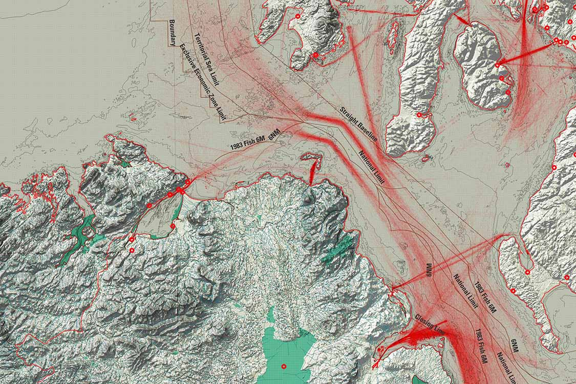
Working across both sides of the Irish–UK border established in 1921, the studio treats the lough not as a fixed line of separation but as a relational territory. Through a wet ontology, water is understood as a force that reshapes space, power, and time, linking urban, ecological, and economic systems. Using experimental architectural operations, students investigate how open built forms emerge from cross-species relations and shared landscapes, and how new forms of commons, access, and citizenship might be imagined across bordered space. Lough Foyle is approached as part of Derry’s extended urban condition.
The studio asks how architecture can operate within contested, post-extractive, and ecologically sensitive territories; how built form can mediate between conflict, industry, and environmental change in tidal environments; and how practices of openness might challenge the limits imposed by borders. These questions are explored across six sites, with projects developed in dialogue with local civil society partners to ground proposals in the realities of place.
Top image: Shipping vessels routes and exchanges across North Atlantic and North Channel and between Ireland, Scotland and UK. Map by Killian O’Dochartaigh, based on vessel data from the UK Hydrographic Office